I had a brief chat yesterday with current (and likely future) Seattle City Council President Richard Conlin about his plan to act on rail to both Ballard and West Seattle soon, with City funds.
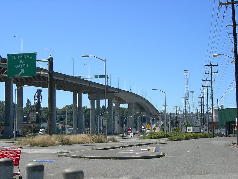
For light rail to West Seattle, no directly applicable studies exist. However, Conlin guesses such a line would cost “$400m or less” based on a Duwamish crossing on the West Seattle Bridge, similar to the monorail, and connecting to Central Link with a transfer at Sodo. “I don’t think it would be a big deal to transfer given how often Central Link runs,” he said.
As for the $135m Ballard/Fremont streetcar, Conlin said that “we haven’t really discussed [financing] this on the City Council,” but he’s optimistic because last year the resolution in support of the Streetcar network passed 6-3. With McIver retiring, Rasmussen and Harrell are the only returning no votes.
One really important thing is the new mayor’s reaction. “Having the support of the mayor’s office is very helpful” because of the staff resources the Mayor’s office can commit to create estimates, said Conlin.
The Mayor-elect, as it turns out, has his own plan for rail expansion, with strong emphasis on dedicated rights of way. Fortunately, Conlin is open to taking parking and/or traffic lanes away in many places: “There are places where that works and places where it’s harder.” Conlin cited Downtown Fremont and the Fremont bridge as places where dedicated ROW would be prohibitively expensive, but the stretch between Fremont and Ballard as a place where it would be relatively easy. He said the Council will have to look at each segment one by one.
Awesome, thanks Martin. I’m curious about McGinn’s opinions toward the comprehensive plan, but judging by his more resent reception toward light-rail and the first hill streecar, I’m remaining hopeful of his enthusiasm.
You mean Conlin wants to use the Mayoral staff that the city council is currently trying to eliminate to create the estimates? That’s rich. Each council member has three legislative assistants, and there are 27 council central staff – and Conlin is as much as admitting that these 54 people can’t handle the job – but the Mayor’s Office of Policy and Management – which Jean Godden just introduced a bill to eliminate – can do the job.
It seems the council that wanted the power can’t handle the work.
An interesting proposal, but there are obvious problems. I don’t think WS folks will be keen on transferring at SODO (esp. in winter), but perhaps this could be an acceptable provisional arrangement until funds are found for construction of a new downtown tunnel under 2nd Ave. and continuation of the line to Ballard. In addition, I thought the jury was still out on whether light rail could be built on top of the WS bridge. On the positive side, there is an already-excavated site available right now at the corner of Alaska and Fauntleroy in WS Seattle (the “Hole Foods” location, that is tied up in litigation). SoundTransit should buy that site and use it for the transition from elevated rail to underground for the WS Junction Station.
WTF? A new downtown tunnel? Uh… how about we just have a 2nd light rail line go through the bus tunnel? You know, two lines going on the same stretch, like every other light rail, bus, or subway system in the world? Every single light rail route doesn’t need its own tunnel…
In Portland, all four of their light rail lines share at least some of the same stops downtown… and they don’t have any tunnel at all downtown.
http://www.trimet.org/max/
There already is a second line to be ran through the tunnel: East Link. Word is there isn’t enough future capacity for another light rail line.
I may be wrong about this. Don’t take my word on it.
You’re right. Once all the alphabet Links open up, trains will be running at capacity on 1-2 minute headways though the tunnel during rush.
If you look at Portland, their interlining on the Steel Bridge of all four lines prevents headways on individual lines from being even as good as Link already has.
East Link may take up too much capacity to run a third line through the bus tunnel, but it seems like you could certainly take some of the U-link vehicles and send them to West Seattle instead of down to SeaTac.
There won’t be any more capacity after University/North Link and East Link go online.
what if they automated operations through the tunnel? would this be possible? I know that automation can reduce headways significantly.
From what I was told by a ST staffer some time ago, the challenge isn’t so much the tunnel itself as the crossings on the places outside the tunnel.
Nobody seems to have designed systems which run in “manual mode” most of the time and in “automated mode” within some key segment. Maybe there’s a design difficulty in doing that. It seems like a wise idea.
Unfortunately it wouldn’t solve the problems in this case because of crossings between the East Link/South Link junction point and the tunnel entrance (in other words, SODO). That area needs to lose all its level crossings.
Have any of the planners looked at the traffic in the Loop in Chicago or the Green Line portion of Park Street in Boston? Lots of lines go through these stations with minimal conflict. Look at the New York subways with lines switching every which way throughout the system. Seattle planners are gutless.
As far as needing another tunnel, Chicago and Boston have examples of pedestrian tunnels connecting lines running a block or two apart, so it can be done. Of course, we will have to subdue the gangbanger worry crowd who think every public transit system is riddled with crime, and pedestrian tunnels are merely caves hiding non-caucasian muggers, murderers, even father rapers.
Maybe this is time to rethink the AK viaduct tunnel (now there is an oxymoron) to include a Ballard-West Seattle track or two.
Chicago at the Loop is grade separated on both ends for miles. You’d have to grade separate SODO.
Grade-separating a half-dozen crossings in SODO sounds a heck of a lot cheaper than digging a second light rail tunnel through downtown…
Ben,
Might not a West Seattle line use the tunnel for a while? It’s projected to reach capacity with two minute headways in 2030; that’s twenty years from now.
If one gets a West Seattle line built in ten years why not use the available capacity in the existing tunnel while the Ballard end and connection through downtown are completed? No transfer would then be required and you’d have service from West Seattle at least to UW, maybe Northgate.
I realize that means running the West Seattle Link over to Fifth between Lander and Spokane (on Horton probably), but in fact it makes sense to have such a connection to the maintenance facility even when WS link follows First South up past the ball parks. The West Seattle/Ballard line will need its own storage yard of course, but there’s no need to replicate the heavy repair facilities there if cars can move back and forth between the parallel lines.
For at least a decade it would be revenue trackage.
In fact, it might make sense to run a couple of trains per hour between West Seattle and North Link permanently. Once Ballard and the Second Avenue Link are completed, a couple of trains per hour to and from Ballard could run through to South Link and the airport, filling the South Link “slots” of the trains “diverted” to and from West Seattle. Grant that it might be a little confusing for people at the airport station to have two paths through downtown and there would be a “hole” in the far south service in the DSTT every half hour, having a direct Belltown-Airport single seat ride would be very popular. I think we can assume that the mezzanine’s of any Second Avenue stations will be connected to the matching DSTT stops, so savvy riders would learn when to move over the Second for the next train. The “Next Train” system could notify folks and they could decide.
To complete that routing one would have to double track the west side of the MF loop because of the opposing move.
In any case Conlin’s proposal would require some sort of ROW to get to SODO station. I expect he’s thinking of Lander and that does have the attraction of paying for a good part of a bridge over the BN tracks there. However West Seattle Link might get to SODO (via the MF or more directly) FRA rules require a bridge over the tracks.
Don’t hold your breathe about that AK viaduct replacement tunnel.
*breath. Why can’t I spell?
Yeah those non-caucasian muggers and murders are much scarier than the caucasian ones.
That only works because Portland’s downtown is tiny. This is the amount of “leasable” office space in the CDB:
http://www.cushwake.com/cwmbs2q09/pdf/off_usnational_2q09.pdf
Portland’s downtown is half as big, which means half as many people work there.
“Leaseable” means it doesn’t include government buildings or institutionally-owned buildings, things like City Hall, the Federal Buildings, etc. but if anything Seattle has more of those than Portland does, so the “twice” is probably pretty accurate.
Actually, Andrew, there is no longer any stop at which all Max lines stop. The closest is the Rose Quarter, but the Yellow Line has its own platforms on a different street.
Andrew,
Sorry, I replied to the wrong post.
WS Junction would have an underground station? Doesn’t seem like that would fit in a $400m proposal…
No it wouldn’t, underground stations cost in the $100~$200 mn range.
Ya, I think Conlin’s estimate was way off base. You could probably do something cheap for what he is proposing, but when we do the WS line (note I said “when” and not “if”) we should do it right and not dumb it down — that means supporting 4-car trains and a tunnel under 2nd.
The tunnel can come in later. It’d be trivial to connect the WS line with a 2nd avenue alignment.
Or a 5th avenue tunnel which would be another possibility. I think 5th offers better connections at Westlake and IDS as well as allowing for a station serving the municipal complex and large office buildings at 5th & Columbia.
How would you approach the CBD for a Fifth Avenue tunnel? The direct approach is already taken by the DSTT, which actually has its portal a few feet west of Fifth. And isn’t the West Seattle Link supposed to go down First South to serve the other side of the ball fields and the development around Lander?
If you go to Fifth you have to figure out how to get over there through some crowded tunnel territory. From west to east there will be the Deep Bore SR99, the BNSF, and the DSTT, which drops below the BNSF. It’d be really tough.
Of course, if you approached the CBD from southeast of Union Station you could probably make it work by tunneling under Sixth South for a few blocks until the jog at Yesler maybe and then shifting over the Fifth. The problem with that is that it serves very little except Metro and Sound Transit activities.
It’s certainly true that an alignment on Fifth Avenue would be closer to the centroid of activity through most of downtown. It has that undeniable advantage.
Actually the DSTT doesn’t go under 5th so there is potentially room next to IDS for another station and room under 5th to pass alongside the DSTT. I’m not sure what the best alignment through SODO would be though it certainly is possible to swing West somewhere between IDS and Lander.
Not sure what you mean about crossing the other tunnels. The alignment I’m thinking of would cross the DSTT at Westlake forming a multi-level transfer station. It would also cross over the deep bore tunnel which could be a bit of a concern but should be well below a shallow tunnel built at a similar depth to the DSTT.
Depending on what is done North of Westlake you get a station on the West end of the Denny Triangle, you also can have a station on the East side of Seattle Center serving the Gates Foundation and EMP. Though North of Downtown Second is probably slightly better due to the higher population density on the West edge of Belltown and Uptown (though a Fifth Ave alignment could serve Uptown too but Second is shorter)
Chris,
Well, that might work and as I replied, it is certainly closer to a large number of big buildings along Fifth. You mentioned the weakness in Belltown and there is the problem of the monorail supports along Fifth. A Fifth Avenue alignment in downtown allows people on Central Link to transfer at ID or Westlake to the Fifth avenue trains for delivery to the top of the hills south of Senaca, rather than the bottom. That’s a big plus.
Basically you’d have to tuck another platform in the ID station underneath Fifth Avenue. You’d also need to tunnel under Fifth South and Airport Way as far as Sixth Avenue, and take a couple of lanes out of Sixth South. The alignment could swing west above Lander and the BNSF tracks with stations at Fifth South to provide transfer to Central Link to the south and at First South for the development there. If definitely has possibilities, but it is a HUGE budget buster. You’re talking a couple of billion for all that tunneling.
If it went on Second it could be largely at-grade as far south as Virginia or Lenora and pop up again in the big parking lot between King Street and Qwest. It’d have to go elevated for the stretch to Atlantic south of Safeco, but that’s cheaper than tunneling almost to Vermont under Fifth and Airport Way.
Still, the balance between closer access to the central destinations versus lower cost must be weighed very carefully. Personally, I like routes that cris-cross. Perhaps not as closely as these would, but generally they multiply the potential destinations for everyone on both lines.
The business about crossing the other tunnels assumed that the WS Link alignment came all the way north past the ballparks on First South, or at least alongside it. To get over to Fifth you’d have to tunnel under the BNSF and Central Link tracks at least, even if you swung east directly north of Qwest in order to be south of the tunnel portals along Main.
The Deep Bore will be dropping to its running depth through that stretch of First South. I don’t know if the engineers have already laid out the exact alignment (they’ll have to do a bunch of drilling in all that fill), but it may already be below First Avenue South somewhere around Diagonal. That wouldn’t leave much room for a Link ROW on First South to dive enough to turn east.
Why support four car trains? Are you planning to turn West Seattle into Belltown? This is a five mile tram line, not a regional metro. Two car trains should be about right for five minute headways. If you make the trains too long, you have to stretch the frequency, making the system less attractive.
People prefer to ride trains; they’re less jerky, quieter, and usually more reliable. But even more they prefer frequent service.
North Link is the only chunk of the currently planned system that is going to be pushing capacity limits at peak times. Two car trains are probably more than enough for a Ballard to West Seattle line, even if it is eventually extended to connect with the Burien/Renton line on the South end and out to UW Bothell via Northgate and Lake City on the North end.
You’re not going to get five minute headways on shared rights-of-way, and you’re not going to get away with only running two-car trains with lower frequency.
It’s also worth thinking about future population growth and extensions. Sure, two-cars is good enough for getting to Genessee in 2020, but is it good enough for West Seattle, Burien, White Center, etc in 2050? It’s worth the effort to build it just a bit better.
I disagree, we should build it to support four-car trains. We’re building this for the long term, and as transit ridership will probably/hopefully double or triple over the next fifty years, we will need that capacity in the future. It’s not a tram line or a regional metro, it’s an in-city metro.
Andrew,
Who said anything about shared right-of-way? The discussion was surface versus underground in the West Seattle collector area, however that’s defined. If it’s on the surface it would certainly be running in reserved ROW along California. And anyway, the N Judah achieves five minute headways with two car trains during the peak and runs in general purpose lanes west of Twenty Fifth Avenue and from Ninth and Judah to the Carl and Cole tunnel. The K Ingleside runs in mixed traffic nearly all the way from 19th Avenue back to San Jose along Ocean Blvd. It doesn’t have five minute headways, but they are six at the peak.
Why would people in Burien and White Center want to go downtown via Admiral Junction? Assuming you chose to go to Burien through West Seattle, it makes the most sense to do the hill-climb along Admiral so that the collector can go southbound through the entire collection zone. Otherwise you have a little stub line between Alaska and Admiral.
If there’s ever a line in the 509 corridor it should break off and travel the Delridge corridor to White Center past SSCC. There is great opportunity for dense development in that area, and it’s already starting.
And I do agree that such a line to Burien should have a regional metro level of service if built.
Alex,
If it only triples to and from West Seattle, you’ll be hard pressed to fill two car trams on five minute headways. You need much more than that to justify another tunnel through downtown Seattle. If a Burien line added to the mix it might be worthwhile, but not for West Seattle alone. It would have to be surface in dedicated lanes through downtown.
Well it will not just be to West Seattle, it’ll be a Univ Dist or Northgate-Ballard-Downtown-West Seattle-Burien line eventually, with possibly a future line up the middle of the city in that tunnel, so yes, I think a tunnel is very much justified. Even if at first the tunnel just serves West Seattle or just West Seattle-Ballard without the extensions yet, it’s worth it.
Yes, Anandakos the N gets seven minute headways in the Market Street tunnel at peak and does run in shared lanes after 25th ave but how many of those six minute headway trains are running after 25th ave?
About half:
http://www.sfmta.com/cms/asystem/routedesc.php?rted=N
I know there will be those two wheel freaks who think they own every right of way in the city and will wish to string me up by the gonads, but how about reactivating the Burke-Gilman trail to Ballard. From the back of high price, surly service Freddy, the tracks still exist to downtown Ballard. Doesn’t the city own this right of way?
There is nothing close by the BG trail except industrial businesses. If it was a streetcar, the city’s current planned route up Leary and Ballard Ave. would work well.
It’ll never happen. I walk the BG from SELU to Ballard every evening. It only had a single track to begin with–there is no room for double tracking. Leary is wide and the way to go for future rail.
Thanks for the support Steve. Just because I ride a bike does not make me a freak. I am just another person trying to get around the best I can. You can always propose to convert it back to rail if you want to, good luck negotiating that with the residents up north. The city is indeed the “owner” of the “missing link” portion of the trail: http://www.seattle.gov/Transportation/missinglink.htm and they have committed to improving it.
I *think* the entire Burke is under control of both the city and the parks dept. Unless someone wants to correct this…
Good information regarding upgrades to the “missing link” and improvements needed in the area that will help everyone, not just cyclists: http://seattlelikesbikes.org/wordpress/
I was fantasizing about that a little while ago when I was walking on the trail between Ballard and Fremont… Have a little streetcar coming by every few minutes right next to the trail through industrial areas then along the canal, just a block from Leary, but much more pleasant.
I am curious why crossing the Fremont or Ballard or even University draw bridges are considered so costly. All three had streetcars when they originally opened.
As streetcar projects go, for the fastest return vs. their potiential cost, I would suggest bringing back the Benson Trolly, and extending it north to Pier 91… initially as a Run to the Pier. We own the cars, and would only have to track from pier 70 around the sculpture park with a stop there, then through Myrtle Edwards Park (we own), add a stop at each end of Amgens Campus, then to the Pier. Almost a half million folks will transit 91 each summer for 5 months. Amgen is paying a private shuttle company right now just to get transportation options for their employees, let along the employees at the Pier.
The Trolley was shut down and became a bus because of the Viaduct issues. Here is an easy fix. Run it to Union Station till construction begins, then stub off the south end at the Ferry dock (4.1 million walk ons!) or Pier 52 for Ivars, Argosy and the Water Taxi (another city benificiary!), or at Pier 66 for the Aquarium and Market (More benifits to the city). Reconnect with Pioneer Square and extend to the ID once the Viaduct is done.
We OWN the Equipment AND the RIghtofway. We spent 20 YEARS working to Get it. I bet we could have this up and running for the 2010 cruise season if we get it started and for a LOT less then Westlake cost us. Oh, and the last few years before we shut the Benson line down, we were AVERAGING 200,000 riders a year.
OH, and the Barn for Maintainence? Build a Temp one under the Viaduct. For the entire time Benson ran it was a Temp Barn. Maybe down the road we can extend the line south 5 blocks to Metros Electric Trackless Trolley Barn.
Or the Line could be extended north on 15th Ave East with stops at Interbay, West foot of Queen Anne and east flank of Magnolia at Dravus before crossing into Ballard, and build a barn there. We did that once before.
The demise of the Benson line is seriously remarkable. The barn was destroyed to make room for a sculpture park. You know, a park full of large metal objects. You’d think a real artist could come up with an attractive temporary barn.
I now want Metro to take the ‘Waterfront Streetcar’ wrapper off the replacement buses, because it just serves as a constant reminder of the all-too-painful Seattle Process. It’s a sick and shameful lie.
I agree and have emailed Metro about the Streetcar Bus Wrapper – it offends me. (back in his Thomas the Tank Engine-obsessed days my son and I called the waterfront Streetcar Kylie, and we’d ride it back and forth with a monorail trip thrown in for good measure…)
I thought the Trolley was shut down for Maintenance Spcae reasons rather than anything having to do with the viaduct.
I noted on my bike commute in on Monday there’s some asphalt poured over the rails near the ID; I doubt that’s temporary.
I saw one of those buses on the 16 at Northgate last week.
In practice no one’s going to take a lane away from cars on those bridges, so if you’re going to give them ROW over the canal you’re talking about a new crossing.
They could look at having dedicated ROW right up to and after the bridge and then use a queue jump to get the train ahead of cars. Of course they would have to study it but these small links add cost very quickly.
Getting rid of the eastbound bus lane would free up some space. The crossing is short enough that they might be able to get away with a single track over the main span. The Max Blue Line ran for years with a 2 mile long single track section between Ruby Junction and Cleveland Avenue. If the single track section is short enough it wouldn’t have an appreciable impact on headways.
Please delete this comment, it’s in the wrong place. :-)
I was under the assumption that the streetcar plan for both the Eastlake/University line and the Freemont/Ballard line would simply run in mixed traffic across the drawbridges. Both of these bridges (along with Montlake) had streetcars doing just that back in the day.
Since the estimate for the Freemont/Ballard line is only $135M I doubt that includes a bridge since even a low drawspan would cost at least that plus whatever property would need to be bought.
The flaw in using the Benson to be a west side link is that it bypasses Seattle Center and Belltown. Not to mention that it doesn’t penetrate the CBD effectively north of Yesler. Everywhere else there are huge hills to climb for anyone bound to work.
It’s a great tourist feature and should certainly be renewed when the viaduct is gone, but it’s not a useful transit alignment.
True, but it could be extended north toward Ballard… for more than 20 years a streetcar ran that route. As a “tourist feature” it would make money. It would connect the biggest attractions in Seattle except the center. The Ferries, the Market, The Aquarium, the Waterfront, and more… but year round Amgen, Interbay, and if allowed, North Magnolia, and East Queen Anne Hill.
If you want, run it north and loop along the Ship Canal to Freemont and Westlake… even connect with SLUS…
OR run it across the Ballard Bridge as is the past, and to Ballard or the Locks, or up to 85th. there is a reason a number of the N-S routes have a median… using the antique style it would be like East St.Charles Trolley…
The Seattle Center will be served by the First Avenue Line. The plans are already in the works… I am just asking for a few dollars more for a sure thing… then extend it as success demands…
If we WAIT for the Viaduct, we will miss 10 years of potential revenue the current contract with Carnival Corp, Holland America and Princess offers… thats almost a million transits each 5 month long season between Pier 91 and Pier 66, let along the 4.1 million walk on the ferries…
Just being pragmatic, and trying to make the best use of the investment we have all made so far with 20 years legal gyrations, purchase and import of 5 antique trolleys, etc. Every day they don’t operate is another day of wasted tax dollar in my opinion.
Is it really true that the waterfront trolley made money? I keep reading that, but with only 200,000 riders a year, I don’t believe it.
Mr. Coe,
Nobody, not even a tourist, is going to ride the slow waterfront streetcar out to Ballard or around Queen Anne Hill. Besides, we don’t have enough cars to lengthen the trip without lengthening the headway.
Maybe it would make sense to lengthen it to the first station on the Westside Link along Elliott in order to provide people using that line egress from the waterfront without climbing the stairs. But it’s not really a transit system.
I agree that we should restore it, and I like the idea of extending it to Terminal 91 at least during the summer months, but I don’t think it should be our Ballard link, as it can’t go that fast and has very little capacity. That being, I disagree with Anandakos that it is “not a useful transit alignment.” There are quite a few residents and a lot of attractions along the Waterfront, not only for tourists but for Seattleites as well.
Realistically how much would a tunnel be if you started it heading West from the WS Bridge and then turned it South at California Ave. Say, having stops at Spokane, Alaska, and Fauntleroy. Probably an extra billion?
I know that might not be good for a first round, but overall having that connection to the Admiral District and keeping it underground is so much better.
Also, I’m curious if the Broadway Station, where ST bought the land in a increasingly urban neighborhood, will actually net them a little money due to the intense desirablity for development on that property.
There’s nothing wrong with running on the surface in semi-dedicated lanes through the collector portion of a tram line. And, regardless of the technology chosen — trams or full LRT — that is exactly what the Ballard-West Seattle Link will be.
It allows stations to be closer together, requiring less intrusive TOD to gain the same ridership as would the high rise development that underground stations necessitate. You will never convince people in Ballard or West Seattle to change their communities to become like the Pearl District in Portland or Belltown. But they could certainly become more like Capitol Hill, at least along the LRT line.
The trunk line between the collector area and the CBD needs fully separate ROW of course, but it’s absolutely fine to have surface stations in residential areas.
I think it should be on the surface in an MLK-like alignment along Fauntleroy, but then should go into a couple block long tunnel into the Junction. It would be far too costly for the return to have it in a tunnel from the bridge to the Junction, but a short tunnel into the Junction would be good so it doesn’t have to deal with the traffic around there.
The N Judah threads its way through the Ninth Avenue mess with signal priority just fine. Yes, it takes about three minutes but it stops two times, both at Judah where there’s an accessible ramp and at Irving.
It sounds like you’re thinking that it should follow the route of the old 55: go north from Alaska rather than south from Admiral. That leaves you with a problem for Fauntleroy south of Alaska and the Ferry Terminal.
Unless you’re not planning to serve California north of Alaska, in which case, fine.
Correct, I’m not planning on serving California north of Alaska, until a future line could be built out to Admiral and Alki, then perhaps snaking east from the Junction to go along the Delridge corridor. In the 50-100 years until we build this line, we could have a cable car from the Junction to Admiral and Alki. That would be awesome.
Light rail cannot go over the West Seattle Bridge without taking away a lane of traffic somewhere. That’s going to be a tough sell considering the bad engineering that already contributes to traffic congestion there.
You also cannot run light rail into the WS Junction without probably some small amount of tunneling somewhere since the only ways up that hill are Fauntleroy or Avalon. And for Fauntleroy, I assume you’d have to take away that lane of traffic or carve into the hillside. Once again, I just don’t see the neighborhoods going for that.
While it wouldn’t help my commute, I actually like the thought of a line starting at the Junction (or at Admiral) running southbound towards the airport and turning to make the transfer at the huge Tukwila station and then continuing past that to Southcenter Mall and perhaps into Kent or Auburn.
This would open up all sorts of interesting new possibilities for TOD, depending upon where stations land, and for ridership transferring between different lines once East Link opens.
I’m guessing at the end of the day a Duwamish crossing is going to run around $200-$300 million since I think a new bridge or tunnel will be required. I’m guessing any line would likely go up Avalon which isn’t that steep and should have enough room if parking is eliminated.
With any Link expansion a careful balance needs to be struck between designing the system for the next 100 years and building something that is a bit too gold-plated.
Well said. Avalon was the original streetcar route, so it has the proper curve geometries. I think that the curve on Fauntleroy Way at the end of Spokane is pretty darn sharp to be taken at any kind of speed.
Getting rid of the eastbound bus lane on the West Seattle Bridge would free up some space for light rail. The crossing is short enough that they might be able to get away with a single track over the main span. The Max Blue Line ran for years with a 2 mile long single track section between Ruby Junction and Cleveland Avenue. If the single track section is short enough it wouldn’t have an appreciable impact on headways.
The monorail was supposed to be elevated over the W Seattle Bridge. Let the engineers figure out if LRT can do it too. No reason the whole line to WS couldn’t be elevated and not in a tunnel.
Too heavy. Guaranteed.
If the bridge can even support LRVs it is only going to be able to do so if space for the rails is taken from car/bus travel lanes. No way the bridge would be able to support the additional weight of an elevated track support structure.
Still not sure why the First Ave. streetcar fell off the face of the earth. Less than a year ago it was clearly Council’s and SDOT’s priority after First Hill. It still offers the highest ridership in the network, doesn’t involve crossing water, and connects a ton of destinations from the Seattle Center through the ID out to Little Saigon and the Central District. And whether or not the deep-bore tunnel is built, the Central line would still mitigate the construction impact of viaduct replacement.
Both Mayoral finalists coming out against it probably had something to do with it.
Well, of course. But, especially given the reinvigorated council and all the talk of “Mayor” Conlin, I’m looking for the end of this sentence: “Conlin and the council have chosen not to fight the mayor-elect over the Central streetcar line they prioritized just 11 months ago because…”
“…because of the enormous traffic jams on First Avenue nearly any day and the stupendous ones on game days”.
No, that’s why you don’t like the route. That traffic didn’t mysteriously appear in the last eleven months.
Point well made: the traffic didn’t just appear in the last eleven months. What probably appeared is the realization that they made a big mistake eleven months ago by ignoring the stupendous traffic jams on game days.
Please stop projecting your opinions about the line onto council, unless you have some source indicating they do actually agree with you. There’s been plenty of discussion on STB as to whether the First Avenue line is a good idea. I’m not interested in rehashing a stale debate, which is why I didn’t ask an open-ended question about how people felt about the project.
Well, excuuuuse me for daring to question the omniscience of “STB” whose decisions are binding on all who live.
Oh, get over yourself. I don’t write for this blog and I’ve never even met anyone who does. There’s no way to pretend your previous comments were remotely sincere attempts to answer my questions, so stop playing the victim.
Oh, the 1st Ave Streetcar is still there. I was at the latest SBAB meeting on 11/4/09 and SDOT was presenting plans for the re-vamped “Westlake Park” plan for the current streetcar stop: http://www.seattle.gov/transportation/westlakehub_streetcarplaza.htm
While the images here don’t show the 1st Ave connections, they were clearly marked on the slides SDOT presented. Coming east on Olive and south on Stewart. This park seems to be a major connection point and 1st Ave Streetcar plan was mentioned, but in the present tense.
Thanks, Al. I might ask around at the Great City brown bag tomorrow.
Has anyone considered a couplet on 2nd and 4th instead of 1st? It seems like it would be much less disruptive.
Dare one suggest a mode-neutral study of the WS/Ballard corridor, one not focused on light rail only? The Link model, with it’s 380-foot-long platforms, may not be the most effective way to provide high-capacity congestion-free transit in this corridor.
And Central Link capacity at buildout doesn’t contemplate transferring whole trains-full of riders from West Seattle in SODO (Same issue as 520 train riders transferring to University Link at Husky Stadium)
I seem to remember that the Corps of Engineers has lowered the minimum clearance requirement for the Duwamish River — after the Port decided it wasn’t going to build huge new container facilities upriver after all (and after the City built the high-level WS Bridge to enable the Port to build huge new container facilities upriver…) So maybe a mid-level transit only bridge is not beyond the realm of contemplation.
Are you suggesting monorail? Or streetcar? Or BRT? And Central Link capacity doesn’t need to contemplate having West Seattle trains dumping everyone at SODO because the idea here is that when we have more money we can extend it downtown, before Central Link is getting to capacity.
I really like this idea. It is very important to get light rail to West Seattle and Ballard, but it is also important to do it right. Conlin is recognizing that it would be too costly to do it all right this first time (aka build a downtown tunnel) so instead of building it wrong (on the surface through downtown) he is advocating an inexpensive way that allows for it to in the not-so-far future be extended through a downtown tunnel and to Ballard.
As I recall the Green Line was supposed to run on elevated rail through downtown Seattle like the current monorail? Is it possible to do the same today for light rail? It should be cheaper than a tunnel!
The problem is that the monorail was just two couple feet wide beams, while light rail would be a 30+ foot wide guideway, with stations spanning the whole width of the streets. As cool as the El is, I really don’t think we should have that kind of thing over our downtown streets.
Alex,
Did you read the long post in response to Ben at 13:21 yesterday? I don’t think we need to do the transfer. Just use a connection to Central Link at the Maintenance Facility and run trains to UW. I’m sure that West Seattle won’t be completed before University Link is so there should be no problem with too many turnbacks.
East Link and Central Link will fill up the tunnel
Not until 2030. Headways in the tunnel will be longer than two minutes until Redmond, and Federal Way are completed.
In any case, why is the system planned to be expanded to Redmond, Everett and Tacoma in ST3? If it will really be at crush load 24,000 passengers per hour through the tunnel in 2030, how can they even contemplate extending the system? They won’t even be able to keep up with population growth along the Alderwood to Star Lake and Overlake.
It doesn’t add up. Either the ST planners don’t really believe the projections for 2030 or they’re doing a bait and switch.
If West Seattle can get ten years of direct downtown service out of some otherwise non-revenue but necessary trackage (the systems have to be linked somewhere and where better than the MF?) seems like a good thing to me.
Anyone basing serious cost estimates for West Seattle on monorail numbers is not being serious. The monorail was not anywhere close to the 30% design mark where you begin to get reasonable cost certainty. Sound Transit learned that lesson painfully, Joel Horn and the monorail gang never did.
The Duwamish crossing is a huge issue. It would likely require a new, separate bridge with all of the environmental issues that would entail. Crossing of the railroad tracks in SODO would be another bridge. Avalon is a possibility for climbing the hill, but a short tunnel would likely be needed to get up to the Alaska Junction. California would be a tight fit for elevated or at grade light rail. They may need to cut-and-cover a tunnel.
Conlin does us a disservice by floating wild guesses like this. Perhaps he should pay more attention at Sound Transit board meetings. I am guessing they are shuddering to hear his estimate.
Re: Waterfront Streetcar
My dream has always been to see the Waterfront Streetcar restored and extended to Pier 91 and the Ballard Locks. Why? It would connect some of the great touristy stuff to do in our region. The WF line will never been a good commuter line but it is a wonderful way to connect the Waterfront to other communities. Getting to the Locks for example would be fairly easy, especially if the single track with passing sidings is maintained a practice. During the Summer with the connection to the cruise ships, it would be a huge boon to these folks visiting.
There are a ton of reasons to restore the Waterfront Streetcar. We have 6 vehicles in hand, we will still have all of the track after the Viaduct is gone (all of it is reusable still, along with the concrete ties) and we have the Overhead Contact System. An extension to T91 would be fairly cheap, same with an extension to the Locks.
So what are we waiting for besides a new Viaduct and Seawall? We have everything required except for a maintenance facility.
This is an old thread, but I just had a new thought.
Were a line ever built to West Seattle, as Richard Conlin suggests, you could have a transfer at Sodo… and then just through-route those trains onto East Link, once built. This would create a West Seattle to Bellevue/Redmond line via I-90.
Continuing the thought experiment: If you were to run light rail from West Seattle with a transfer at Sodo, targeting East Link, how might that work?
You could run it east on, under or alongside the West Seattle Bridge, under or on the Spokane Street Viaduct, with some kind of stop serving the south industrial area en route (a major employment base).
From there you could hook into existing trackage at the to-be-expanded-anyway maintenance base that gets you onto trackage heading north with no capacity constraints in this stretch. (The capacity constraint starts in the International District Station area when East Link merges in.)
Both Central Link and West Seattle to Bellevue/Redmond lines would serve Sodo (the transfer stop.) Only Central Link would serve International District Station and downtown.
Now all you need is one more ramp to hook into the existing busway that will become East Link.
This would introduce a transfer for many West Seattle residents that does not exist today. That is certainly a flaw of any plan that has a transfer at Sodo to get downtown.