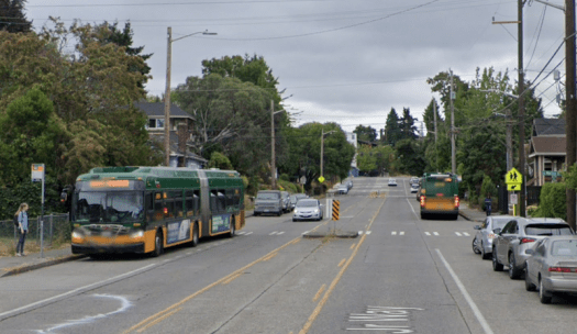
September Service Cuts

Metro’s service cuts announced in May go into effect tomorrow, September 2nd. These are due to the driver shortage, mechanic shortage, and supply-chain bottlenecks for bus parts. Metro is shrinking the schedule to fit the available resources to minimize mid-term or last-minute cancellations. Normally new schedules are available a week ahead, but I just saw the Rider Alert yesterday. Sound Transit and Community Transit also have their semi-annual service changes at the same time. Everett Transit had a change in June. Kitsap Transit doesn’t appear to have changes.

Quick links to changes: Metro | Sound Transit | Community Transit

Metro

On September 2nd the following routes will be suspended (no service): 15, 16, 18, 29, 55, 64, 114, 121, 167, 190, 214, 216, 217, 232, 237, 268, 301, 304, 320, 342. The link above has an extensive list of alternatives for each route. These are all peak expresses I believe. With the loss of the 15 and 214/216/217, anecdotal reports predict overcrowding on the D and 218 peak hours.

Reductions:

  • 10: 30 minutes after 8pm weekdays, after 6pm Saturdays, after 8pm Sundays.
  • 20: Half-hourly off-peak, hourly at night.
  • 28: Hourly off-peak.
  • 73: Half-hourly peak hours, hourly otherwise.
  • 79: Hourly.
  • 225: Hourly.
  • 230, 231: Each hourly. Combined half-hourly between Juanita and Kirkland.
  • 255: Half-hourly after 7pm.
  • 345: Hourly. Delete three northbound and three southbound trips after 6:35pm.

“Route 10 will have a decrease in service due to a reduction of the Seattle Transit Measure investment in the route…. To reduce the impact of reductions to Route 36, the City of Seattle is providing additional funding on this route in the PM Peak period through the Seattle Transit Measure.”

Routes with timing adjustments: 3, 4, 7, 8, 31, 32, 36, 44, 249.

Routes with stop location changes: 22, 208, 225, 249.

Other changes:

  • F and 153: Continue long-term reroute due to I-405 overpass closure.
  • 22: Extend last trip at 9:09pm to two additional stops.
  • 107: Add two afternoon trips for Mercer International Middle School.
  • 208: Add one trip westbound at 5:09am.

More below the fold.

Continue reading “September Service Cuts”

Open Thread 15: Steps to Transit

A step-by-step guide to incrementally improving your city’s transit. (RMTransit)

This was in the last open thread but deserves a feature position. Glimpses of Link in a few places.

This is an open thread.

A new civic campus isn’t worth sacrificing the ST3 CID station

Dow Constantine’s pitch for a new civic campus redevelopment

At last Thursday’s eventful Sound Transit Board meeting, a large contingent of supporters of the 4th Avenue Chinatown-International District (CID) station showed up en masse, thanks to prompting from community activists and Seattle Subway. Although the Board did not make any further alignment decisions, they did authorize a contract modification to HNTB to extend EIS planning and preliminary engineering for the Ballard Link extension.

Back in March, the Board voted to approve the “North of CID” and “South of CID” station options as part of its preferred alternative. These were relative latecomers to the game: all previous options were centered around Union Station, either at 4th or 5th. Sound Transit Boardmembers cited lower costs and lower impacts from the North and South options, in spite of the loss of a station actually inside the Chinatown-International District and the connection opportunities it would provide.

Two big champions of the North/South CID options are King County Executive Dow Constantine and Seattle Mayor Bruce Harrell. A key linchpin in Constantine’s station preference has been the new Civic Campus Initiative, which he announced as part of the State of the County address back in March.

There are sensible reasons for redeveloping the civic center area. Most of the city and county’s key offices are located there and a number of the buildings are dilapidated tokens of modernist architecture. In recent years, the neighborhood has also contended with a large homeless population and street-level crime, particularly around the King County Courthouse.

None of these are good enough reasons to shift a future Link station out of an existing high-traffic hub into other areas merely on the basis of development potential. Prospects for infill TOD opportunities are always tempting to think about, but they wouldn’t warrant the loss of a station that would serve the thousands of existing residents between both the CID and Pioneer Square neighborhoods.

It’s also worth reexamining whether master planning the civic campus redevelopment is even the right approach in the post-COVID world. Rather than concentrating the bulk of key government offices in a single location, newer ways of working might instead warrant decentralizing the city’s and county’s real estate assets. Incentivizing developers to build a variety of mixed uses can help accomplish some of the initiative’s goals while still avoiding an eggs-in-one-basket situation.

But should the Civic Campus Initiative become reality, its success doesn’t hinge on the presence of a Link station right underneath it, especially if it’s at the expense of a much higher-trafficked area. The neighborhood is already extremely walkable: between the original Midtown and Jackson Street locations and the existing Pioneer Square Station, the civic campus would be well served by Link anyway.

Even if the county is keen on ensuring proximity to an ST3 station for its employees, there is no better place than the Jackson Street hub, which is already home to Sound Transit and Metro employees. The substantial amount of buildable capacity in the area also offers plenty of excuses to scratch any development itches that might otherwise be satisfied by the civic campus redevelopment.

High Frequency Network Surrounding RapidRide G

RapidRide G is set to open next year as what many consider the first (and only) Bus Rapid Transit system in the state. The buses will run quickly, traveling in the center lanes on Madison for much of the way. Just as importantly, the bus will run every six minutes every day until 7:00 PM, making it the most frequent individual line in the region.

Along with this important addition, Metro is proposing several bus changes in the area. To call these disappointing is to put it mildly. The 10, 11, 12 and 49 would run every 20 minutes at best. The 47 may be eliminated. This is a major degradation in one of the most densely populated, highest transit ridership areas in the state. As an alternative to these plans, I propose the following:

As with the previous maps, you can make it full page (in its own window) by selecting the little rectangle in the corner. Selecting individual routes highlights them, making them easier to see (with a short explanation as necessary). There are different “layers”, visible on the legend (to the left). For example, you can hide or display the routes that haven’t changed. Feel free to ask questions in the comments if there is any confusion.

Changed Routes:

  • 2 — Doglegs over to Pike/Pine to better complement the G.
  • 8 — Sent to Madison Park, replacing the 11, and resulting in fewer turns.
  • 10 — Goes south to Pike/Pine, combining with the 2 for better headways along much of the corridor.
  • 14 — A little more efficient coverage in Mount Baker.
  • 27 — Combines with the 14 for more efficient coverage in Mount Baker.
  • 47 — Same routing as before, just operates more frequently.
  • 49 — Sent to Beacon Hill, to take over that part of the 60. Runs opposite the streetcar.
  • 60 — Truncated at Beacon Hill (runs from Westwood Village to Beacon Hill Station).
  • 106 — Sent to Yesler to get better combined headways with the 27.

Frequencies:

Every bus would run 15 minutes or better midday. The 47 would run every 12 minutes (like the current 60). Buses like the 8 and 48 would likely run that often as well (if not better). This is based on current service levels and the savings found simply by building a more efficient network. It would be expected that these buses run more often as we pull out of the pandemic and its aftermath.

While these numbers represent a big improvement over the Metro plans, it is when you consider combined headways that things start looking especially good. Broadway along the streetcar path would have 6 minute headways. Yesler, east of 23rd would have 7.5 minute headways. So would Pike/Pine, between 3rd and 15th. All of this can occur at today’s heavily reduced service levels. It is definitely plausible that the 2 and 10 run every 12 minutes in the future, for combined 6 minute headways along their very productive corridors.

Complementary Service

Metro has struggled with the 47 for quite some time. Part of the problem is that it lies fairly close to the 49. Yet there are no routes to the west of the 47, until you get to Fairview (on the other side of the freeway). Thus the spacing between the lines is relatively close, but if you eliminate the 47, you create a large service gap to the west. Compounding the conundrum is the fact that Summit is one of the most densely populated areas of the state, and very close to downtown. A bus should get good ridership there, as long as another bus doesn’t poach its riders.

Sending the 49 to Beacon Hill solves this problem. The 47 and 49 go to different places. Thus riders in the Summit neighborhood walk to the 47 if they want to go downtown. Those headed to the south end of Broadway (or Beacon Hill) use the 49. This pattern continues to the east, as buses alternate between going downtown and going north-south. The results are striking. For most of the people in the area, bus service to downtown is better than ever, while we have more of grid.

Drawbacks

None of this comes without some cost. Service is eliminated on 19th. As a result, I could see a small modification in the northern tail of the 10 to cover it, using Aloha. Otherwise, it isn’t that far of a walk to a fairly frequent bus. At worst you catch the 48, which would require a transfer. Since the G runs every six minutes, this is about as painless a transfer as you can have. Losing service on MLK is perhaps a bigger hit, but it isn’t that far of a walk to 23rd for most riders. If funds become available, I could see adding a coverage route for MLK, and maybe even 19th. But at this point, what the area needs more than anything is better frequency on the core routes.

Likewise, it is clear that the grid for this area is nowhere near complete. It begs for a bus on Boren. Similarly, I could see serving the north-south gap between 23rd and Broadway. These are ambitious, future plans that should be considered when we pull out of the mess we are in.

But for now, we should create a set of core routes that run frequently even in the worst of times (like now). What I’ve sketched out does exactly that. The savings are large, and should be put into running these routes more often, even if they aren’t running as often as we would like.

Sound Transit soliciting feedback on 1-Line disruptions

Sound Transit is inviting anyone who rode Link during the recent 1-Line disruptions to participate in a survey. Service was reduced between August 12th and 20th to fix sagging tracks at Royal Brougham Way. 1-Line service continues to be impacted due to platform reconstruction work at Othello and Rainier Beach stations.

Service disruptions are certainly a thorn in the side of the riding public, but I commend Sound Transit for taking the step to solicit feedback. Even if disruptions can’t be avoided, they can be mitigated by a sound communications strategy.

Open Thread 14: Rural Transit

Thoughts on car dependency from rural America. (InDefenseOfToucans)

Link remains at 15-minute service with single-tracking at Othello and Rainier Beach stations through September 17.

Phase 2 of the T Line opens September 16. This extends Tacoma Link to what we might call Tacoma’s First Hill.

Page 2 has an article on a Jefferson Street funicular in Seattle’s First Hill.

King County explores redeveloping a 9-block government district downtown. This includes the North of CID Link station alternative.

A step by step guide to improving a city’s transit. (RMTransit video)

Trolleybuses vs battery buses. (City for All video)

Montreal transit and urbanism. (CityNerd video)

Non-transit interlude: Why Shakespeare plays can’t be presented the original way. (J Draper video)

This is an open thread.

Sound Transit Board approves Spring 2024 opening for East Link starter line

East Link testing on 112th Ave SE, photo credit the author’s wife

The Sound Transit Board green-lighted the much-anticipated East Link Starter Line (ELSL) earlier today, approving a resolution that authorizes up to $43 million on implementing passenger revenue service in Spring 2024. Previously, the Board had approved $6 million to study the idea of a phased East Link opening, per the urging of King County Councilmember Claudia Balducci.

Earlier in the year, boardmembers representing Snohomish County had expressed concern that opening the ELSL in 2024 might detract from a timely opening for the Lynnwood Link Extension (LLE). However, Sound Transit staff determined no schedule impacts from the ELSL on the LLE, which is on track for a Fall 2024 opening. Nonetheless, Lynnwood Link is expected to operate at lower frequencies until the I-90 connection to the Eastside operations and maintenance facility (OMF) is complete.

With the ELSL’s approval, service levels will be formally laid out in the 2024 Service Plan, which is anticipated for a board vote later in October. In the meantime, initial readiness plans call for a 16 hour service span with constant 10 minute headways across the day using 2-car trains.

The ELSL will also only operate between Redmond Technology Station (serving the Microsoft campus) and South Bellevue Station. Since it does not directly duplicate any existing services, it remains to be seen whether or not Sound Transit will adjust service levels on the 550 or 556 when the starter line opens.

Ridership on the ELSL is forecasted at 6,000 daily boardings. Given the ubiquity of remote work and ample parking along the corridor, I expect ridership to be relatively muted until the I-90 connection is complete and Bel-Red is more fully built out.

Although East Link and the year 2023 have suffered an irreparable divorce, it’s encouraging to see the ELSL come to fruition, thanks to hard work from Sound Transit staff and championing from councilmember Balducci.

Open Thread 13: Hope

Hope for American transit: things are getting better. (RMTransit video)

Top 10 US metros with the highest bus ridership per capita. Seattle is #4. (CityNerd video)

Washington congressional delegation asks FTA to fund Cascadia high-speed rail study. ($)

Trolleybuses vs battery buses. (City for All video)

The advantages of green tram tracks; i.e., grass between the rails. (City for All video)

A Taylor Swift fan from Canada vlogs her Seattle light rail weekend. (Keri Pratt video)

This is an open thread.

Metro 8: Connections Comprehensive

(Part of a series highlighting high-performing transit routes in the Puget Sound region)

Route 8, King County Metro, in Seattle. North points down and to the right. Illustration using Google Maps.

Metro 8 performs well at all times of the week, with its particular strength being the amount of rides it carries for its level of service. Its total ridership is eighth among Metro routes, with 4,828 rides per weekday, but it does that with fewer platform hours than anything above it on the list, which is the reason it performs so well on rides per platform hour. It places second in that metric among Metro routes on weekdays, carrying 34.7 rides per platform hour during peak periods and 32.3 daytime off-peak. That means a single 8 trip taking 45 minutes provides a ride to an average of 26 people. I was interested in what accounted for its success, so, as I did with RapidRide A, I went looking for answers. I took the light rail to Mt. Baker, where I hopped on the 8 heading north.

Riding the 8 on that weekday afternoon, it was interesting to me how much the 8 felt like two routes in one. The first section, which aligns north-south mainly on MLK Way, runs through the leafy pre-war neighborhoods of the Central District. The trip during this leg was fast and lightly boarded. With the exception of a clutch of people who boarded at the deviation to 23rd Avenue (near the excellent Communion restaurant), the bus was almost empty.

The north-south leg of the 8 runs through the leafy neighborhoods of the Central District. Photo: Google Maps.

The second leg of the route was much busier. This is the section that runs east-west from Madison Valley to Uptown, ending a block from Climate Pledge Arena. Almost immediately after the bus turned west, a large group of people boarded outside an apartment complex. The bus was suddenly busy, and it remained so through the end of my trip, despite big turnovers of people at the major stops. As we passed through Capitol Hill and South Lake Union, people came and went so rapidly that it was hard to keep track. Finally, the bus stopped, and I realized (after everyone else had debarked) that this was the end of the line. I wandered around, bought a sandwich, and looked for a way to get home.  

What makes the 8 successful on its productivity measures? It has the benefit of going through some very dense places of Seattle, plus serving points of interest like Seattle Center. But it is hardly unique in this regard. In fact, its performance (on total ridership, on rides per platform hour) is better than other routes that serve even denser areas, like Routes 2 and 10. Those routes have similar frequencies throughout the day to the 8, so frequency cannot explain it, either. The 8 does avoid deviations, except the one to 23rd Avenue. That counts in its favor, but that alone does not make a route a top performer.

The 8 (in yellow) and the 2 (in orange) both run through areas of high residential density. Both are strong routes, but the 8 has higher daily ridership and rides per platform hour. Map by author.

Judging from how busy that east-west leg was, I would argue that the major, useful connections along its east-west leg account for its success. In less than three miles of travel, it makes connections to Link, RapidRides C, D, and E and the 40 and 48 bus lines. All of those are among King County’s busiest transit lines, and a rider on the 8 can access any corridor that they would like. Because it runs cardinally east-west and makes perpendicular connections with those lines, it is the most direct route to connect them. In this city where so many travel routes run north-south, it makes sense that a route providing a useful connection with all of them would be highly productive. I believe that is what we have here.

There are other ways to conceptualize the 8. It takes an indirect route between Mt. Baker and Uptown, meaning it is not good for end-to-end travel. But it does connect the midpoints of the route to either end, directly. You could think of the 8 as two routes, heading west and south from Madison Valley, that just happen to be through-routed with each other for efficiency’s sake. The 8 also is a part of what Jarrett Walker calls a “spiderweb grid,” playing the role of a circumferential by joining routes radiating from Downtown on two sides. One of the interesting things about the study of transit is there are so many ways to think about how a single line fits into a larger network. When you consider all the possible connections and routes a person could take, the possibilities are almost limitless.

Overall, the 8 suggests the importance of transfers in the success of a transit line. It doesn’t serve downtown. It does not have a clear niche to serve a particular type of travel pattern. Yet because of the way it connects to other routes, it becomes significant and useful enough to count among Metro’s best-performing services. There is a larger lesson to this observation: after all, even though this series is focused on high-performing lines, it ultimately does not matter where a single line can get you, but where the whole transit network can get you – and how quickly. Each individual line is subordinate to its position in a greater network, a greater ecosystem. By making so many quality connections to other routes, the 8 points to the importance of all the other routes that enable it to succeed.

The 8 near its terminus in Uptown. Photo from 2015. Photo: Google Maps.

Bus Restructure for Lynnwood Link

I’ve come up with a few suggestions based on the latest proposal for Metro’s network following Lynnwood Link (P3). My goal was to improve the proposal while retaining as much of it as possible. As has been the case in the past, I’ve made a map to make it easier to understand the suggestions:

As with the previous maps, you can make it full page (in its own window) by selecting the little rectangle in the corner. Selecting individual routes highlights them, making them easier to see (with a short explanation as necessary). There are different “layers”, visible on the legend (to the left). For example, you can hide or display the routes that haven’t changed. Feel free to ask questions in the comments if there is any confusion.

I would not expect every suggestion to be implemented. I’ve listed each one in the order of importance, starting with the most important first:

65 and 77

The 65 is back to what was suggested in P2. The 125th/130th corridor is one of the most important in the area. Not only is it the fastest way for someone to get from Lake City to Link, but also the fastest way to get to Aurora and Greenwood Avenue. There are several reasons why making this corridor part of the 65 is better than the proposed 77:

  1. Avoids the awkward turn in Lake City mentioned previously.
  2. More bus stops in Lake City. The stops on the 65 manage to be within walking distance of almost all of the apartments in Lake City. In contrast, the proposed 77 only covers a subset of the area, before heading south on Lake City Way, leaving a significant gap in coverage. For example, this versus this. The 65 would provide a much shorter walk for a lot of people looking for the fastest way to Link (or Bitter Lake, Ingraham High School, Aurora, Greenwood, etc.).
  3. More one-seat connections. Both the P2 version of the 65 and the P3 version of the 77 serve Bitter Lake and Ingraham High. Connecting those areas to Nathan Hale High School, Wedgwood, Children’s Hospital, the U-Village and the east part of the UW adds a lot of value. In contrast, south of Lake City, the main destinations on the 77 are Roosevelt and the UW — areas served by Link. I don’t see too many people sitting through the hairpin set of turns to get from Roosevelt to Bitter Lake — they will simply take Link and transfer. The P3 version of the 77 appears to be two buses awkwardly glued together, whereas the P2 version of the 65 works for a lot more trips.
  4. Good match of frequency. The proposed 65 is not as frequent as the 72, but is still a lot more frequent than the 77 . While I feel that Lake City Way should have good frequency between Northgate Way and Roosevelt, it isn’t as important as the critical 125th/130th corridor. The frequency on the P2 version of the 65 is much better than the P3 version of the 77.

With the 65 being sent to Bitter Lake, the 77 can cover the area between Lake City and the station (30th, 25th, etc.). Northbound, the bus would turn left on 127th, then right on 30th. If 127th turns doesn’t work, then 130th might. Either way, it wouldn’t make a detour, like the proposed 77; there would be fewer turns, with the bus always headed the same basic direction. Going the other way, it is even faster, as it simply stays on 30th until it merges with Lake City Way.

348 Replacing 67

Most of the suggestions here are revenue neutral (or close to it). In this case though, the changes would save service hours. That is why I think it is so important. Most of the routes in the P3 proposal have very poor frequency. This change allows the buses to run more often, with no additional funding. This is critical if we are going to have a good transit system.

This comes with trade-offs, but rather minor ones. Some riders along the 15th NE corridor lose their one-seat ride to Northgate, but they gain a one-seat ride to Roosevelt and the U-District. The route complements buses like the 61 and 75 (which go to Northgate). It is a bit faster to get to Northgate Station instead of Roosevelt Station, but a large portion of the riders heading to Link will take crossing buses to 130th or 145th station anyway (or the 61 to Northgate). For those in between the major cross-streets, this still provides a fairly fast connection to Link (via Roosevelt) while providing a new one-seat connection for everyone along the corridor. The only significant loss is for people along 5th Avenue NE (between Northgate Way and 103rd). They lose their one-seat wrap-around ride to Maple Leaf, Roosevelt and the U-District. The alternative for those riders is to take a different bus and transfer or walk about five minutes and catch the same bus.

This change could be justified without the time savings. With the time savings, I believe it is critical.

72 and 333

This is a relatively minor change that could have very positive benefits. As of right now, Lake City is directly connected to Shoreline Community College (SCC) via the 330. While the bus does not run often, it performs quite well — in the top 25% of routes in rides per platform hour and passenger miles per platform hour, which is striking given its low frequency. This restores that one-seat connection, while providing other benefits.

The current 330 pathway is a faster connection between SCC and Link, while also getting lots of riders along the way. It is also the fastest way to get from Aurora to SCC. Someone from either end of Aurora (transferring via the RapidRide E) could get to the college much faster. Combining this section with the 72 is a better balance of frequencies. The 72 runs often (for good reason). In contrast, the 333 is not slated to run as often, and this looks to be the strongest section. By having the 72 operate this vital section, headways should be better (now, and in the future).

Under the current proposal, riders from the east can stay on the bus as it goes through SCC. My guess is very few would do that though. It simply takes too long for the bus to weave its way so far west, only to have it turn around and weave its way east. Shoreline Community College is a much better terminus.

345 and 365

Extending the 345 to SCC gives it a stronger anchor. The college is the second most popular stop for that line (second only to Northgate Transit Center). About 40% of the people who board at Four Freedoms head west (to get to SCC) not east (to get to the hospital and Northgate). This restores that connection.

With the 365, service is restored to most of Meridian. The section on 5th is basically an add-on (I don’t expect many riders to “round the horn” and take a bus from Meridian to 5th). Overall, the changes to the 345 and 365 would provide better coverage (and probably significantly more ridership) at little additional cost.

U-District Routing

I’ve largely ignored the subject of through-routing in the U-District. This is a tricky subject, with a lot of trade-offs. I don’t have access to the information (such as reliability data) that would allow me to make a more informed decision. In terms of frequency and total travel time, the 77-75 or 45-72 seem like possibilities. I don’t think the 348 could be through-routed with another bus, simply because it is long. Speaking of which, I also accept that there will be service on Roosevelt Way through the U-District, even though I could make a strong argument for consolidating service on The Ave (University Way). I don’t feel as strongly about that issue as I do the suggestions made on the map.

Deadline for comments is August 27. Please let Metro know what you think.