Countdowns: Lynnwood Link (August 30); RapidRide G (September 14)
Transit Updates:
Seattle Times ($): A Sound Transit bus crashed at 5th and Terrace on Saturday. 17 injured; 11 hospitalized. KING 5 notes that the driver told emergency responders the brakes failed. Also covered on Seattle Fire Line.
A new bridge connecting Eastrail across NE 8th Street to the 2 Line’s Wilburton Station opened on Sunday; coverage in The Urbanist and The Seattle Times ($).
You can now use ORCA cards through your Google Wallet on your Android phone; coverage in The Urbanist, the King County Metro Blog, and Community Transit Blog. The digital card replaces an existing card, preventing folks from double-dipping a pass between a digital and physical card.
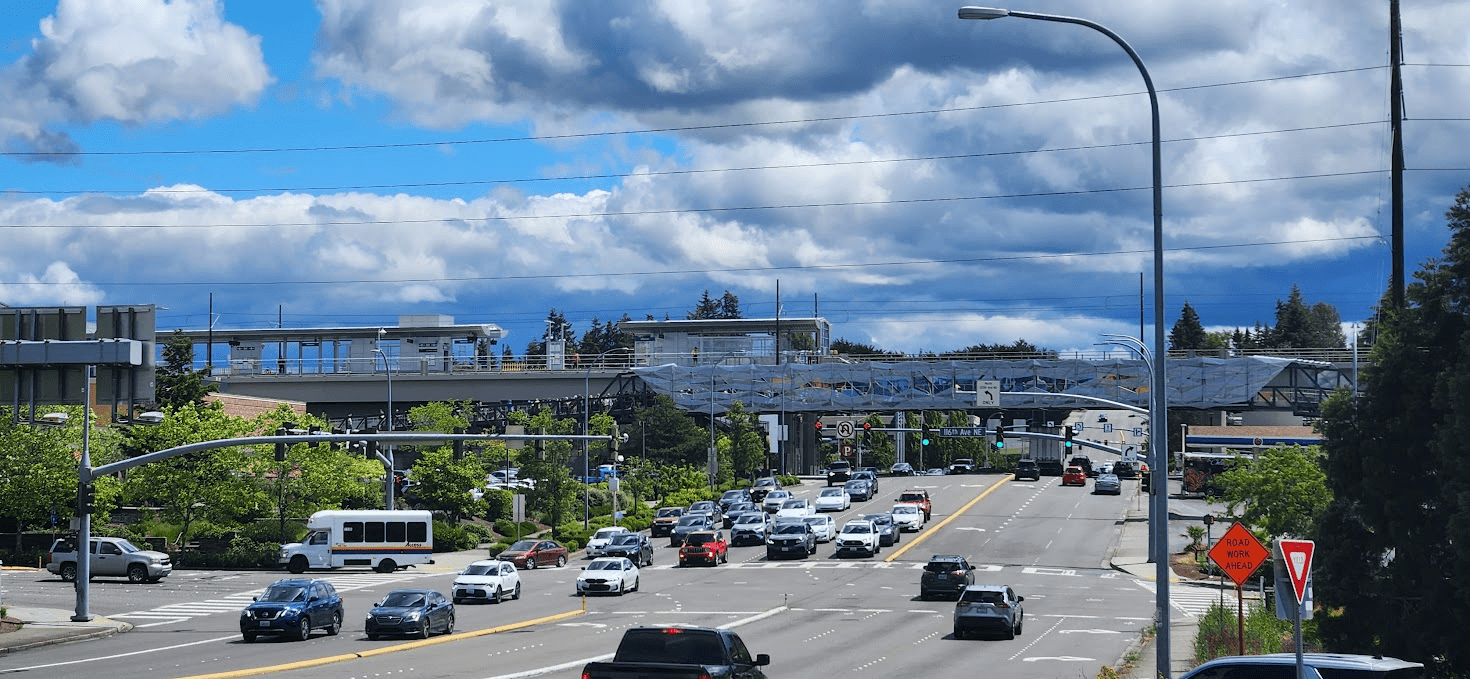
The Urbanist: RapidRide K planning kicked into higher gear.
Local News:
King County Councilmember Claudia Balducci formally proposes adoption of a “Safe Systems” approach across the County.
Seattle Times ($): traffic slowed in 2023, but is still better than 2019.
The Urbanist: Extra funding proposed for Transportation Levy may not actually build 500 block of sidewalks in 5 years.
Other News & Opinion:
Should we paint the bus with route information?
How cheaper, quicker-build BRT could benefit cities more than rail.
This is an Open Thread.
Nathan,
It’s a small thing, but thanks for the update to the countdown timer for Lynnwood Link Extension. The “all days” format is much nicer than the weeks-days-hours format.
Just 65 days to go!
Thanks, Lazarus.
@Nathan,
No prob.
The opening of LLE is going to be absolutely transformational. It’s going to change people’s lives. And, as it turns out, it is going to change my life even when I DON’T use it.
How is that possible?
Well….the sister-in-law in North City has decided that three-seat rides are inhuman. So, for example, if she is going home from Bellevue she won’t do the bus-Link-bus thing anymore. Instead she just does bus-Link and moves in with us for the night. She has a key to the house so she just lets herself in. Surprise!!!!
It can be a bit unnerving when you aren’t expecting it, but it should all end when LLE opens. We get our house back!
And, the sister-in-law doesn’t drive so with the extension of Swift Blue to 185th they can get from North City to Costco at Aurora Village without me having to drive them every time.
So my life will get much better even when I don’t use LLE! And for a variety of reasons.
It’s not just your sister-in-law. Nobody would subject themselves to 3 seat rides if they have any alternative. Planning transit as if anyone would do that is a massive error.
I know people here love to tout this an a legitimate option, “if frequency were only high enough”, but is simply not.
There is no countdown clock on this, but also worth noting the CT Swift Blue Line extension to 185th/Shoreline also opens Sept. 14.
@another engineer,
“ also worth noting the CT Swift Blue Line extension to 185th/Shoreline also opens Sept. 14.”
They are aware of the timing for both the opening of LLE and for the extension of Blue Swift to 185th.
However, I need to keep reminding them of all that because whenever they see an LRV operating on the line they just assume the line must be open.
They bought the house in Shoreline with the anticipation of LR arriving, but the addition of Blue Swift is a huge improvement that they did not ever anticipate.
They look forward to both openings.
@Cam,
“It’s not just your sister-in-law. Nobody would subject themselves to 3 seat rides if they have any alternative”
That is certainly true. Nobody likes 3-seat rides. But only my sister-in-law seeks to avoid 3-seat rides by moving into our house. It’s a unique situation, to say the least.
That said, life for the sister-in-law will get much easier when LLE and full ELE open.
When LLE opens effectively all of her 2-seat rides become 1-seat rides. These are the bulk of her trips and they will become 100% Link only. Then, when full ELE opens, her current 3-seat rides will also become 1-seat rides, and also 100% Link based.
Interestingly enough, when LLE opens and the bus restructures happen she will increase her bus usage in one important area. She will start using CT’s Blue Swift to access Costco and Aurora Village. She is also looking forward to this, as is the father-in-law.
Hey all. I was able to get STB back to almost-daily posts in May and was hoping to keep that energy through June and beyond, but I’ve recently changed jobs and now have less capacity to write in my free time than I’d hoped.
If anyone is interested in writing for the blog, check out the “Guest Post Guidelines”, here: https://seattletransitblog.com/guest-post-guidelines/.
Although the guidelines are generally oriented towards longer posts historically put up on Page 2, they also apply to Main Page posts, long form or short, and I’d be happy to help an interested writer fill STB’s pages between our news roundups and Sunday videos.
What sort of guest posts are you looking for? I don’t have any news to share, and I’m less optimistic about transit these days, but I’m still following the blog and I might be interested.
May I ask why you are less optimistic about transit these days, especially considering Link’s expansion over the next few years? Perhaps that’s a blog post right there. Why I’m not optimistic about local transit, by William C.
Based on my experience as the newest member of the editorial “staff” at the blog, I think anything of transit or land use interest in the PNW is worth considering writing about. The blog is relatively unique these days in that it (still) has a healthy and thoughtful commentariat, so anything that seems worth giving the commentators something to discuss is worth writing about, in my opinion.
Since we’re all-volunteer and have full-time jobs or other responsibilities, we don’t have the capacity to stay on top of the news beat. However, you may have noticed an increase in concentration of articles from the Urbanist in our news roundups, and that’s the direct result of them hiring some great writers recently who are filling that role for local news that would typically fall into the Blog’s purview.
I’ll send you an email, but I’m also happy to discuss additional post/article/story ideas openly here in the comments.
Personal experiences or interests are a starting point. If you live in a neighborhood or city we haven’t covered much, you may have some thoughts on how well its existing routes work, whether various proposals will meet the needs of the residents/visitors, or a new idea you might have. I took a particular interest in East Link since that’s where I’m from. I followed Lynnwood Link heavily during its alignment debates because I felt it could have a lot of potential if done right. I did a bus tour of the Snoqualmie Valley and a walking tour of northwest Everett because I wanted to see them, and wrote about them.
There are always ideas and perspectives the other authors haven’t thought of, and we don’t realize it until somebody suggests it or we see a mention in the comments. One of the general things we’re trying to do this year is to identify things that get mentioned in the comments, or maybe get long discussions in the comments over months, and consolidating those into articles that address the issue more completely and give it deserved publicity. So if you see any of those that could be articles, you can suggest them.
There’s also room for artistic features like haiku or poetry or photographs. Somebody used to put an occasional transit poem in the comments, and that was nice.
How about the relationship between transit and health? Transit and climate? Transit and housing? We touch on these things, skirting the line of OT.
There’s plenty of space to write about connections between transit and health, climate, and housing. There’s no shortage of topics; just a shortage of volunteers with the capacity to do the writing and analysis in their free time.
I mean, I could probably put a post up every day regurgitating some recent news release, but I think that job is generally better done these days by other outlets. The Blog used to have over a dozen active writers; we currently have half that, and none of us have the time or energy Martin H Duke had to make sure there’s something new every day. I think there’s a worthwhile niche to fill of thoughtful commentary on transportation and land use issues in the region (definitely not just Seattle!), but we just need a new stable of thoughtful folks to fill it.
There might be some who would be open to writing a post, but aren’t sure what to write about. Why not take this opportunity to throw out some post subject ideas? Someone here may see an idea, and decide that’s something they’d be interested in, and could handle writing.
You asked for it. Here’s a dump of ideas off the top of my head:
Seattle-focused:
– A breakdown of transit/street improvements that could/would be funded by the proposed Transportation Levy
– Proposals for improved land use around upcoming Link stations, especially WSLE and 130th, but also Graham Street, BAR, and BLE.
– A series of posts reviewing of each of the “Neighborhood Centers” proposed in the draft Seattle Comprehensive Plan, discussing current land use patterns and potential future development, and current transit service.
– A series of posts proposing pedestrian-oriented streets in various core neighborhoods, and how they might be implemented.
Greater Seattle/Puget Sound:
– A discussion of Darrell Owens’ recent essay “How Urban Renewal Ruined Everything” (https://darrellowens.substack.com/p/how-urban-renewal-ruined-everything) and how it may or may not apply to the region.
– Review(s) of other city’s draft comprehensive plans and how they may be improved to be transit-oriented if they aren’t already.
– Interviews with transit operators on their current experience.
– Ideas on new travel opportunities made feasible with service restructures around ST2/ST3 openings.
– Proposals for improved land use around ST2 stations opening in the next two years.
– Construction updates w/ photos of ongoing SDOT projects like the Route 40 TPMC, Ballard Bridge/15th Ave NW repave + bus lanes, Rainier Ave bus lanes, Beacon Ave S, and others.
Outside of the Puget Sound:
– Reviews of transit/land use further afield, even out-of-state or out-of-country, with comparison to service in the Puget Sound.
– Travelogs of long or multi-step trips to places typically considered only accessible by car, such as the outer Olympic Peninsula, or central Washington, or longer-haul rides across country.
– Comparison of how other cities (primarily outside of the USA) are implementing aggressive changes to land use and street design to combat climate change, and how we might implement those changes here.
– Comparison of recent (or not-so-recent) zoning changes in other cities and how they’ve transformed areas that may have looked like areas of Seattle into higher-density forms.
General Commentary:
– The suburbanization of poverty and gentrification of inner cities, and how that affects who has access to transit.
– Impacts of transportation systems on public health and the environment, including air quality impacts around freeways, release of 6PPD-Quinone from from rubber tires, noise-induced stress, deadly street design, etc.
– Book reviews, as there have been several new and excellent books with updated takes on urbanism and transportation issues
– Political commentary on support or opposition from empowered electeds regarding progressive land use/transportation changes.
– Advocacy for progressive revenue streams to support aggressive adaptation of land use and street design for a sustainable future.
– Review of advances/pressures in urban/suburban/exurban freight and how we might electrify those systems
– Do cruise ships or airlines count as transit, and are there sustainable alternatives?
– Review of newly published academic literature on urban planning and/or transportation and how it may apply to Seattle or the broader Puget Sound. (I’ve also imagined guest posts from students in urban planning courses at local colleges summarizing recent projects and current research, but I’m not sure how to pursue that).
Plus, not every post has to be criticism or breaking news! There can be celebration of improvements or recognition of things done well here that are poorly executed elsewhere; a post could be creative/artistic expression as Mike mentioned, or a review of local history.
A post topic might even be superficially unrelated to transit and land use; for example: Seattle Public Schools is planning to shut down many elementary schools due to lack of enrollment, but could that be related to a lack of new development or housing affordable to young families near those schools? Would closure of the schools affect transit ridership if local families move away? A writer could theorize on relationships between seemingly disconnected issues and the topics of the Blog.
I could keep going, and I’m sure there are issues I don’t even know about. All these need is someone will to volunteer the time to write. If you or others find interest in any of these topics, or is inspired to consider writing about another topic, I’d be happy to reach out.
Based on my experience as the newest member of the editorial “staff” at the blog, I think anything of transit or land use interest in the PNW is worth considering writing about.
Agreed. We really aren’t that picky when it comes to material, or even a particular argument. Presentation and grammar are a different matter (although even then we usually aren’t that picky). Mike does almost all of the editing (which I very much appreciate). I tend to chip in when it comes to structure or approach. For example, Martin recently wrote about West Seattle bus service (as an alternative to West Seattle Link). He wrote the whole thing, but we bounced a lot of ideas back and forth (which I very much enjoyed). To be clear, these are basically suggestions — writers are generally free to ignore our ideas and do their thing.
Personally I prefer nerdier discussions, but it can be difficult to dig out the data from the various agencies. There is also a lot to be said for essays that are more “human interest”. For example I’ve always wondered what it would be like to take transit from Seattle to Hurricane Ridge (it can be done). I’m sure this would get plenty of interest, especially outside the usual group here (which is good).
There is nothing wrong with focusing on the big picture (e. g. what is happening in the other Washington in regards to transit) but chances are, other writers across the country are doing that. In contrast, looking at things from a local standpoint may result in writing about things that no one else has covered. Thus if you do write something — even if it is about a national situation — it is best to tie it back to something local.
“Ideas on new travel opportunities made feasible with service restructures around ST2/ST3 openings.”
That sounds promising. We could probably have two or three people write articles about that, and they’d all come up with different things. Both in terms of knowing what’s near stations or on frequent bus feeders, and what kinds of destinations people would look for. For instance, I’ve been making a mental list of parks with the best transit access.
There is a grassroots effort to retain route 20. Maybe they would be interested in writing a guest post.
Supposedly they have parsed the pertinent Metro data and determined that Metro’s own data indicates that route 20 should have been retained. In addition to identifying some other issues related to the proposed elimination.
Note: I am not involved in this effort so I can’t comment on their claims, although I am sympathetic to their goal.
If you keep route 20, what do you cut to pay for it? And the part of route 20 that has the most riders (Northgate to Lake City) is kept, just under route 61.
If you keep route 20, what do you cut to pay for it?
That is always the hard part. In this case there is no straightforward solution, although moving the 62 (as Metro wanted to way back when — https://seattletransitblog.com/2024/03/20/improve-buses-on-the-east-side-of-green-lake/) would help quite a bit.
@asdf2,
“ If you keep route 20, what do you cut to pay for it?”
That is easy. There basically isn’t any Metro route right now that is operating at capacity at anytime of the day.
You name the route, even a slight reduction in frequency would be adequate to fund a route like the 20.
It’s just not that hard.
“There basically isn’t any Metro route right now that is operating at capacity at anytime of the day.”
The issue isn’t whether bus vehicles are full. It’s whether the most people have the most mobility choices. A mobility choice is the opportunity to go somewhere, regardless of whether you go today or not. The 20 can get less riders per service hour than routes on nearby denser streets or other denser streets; that’s why it’s being cut. Because the hours can serve more people elsewhere. Because there are more people on another street, and more destinations on the other street that people can go to. That translates to meeting more of the total public’s mobility needs, and also leads to higher total ridership.
> That is easy. There basically isn’t any Metro route right now that is operating at capacity at anytime of the day.
Actually the 62, 40, 7 and probably other major routes are a full bus during peak times. They’ve removed most of the peak routes so it’s less peak capacity. Though there are definitely other less popular routes not running full capacity or the popular routes during off peak — the question is which route’s frequency to cut.
Saying there are no Metro routes operating at capacity anytime of the day is like claiming Link is never operating at capacity anytime of the day. Ridiculous.
@Mike Orr,
“ The issue isn’t whether bus vehicles are full. It’s whether the most people have the most mobility choices.”
Ah, you sort of make the case for saving the 20 for me. Because saving the 20 is about providing the “most mobility choices” for the “most people”. That is exactly why people want to save the 20 — they want to maintain a mobility choice for people who will otherwise be cast into a mobility desert by Metro’s restructure plan.
And Metro has the capacity and the service hours to save the 20. They just need to reduce frequency on some other route to do it. And Metro’s own data shows they aren’t operating anywhere near “at capacity”.
So, ya, maintaining the most mobility options for the greatest number of people is exactly what saving the 20 is about.
Ah, you sort of make the case for saving the 20 for me. Because saving the 20 is about providing the “most mobility choices” for the “most people”. That is exactly why people want to save the 20 — they want to maintain a mobility choice for people who will otherwise be cast into a mobility desert by Metro’s restructure plan.
Um, what transit desert is this? Going south from Northgate, until you hit 85th is still directly served by the 61, and the walkshed easily extends south to 80th for that. Past 80th, you still have the 45 and 62, and once you get to 50th can walk to the 44.
Moving the 62 to run on Latona and 56th would help but even without that the area will remain a transit oasis, especially compared to other parts of the city.
“Because saving the 20 is about providing the “most mobility choices” for the “most people”.”
“The most people” meaning out of all of Seattle’s or King County’s population, not just Latona Ave NE. A separate route on Latona is not the way to serve the most people. More frequency on Roosevelt is, or moving the 62 to Latona so that a high-volume route can serve it without needing a second low-volume route a few blocks away.
The 20’s proponents may have a point if they can prove it scores better on Metro’s metrics than Metro claims. But the issue gets into whether that applies to the whole route or only half the route. The northern half between Lake City and Northgate is more strategic, and is being retained with the future 61. It’s the southern half that’s lower performance, and is a few blocks away from a parallel north-south 62. “Saving the 20” means retaining the entire route, when it has two halves that don’t relate to each other much (few people stay on it past Northgate), and when the northern half can be attached to a better corridor (like the proposed 61). Keeping the 20 as-is requires taking hours from another route. Restructuring the 20 frees up hours that can go to a route that serves more people.
@Mike Orr,
“ The 20’s proponents may have a point if they can prove it scores better on Metro’s metrics than Metro claims.”
The proponents of the 20 claim that Metro is violating its own guidelines when selecting the 20 for deletion. Based on Metro’s data.
“The northern half between Lake City and Northgate is more strategic, and is being retained with the future 61.”
Ya, the future 61. The Fred Meyer Shuttle. It goes from Fred Meyer in Lake City to Fred Meyer in Greenwood. It’s really useful if you go to the Greenwood Fred Meyer for Chobani but they are out of your favorite flavor.
“It’s the southern half that’s lower performance, and is a few blocks away from a parallel north-south 62”
The 62 doesn’t go where the 20 goes. Full stop.
There is no Metro in the proposed restructure that ties North Seattle College, Blanchet, and the UW together with a 1-seat ride.
And, many of the riders of the 20 along Latona are heading to the U-Dist LR station to continue south. Make in them walk several blocks west to the 62 so they can travel north, and then travel back east, and then travel south on LR to get back to UDS where they would have boarded Link if the 20 still ran is a bit fantastical as an option.
It’s just making Link harder to access. That shouldn’t be our goal regionally. We need more connections to Link, not fewer.
“The proponents of the 20 claim that Metro is violating its own guidelines when selecting the 20 for deletion. Based on Metro’s data.”
That’s what I mean. Metro’s guidelines say it should review the bottom quarter of routes to potentially delete or restructure them, to shift hours to underserved corridors or the top quarter of routes. Being a coverage route far from other alternatives is a reason for keeping it, as in the 27, a steep hill down from the 14. The 20 is close to other north-south routes in a flat area. The proponents can argue Metro made a mistake in evaluating the 20, but it will have to prove its case.
“It goes from Fred Meyer in Lake City to Fred Meyer in Greenwood.”
There’s more in Greenwood than just Fred Meyer.
“many of the riders of the 20 along Latona are heading to the U-Dist LR station to continue south.”
There aren’t many people on Latona so there can’t be many riders. That’s the point. Latona is lower-density than other arterials and has little retail. Residential-only areas have one-way demand out of the area and back. Mixed-use areas also have a reverse demand to the businesses and amenities in the area. Those are what’s missing on Latona, and what make it a weaker corridor for bus service. And what’s wrong with Seattle, that it has such large residential-only seas like that.
“There is no Metro in the proposed restructure that ties North Seattle College, Blanchet, and the UW together with a 1-seat ride.”
Do a lot of people want to take a slow milk run from the college to UW and admire Blanchet’s building on the way? Blanchet’s riders just need to get to Northgate or UW, they don’t need them both to be on the same route.
North Seattle College to UW has Link. Blanchet to UW has the 45. Blanchet to North Seattle College has the 61. Getting closer to the college than the ped bridge may be a bit of a transit hole, but that has to be compared to other holes in North Seattle, or holes that would be created if you reduce/delete another route to save the 20. Metro has a limited number of service hours and drivers, and has to deploy them where they would serve the most people’s needs, as I said above. The most people’s needs aren’t on Latona, or the difference between Northgate Station (on the 61) vs College Way & 95th (on the 20) re which is closer to the college.
“It’s just making Link harder to access. That shouldn’t be our goal regionally. We need more connections to Link, not fewer.”
It’s ironic that you’re reducing Greenwood to just Fred Meyer, while simultaneously arguing that Latona is so big it must have a separate bus route, as if Latona is more major than Greenwood.
The reason the 61 is being created is that people have been crying out for better east-west transit between Lake City, Aurora, Greenwood, and Ballard. The 61 doesn’t get all the way to central Ballard but it’s a starting step. Every one of those areas — Lake City, Greenwood, Ballard, and transferring to Aurora — has several times more residents and retail/amenity destinations than Latona has.
But that’s just one of your inverted logic claims. You’re also claiming that 130th station isn’t worth it, even though it would allow an east-west route to connect Lake City and Bitter Lake directly to Link and to each other. Again, two areas that are much larger than Latona. And adding east-west service, which is underserved in Seattle. You say 130th station won’t add any net Link riders. One, it will make all those people’s trips better, and that’s worthwhile in itself. Two, I don’t believe it won’t add riders.
The commonality between both these claims is dismissing Lake City. Why do you think it has so little potential? Why do you think Latona has more potential than that?
The problem with the second half of the 20 is that is mimics Link. It might have made sense twenty years ago, or maybe when Link ended at the UW (or if Link ended at the U-District). But Link has made it to Northgate, and the 20 just doesn’t make sense any more.
Just to go over the basics, it goes from Lake City to Northgate to the U-District. Would anyone take it from Lake City to the U-District? No. A quick check of Google shows me six transit options for getting from Lake City to the U-District. Only one involves the 20, and it suggests transferring at Northgate to Link. Likewise, no one would take it from Northgate to UW. Thus many combinations — including those with the most potential riders — just don’t work.
In contrast, consider the 61. It connects Lake City to Northgate to Greenwood. Would someone take it from Northgate or Lake City to Greenwood? Yes! Absolutely. It is basically a straight shot. Every combination along there makes sense. It isn’t trying to replace Link. In fact, it complements it. If you are in Greenwood, this is the fastest way to get to Link. I realize that isn’t intuitive, but it is faster to head up to Northgate (even if you are going south) then it is to continue to Roosevelt. Furthermore, the combination means that someone in Greenwood (or along 85th) can get to Link twice as often. They can take the 61 and if they happen to miss it, they can take the 45. Since both will run at the same frequency, that means a combined frequency to Link of 7.5 minutes.
Likewise, because the 20 mimics Link, it adds little from a network perspective. Let’s say I’m in Sand Point and want to go up to Northgate or North Seattle College. I can transfer to the 20. But no one will do that. They will use Link. In general the 20 doesn’t connect well with other buses. From the east there is the 44. Again, if someone is coming from Ballard and heading to Northgate they will just take Link. Even if they are headed to Green Lake they will just take the 62. Speaking of the 62, that is another possibility. They could be riding the 62 north from Stone Way and want to get to Northgate or Lake City. The 20 works, but again, it makes more sense to just transfer to Link (to get to Northgate) or the 522 (to get to Lake City). From a network perspective the 20 isn’t very good because it can’t compete with Link.
In contrast, imagine I am on the East Side of Green Lake, and I’m headed to Northgate or Lake City. Right now my options are terrible. I’m looking at 3-seat ride, or maybe taking the E and the 40. This means going back and for miles before I finally head the direction I want to go (https://maps.app.goo.gl/ANJfwr3tmDzNkpQeA). But with the 61 I can get to Northgate or Lake City much faster. It is a straight shot. The same is true if I’m in Phinney Ridge and take the 5 north. The 61 adds quite a bit from a network perspective, while the 20 adds next to nothing.
Again, it goes back to Link. The 61 works very well with Link. The 20 is a poor substitute for it. Link is here. Get used to it.
That is exactly why people want to save the 20 — they want to maintain a mobility choice for people who will otherwise be cast into a mobility desert by Metro’s restructure plan.
So basically you want to create another mobility desert to replace the one created by the 20. Since you haven’t actually suggested a route, I’ll pick one for you: the 28. The 28 has struggled of late so this isn’t a crazy choice (I’m not suggesting we get rid of the 7). The problem is, if you cut the 28 while retaining the 20, way more people have to walk much further to catch a bus. You have replaced a fairly small desert with a huge one. That is the problem.
Look, I get it. This is a coverage hole. But that is all it is, a coverage problem. From a network standpoint or a ridership standpoint or even just a service standpoint the 61 is better (it is shorter). Coverage holes are bad. But we have worse coverage holes. Look at West Seattle! The 37 (which is currently suspended) and 57 only run a few times a day. That means there is a huge swath of West Seattle with no service at all. It is a 20 minute walk to the nearest bus from here (https://maps.app.goo.gl/2EBPcBz2fpPeByA67). This isn’t the worst possible trip, either. This isn’t beachfront property — that is four blocks from an elementary school! It is largely single-family homes, but there are a bunch of single-family homes. Why should one tiny piece of Tangletown have all-day service when so much of West Seattle has nothing?
The same goes for Sunset Hill (or Seaview). Or various parts of Wedgwood. Unfortunately, coverage is almost always a zero sum game. One place gets coverage, another place gets less. Unless you want to shift away from ridership-oriented service to coverage service. That is a trade-off. We can do that, but the results can be really bad. It means that buses (and trains) that carry lots of riders run less often. If we want to do that, the first thing to do is cancel all of Link expansion. Link provides very little coverage for the amount of money. Take the money and run lots of buses to far flung locales. That works, but I don’t recommend it.
In general it is a zero-sum game. It is rare that you can increase coverage in one area without decreasing it somewhere else or reducing ridership. As luck would have it though — this is one of those rare times when we can have it both ways. We can increase coverage and increase ridership in Tangletown. The way to do that is by changing the 62, as Metro wanted to do quite a while ago (I wrote about it recently). The folks who are trying to save the 20 should stop trying to make transit worse (for everyone else) and work towards making transit better for everyone. Move the 62 and it covers the area better, runs through the neighborhood faster and thus is just better, overall. Let them know. The chance of saving the 20 is slim. The only people that support that idea are those in the neighborhood. In contrast, moving the 62 has widespread support across the city (and county). The main thing it lacks is publicity.
In that sense it is like the monorail and ORCA card. A few weeks ago I rode the monorail to Folk Life. I paid with my ORCA card. Why do they accept the ORCA card? This blog! Seriously, it would not have happened without this blog. In fact it was the comment section that made it happen. I can go into details if someone wants, but the point is, it was a grass roots movement that started here. The same thing can happen with the 62, but the more locals who support the move, the more likely it is to happen. They need to talk to the city council, as well as the county. But it can happen when people see it like they did the monorail (a win-win). That can definitely happen with the 62, but it won’t happen with the 20.
Ya, the future 61. The Fred Meyer Shuttle. It goes from Fred Meyer in Lake City to Fred Meyer in Greenwood.
Greenwood has way more people than Tangletown. It is also growing. There are a lot of huge apartments going up there (https://www.seattleinprogress.com/).
“It’s the southern half that’s lower performance, and is a few blocks away from a parallel north-south 62”
The 62 doesn’t go where the 20 goes. Full stop.
Right, so move the 62. As it is, it is fairly close. Very few people are hurt by the loss of the 20 — it is a relatively small, low-density area.
There is no Metro in the proposed restructure that ties North Seattle College, Blanchet, and the UW together with a 1-seat ride.
Yes there is:
UW to Blanchet — 45
Blanchet to Northgate — 61 (basically unchanged from the 20)
North Seattle College to UW — Link
Are you saying we need an alternative to Link, in case people don’t like the train?
I’ve thought about writing supporting the “tram-train” or local-freeway bus patterns and how they are still useful. Aka for the 150 to southcenter/kent or say the route 5 using aurora. Most of the others we’ve truncated like the 522 (seattle to bothell) or 544 (seattle to issaquah) with the light rail extensions and while I do agree with the truncations here, I’m not as supportive of say truncating the 150 to say a proposed boeing access road station. Honestly even for renton I think having stride 1 exit to reach the landing and downtown renton would be more useful.
For bus route improvements perhaps discuss route 45 on n 85th st? Route 5 and 36 already have been discussed by the urbanist.
Issaquah’s thinking about an i90 pedestrian/bike crossing though hasn’t chosen where yet.
For federal way downtown, could talk about the changes coming to the city. There’s of course the light rail station, but also the new housing development, the south federal way changes, and the new freeway interchange; though at least there might be hov lanes for route 181.
https://engagefw.com/hub-page/comprehensive-plan-update (it’s also out for comment right now)
For freeway items, I guess could briefly discuss hov projects wsdot is completing on i5 for marysville to jblm continuous hov lanes and the upcoming master plan. And while we have link will eventually reach tacoma and everett. If the hov lanes are ever tolled since we already have the hov ramps we could have some intercity express bus from everett to lynnwood, seattle, federal way and finally tacoma. The only hov ramps that are missing are tacoma ones.
Why would the agencies be worried about “double-dipping a pass between a digital and physical card”? I guess that might be a programming complexity on Link, because of tap-on, tap-off, at least for now. But who cares if I let a visitor use the card and use the phone myself and we both board the same bus? There will be two taps and Metro will get paid for both.
Is ST actually worried about not getting the charge for purchasing a second card that will only be used for a week? If so, “Weird!!!!”
The wording said “pass” so I think they’re more worried about a duplicated monthly pass so you end up with two unlimited cards for the price of one.
I can see it being frustrating that you can’t duplicate a stored-value-only card, although I guess transfers are sorta a kind of pass and if they are the same card, there’s no way for the system to distinguish.
It’s like two people using one Netflix account on different devices. Netflix is cracking down on that. When two people have passes, each has a separate $100 that gets divided among the agencies based on the proportion of taps and fare levels. When two people have the same pass, only $100 gets divided. If you only ride one agency, they get the $100 no matter how many or few times you tap. So the second tap by the other person doesn’t benefit the agency financially, it only gives their ridership number a microscopic boost.
I wonder though if this is really an important enough problem to justify not allowing people to have a split virtual+physical account. It’s not how credit cards or IDs work: you put them in a digital wallet but you can still use the physical card as a backup. I guess it’s just one of the negatives of using a digital wallet, and those who do are already aware that if their phone battery dies they won’t have proof of payment on Link or their boarding pass for a flight.
OK, I can see that folks with monthly passes are a problem.
Not weird at all and I understand their concern. In fact, I’m suprised someone at ST caught on early. Preventing double-dipping between the card and wallet is not different than preventing two people from using a single monthly pass. The pass is valid for one person and not transferrable.
As for a cash balance, I believe multiple individuals should be allowed to use a single card or double-dip between wallet & card because it’s pay-as-you-go. Before ORCA 2.0, one could pay for multiple people using ePurse from a sinhle card. Not anymore, though.
With Rapid Ride K, we’re seeing more of the consequences of the bad Bellevue Downtown Station transfer. Currently, a lot of buses take 108th Ave past that side of Bellevue Transit Center; a lot of plans were for Rapid Ride K to take that too. That’s a good side to take; it’s closer to a lot of downtown destinations.
Problem is, it’s now on the wrong side for the Link transfer. So, people are lobbying for the K line to take 110th up the edge of downtown. Admittedly, this’s a straighter route given that it’s on 116th on both edges of downtown… but it’s worse service to actual downtown.
That has been a problem ever since the Link station was sited. We tried to get ST to put the station under 110th Street to be closer to the bus bays but it wouldn’t. East Main may be a better transfer point. I’m also wondering if Wilburton will be a better or worse transfer for the B.
Yeah RR K does jog a bit much, especially in Downtown Bellevue. There are long traffic signals and turns usually require long waits through them, even with transit signal priority.
Now that 2 Line is open in Bellevue, the need to stop at the transit center is no longer as compelling. For example, the BRT could run down 112th entirely between Northrup and SE 8th, enabling stops at the base of Bellevue Downtown Station and in from of East Main Station saving up to 10 minutes of run time. Or it could run entirely on 116th and riders could walk from Wilburton Station. Or it could run on 110th or 108th for a longer distance and skip trying to turn in the middle of Downtown.
At some point, the Bellevue Transit Center’s role will continue to diminish as more and more routes become more frequent so a transit center stop is more of a circuitous negative than a transfer ease positive. Plus it takes a few minutes for any bus there to reverse using city streets. And Link riders transferring have to cross 110th, and Bellevue Downtown has no down escalators.
It’s a complicated dilemma about its future — but at some point the transit center won’t be able to function as the useful hub like it has been. The 2 Line opening makes the transit riding experience fundamentally change for many and maybe a majority of riders at the transit center. The time it takes for a rider coming from Seattle to transfer from Link, cross 110th and get on a bus on 108th is long compared to staying on the train until Wilburton or Spring District for example. So the inevitable revisiting of the transit center’s role is now due.
> The time it takes for a rider coming from Seattle to transfer from Link, cross 110th and get on a bus on 108th is long compared to staying on the train until Wilburton or Spring District for example. So the inevitable revisiting of the transit center’s role is now due.
The transit center will still continue to be important, especially as the 2 line route didn’t go on ne 8th street and used the closer to freeway alignment instead.
I mean most likely if one is transferring one is getting on the rapidride b to destinations on NE 8th street where getting dropped off in spring district involves a mile or 2 walk. Or to say crossroads mall again it doesn’t make much sense to take the rail to redmond tech and then take the b backwards.
And then to reach kirkland again still will be taking the 250.
@WL:
“ The transit center will still continue to be important, especially as the 2 line route didn’t go on ne 8th street and used the closer to freeway alignment instead.”
I agree with you. I only said that it will be less important.
It’s truly unfortunate that the RapidRide B transfer with Link at Wilburton sucks. A naive traveler would see it as a reasonable place to do a transfer.
My Spring District reference isn’t advocating for circulating through the station. It’s simply to make the point that riding a bus that turns a few times in Downtown Bellevue is as time consuming as riding two more stations on Link.
Because there are no immediate studies and no funding to change anything about the Bellevue TC, it’s going to remain —warts and all. I see the change as happening incrementally route by route. Its greatest feature is that it can serve 405 and Stride directly — even though Stride isn’t through routed because buses can’t turn around easily (noting that it appeared through routed in the ST3 deceptive campaign maps).
“It’s truly unfortunate that the RapidRide B transfer with Link at Wilburton sucks. A naive traveler would see it as a reasonable place to do a transfer.”
Would you explain this a little bit more? For which rider on which mode, going which way, would someone mistakenly think Wilburton would be a good place to transfer? And transfer onto what, and going which way?
“Now that 2 Line is open in Bellevue, the need to stop at the transit center is no longer as compelling.”
There’s also transfers to Stride 1 and other bus routes. K+Link aren’t the only transfers. If you move the K away from the transit center (as the westernmost alternative suggests), will it hinder access to a significant institution or city from the K? Will people have to memorize “transfer here to this route and there to that route” that the transit center improved because you could transfer to everything there?
When I lived in Bellevue, at different times I and other people transferred between NE 8th Street, the Kirkland route, the Newport Hills route, the U-District route, and there are probably other combinations and routes we haven’t thought of. So we need to make sure transfers are generally good for most trip pairs, not just for one or two.
Sound Transit really made it harder by putting the station a block away from the bus bays. Otherwise we wouldn’t even be considering alternate transfer locations like East Main or Wilburton or South Bellevue. But we have to work around what Link and the expected restructure will be, and try to make it the best we can.
“For which rider on which mode, going which way, would someone mistakenly think Wilburton would be a good place to transfer?”
I was thinking of transferring to the B to Crossroads (where a lot of people live and shop), 124th (where my relative lived until 2022), or 140th (the church I used to go to). I won’t be doing that now since my main transfer point is Overlake Village/Redmond Tech, but other people would want to.
What I don’t know is whether the long-term transfers will be closer or further at Wilburton compared to Bellevue TC. The westbound B stop has been displaced for Link construction and I’m not sure where it will end up being, or how easy it is to get to the eastbound B stop station from the new trail crossing. Or even how easy it is to get from the Wilburton platform to the trail.
If you’re on an eastbound train, looking to transfer to RapidRide B in Bellevue, I think what do should do is pull out OneBusAway. If it looks like the bus might depart Belleveue TC in the time it takes to walk from the train platform to the bus stop, the smart thing to do is to stay on the train one more stop to Wilburton station; if you walk fast or run, you will almost certainly make the connection, and won’t be waiting very long at all (you can take the bridge over 8th St. to avoid the stoplights).
But, if it looks like, as you approach Bellevue, that a bus just left, and you’re going to end up on the same bus regardless, then you may as well make the connection at Bellevue downtown station for the sake of a slightly more sheltered/comfortable place to wait.
Of course, you could also just not even bother to consult OneBusAway and take the latter approach all the time. But, I don’t think the B, which runs only every 15 minutes, is frequent enough for that to be a good idea. Maybe if it ran every 5.
> Problem is, it’s now on the wrong side for the Link transfer. So, people are lobbying for the K line to take 110th up the edge of downtown.
Partly related the “Lake Hills Connector Southbound OnRamp” they are planning to build for i-405 will probably impact the rapidride k.
There were some plans to complete the NE 6th Street extension aka the hov section that goes over the freeway. Potentially the rapidride K could use this when crossing over and then it could go down 110th.
Though on the opposite end, the new freeway ramp might mean a lot more traffic on 116th ave se slowing down the bus, especially in the southbound direction. https://i2.wp.com/www.theurbanist.org/wp-content/uploads/2020/08/Alt__2.jpg
The K Line (and Route 250) could serve the Spring District station by shifting to 120th Avenue NE from 116th Avenue NE; it could shift back to 116th Avenue NE at NE 12th Street.
I’m not a particular fan of the K-line in general. I feel like we have an established service pattern where the Redmond->Kirkland bus continues onward to Bellevue, and I don’t see an obvious reason why the RapidRide K route proposed is a better RapidRide candidate than simply following the path of route 250, as it currently exists (with minor tweaks, such as eliminating the Bear Creek P&R detour).
I think it’s fine to shuffle bus routes around where there is actually a net benefit to the system in doing so. But, the K-line feels like a lot of change-for-change-sake and, unless the new routes offer clear improvement over the existing routes, the default should be to just stay with the existing, established routes.
That was the original intention for the K, to serve Bellevue, Kirkland, AND REDMOND. That’s why the 250 was created to prefigure it. But later the city of Kirkland argued to reroute it to Totem Lake to support is regional growth center there, and somehow Redmond was chopped liver. I couldn’t believe Metro would drop one city because another city was selfish, especially when Redmond is one of the big three in the Eastside. Later the pandemic happened and scrambled everything. Since the recovery, Metro hasn’t revisited the K’s alignment, other than the small section around Main Street in Bellevue.
At the same time, I’ve always found the 250’s turn questionable. 85th is so far from Bellevue that I wonder if they have much to do with each other. The ancestors of the 85th route were on 80th and 70th. I haven’t been on the 85th/80th/70th routes for decades, so this Bellevuite doesn’t see it as part of their travel area.
You’re a K Line constituent so you’d know better than I would what the travel patterns are there, and you should theoretically have some clout with Metro and the cities on that. But the decision was made in Totem Lake’s behavior in the late 2010s, yanking the 250’s reason for being out from under it.
Metro’s replacement for the 250 in Metro Connects is the 1026 concept, which goes east from Kirkland TC through downtown Redmond to somewhere near Sammamish (188th & 202), with things called “Vesta” on the map next to Sportsman’s Park. I looked to see if that’s Redmond Ridge but it’s not, so I don’t know what’s there. The route appears to make a large one-way terminal loop around this development, so that raises alarm bells. If it is really one-way, then people going the other way could face a 20-minute layover at the terminus until the bus continues. Curiouser and curiouser.
@Mike Orr: Vesta is one of several apartment/condo complexes south/southeast of Redmond, on the roads to Issaquah, Samammish and Fall City. Once you get past a Brown Bear and a Whole Foods, you’ll see a whole strip of newish multifamily neighborhoods.
The transfer between Link and B line at Wilburton is terrible yet this will be a major transfer point. Plus in the future the B will be going to U District too. The B line stops are far from the station on NE 8th and the new Eastrail bridge barely helps the transfer.
The proposed K line route manages to miss much of lower Wilburton since it is proposed to turn on Main Street. That turn at Main & 116 pushes the stops away from the intersection and therefore further south in that soon-to-be emerging urban neighborhood. The K line needs stops further north in Wilburton on that south of Downtown leg.
I don’t think Wilburton will ever be a major transfer point. In almost every combination of transfers (post full 2 Line opening) it doesn’t make sense.
– Eastbound B Line riders won’t use it. They boarded at the BTC. And if they wanted to ride Link, they would have walked across the street to Bellevue Downtown.
– Eastbound 2 Line riders will most likely transfer to the eastbound B Line at Bellevue Downtown/BTC.
– Westbound 2 Line riders will never transfer to the westbound B Line at Wilburton. A few might transfer to the eastbound B Line at Wilburton.
– That just leaves westbound B Line riders wanting to get on a westbound or eastbound 2 Line, and, yes, they will most likely want to transfer to the 2 Line at Wilburton.
Unless I’m missing some other transfer combination, that, to me, doesn’t add up to a major transfer point.
> I don’t think Wilburton will ever be a major transfer point. In almost every combination of transfers (post full 2 Line opening) it doesn’t make sense.
I’m not sure how many people are going this direction, but if you are going from say NE 8th street to south kirkland it’d make sense to transfer on 116th avenue before reaching the transit center. I guess actually south kirkland (along lake washington or 108th avenue in the future) to belred makes sense too.
I tested a couple situations on google maps, transferring at wilburton from belred or n 8th bus to bus to kirkland seems* to save some time rather than waiting to get to the bellevue transit center. But google does seem to get really confused as to the best place to transfer as the bus stops for these different routes are not next to each other near wilburton
> The transfer between Link and B line at Wilburton is terrible yet this will be a major transfer point.
I was going to disagree originally but after checking it out, I agree. Wilburton might be a semi useful transfer point especially for south kirkland destinations. I guess it depends on how bad the traffic is for the buses to cross the i-405
I agree with Poncho and disagree with Sam here.
If it were a race, Link will beat RapidRide B when going between the two stations every time. The difference could be as much as four minutes if RapidRide B buses have to wait to many seconds at the long traffic signals on NE 8th at 116th and 112th. The choice will come down to how much faster the transfer will be. Even though NE transfer points may mean some awkwardness, transferring at BTC isn’t exactly easy. The current stop at BTC is closer to 108th and any transferring rider must cross at the 110th light possibly adding wait time. A transfer can be made at Wilburton without crossing the street, especially westbound.
Plus, for westbound riders, there is an up escalator at Wilburton but no down escalator at Downtown Bellevue. Many of us have knees that hate walking down about 50 steps. If I’m on RR B heading west into Downtown Bellevue I’m getting off at Wilburton every time if I’m going to ride Link! And if I’m standing on that bus, Wilburton looks even better! I would get a better seat for the Link ride into Seattle.
Al. S, no offense, but you didn’t make the case why Wilburton will, or won’t be, a major transfer point. That was the original claim. I explained which transfers make sense, and which don’t. You didn’t do that. You said Link is a little faster to Wilburton than the B Line. That means nothing with regard to Wilburton becoming a major transfer point. Then you said westbound B Line riders will want to transfer at Wilburton to the 2 Line. And that’s exactly what I said. Still, that doesn’t add up to Wilburton becoming a major transfer point.
Also, poncho claimed Wilburton will become a major transfer point, but he never explained why. He actually spent most of his comment explaining why Wilburton isn’t a great place for transfers.
How good are Wilburton transfers? How close are the B eastbound and westbound stations from the Link platform? I’ve given use cases: residents, shopping, and a church at 124th, 140th, and 156th, going from there to Seattle. Will Wilburton be a better transfer point than Bellevue Downtown? Or will it be worse?
Mike, that use case makes sense. Anyone living along the NE 8th corridor, let’s say from west of 156th, all the way to 120th, who want to get to a Link station, will want to catch the westbound B Line, then get off at the bus stop closest to Wilburton, which is about 100 yards east of the station. It makes no sense for them to stay on the bus until the BTC in order to board Link at Bellevue Downtown.
However, with the reverse trip, Wilburton doesn’t make sense. Those same riders coming back the other way, when they are taking an eastbound 2 Line from Seattle, and want to transfer to an eastbound B Line, Bellevue Downtown will be the first station where they can make that transfer, making it the obvious choice.
Other use cases or transfers don’t make as much sense, and some make no sense. I’m pretty familiar with that area, having used both B Line bus stops, Wilburton station, and a couple of days ago I even checked out the new pedestrian bridge.
Staying on Link one more stop eastbound (Wilburton instead of Bellevue Downtown) means a slightly faster trip, and no chance of getting caught in downtown Bellevue congestion. So the issue is how far the eastbound B station is from the Link platform. Is it worse than SeaTac to the 181 stops for instance? Is it worse than from the Bellevue Downtown platform to the B station there?
I gather access from the trail overpass to the eastbound B station isn’t open yet, but can you estimate it from what you saw?
Eastbound 2 Line riders wanting to transfer to an eastbound B Line at Wilburton would descend from the platform to the street level, walk about 50 feet north to the entrance of pedestrian bridge ramp (or walk up the center stairs), then walk south up the ramp and over the bridge until they reach street level, then walk west about 50 feet to the eastbound B Line bus stop in front of the gas station.
Pluses and minuses to staying on the 2 Line until Wilburton.
Pluses: Will be faster for Link to reach the Wilburton station area than the B Line, so sometimes a rider may catch the B Line that is one trip earlier than the BTC B Line.
Minuses: The eastbound B Line bus stop across from Wilburton is a very unpleasant place to wait for a bus. Also, most of the walk to it is uncovered.
Pluses to making the transfer at the BTC … It’s the terminal, so more choice of where to sit on the bus. Also, more overhead shelter to protect from the elements, both while waiting for the bus, and during the walk from the Link station to the bus stop. Most of the walk from Bellevue Downtown to the B Line BTC stop is covered. Then, sort of subconsciously, it’s the first place one can transfer, so that might account for a lot of transfers. For example, I imagine there are a lot of southbound 1 Line riders who are transferring to a southbound A Line, who almost unthinkingly make the transfer at TIBS, simply because it’s the first place they can. Maybe a small percentage of riders are doing math about how many minutes they might save if they transferred at Angle Lake.
I suppose different people will choose different places to transfer depending on what’s important to them. For me, since I dislike the B Line bus stop in front of the gas station so much, I would avoid making that my regular transfer stop.
Houston is ditching its BRT program after the COVID innaugruation of its first line. Other news soruces cited low ridership after 4 years in operation – most of them in COVID restart-mode. Also it’s not a surprise because the bus only runs every 20 minutes.
https://www.houstonpublicmedia.org/articles/news/transportation/2024/06/18/491065/metro-shelves-university-corridor-bus-rapid-transit-project-once-touted-as-transformational/#:~:text=Houston's%20mass%20transit%20provider%20announced,as%20%22transformational%22%20by%20its%20previous
the uptown brt one was a bit of an oddity to start with as it isn’t connected to downtown. Notably that area had the special property? tax funds so that was why that brt was built first rather than other ones with higher ridership
“University Corridor bus-rapid transit” Unfortunately, I think houston tried to go a bit too large for this one. There was a lot of local opposition but it might have been a bit more manageable starting with say 10 miles around the length of a light rail project rather than going the full 25 miles immediately.
> The request comes a few days after Metropolitan Transit Authority announced it planned to not seek a federal grant this year for the 25-mile bus rapid transit project, designed to be the east-west backbone of Metro’s long-term plans.
The purple and the green light rail lines (I think?) are still moving forward though.
It looks like there are some government officials still in support of the project
> Houston council members Letitia Plummer and Tiffany D. Thomas have each voiced their opposition to METRO’s decision not to move forward with the project.
> Harris County Commissioner Rodney Ellis said in a statement last week that the METRO board should hold a formal vote to make clear who’s for and against it.
Most interestingly the project was cancelled without a vote it seems.
https://www.chron.com/news/houston-texas/article/houston-metro-university-corridor-19539583.php
We’ve discussed MTA and the congestion tax before. The biggest issue there was the congestion tax was maybe 1/10th of the needed capital maintenance and replacement costs MTA needs now and over the next decade, and the congestion tax came with political risk. My understanding is only the federal government can provide the necessary funding and if Jeffries is not the next speaker of the House that can’t happen.
Jordan presents the flip side of that coin with Houston “ditching” its BRT. As the article he/she links to states:
“The Federal Transit Administration (FTA) last year recommended $150 million in funding for the initiative, which according to METRO’s latest estimates is expected to cost $2.28 billion – nearly double the initial projected cost. METRO said the FTA is leaving the door open for it to apply for grant funding at a later date “should the project prove to have future financial viability.”
“”METRO’s decision to not proceed with the federal grant process at this time is based upon the need to prioritize improved customer and community essential services and will better position the authority to increase overall system ridership,” METRO board chair Elizabeth Gonzalez Brock said in a statement.
“”METRO’s decision not to move forward on the University line is a major setback to public transit for Houston and will leave nearly $1 billion federal dollars on the table,” Turner wrote Tuesday on X. “This is a huge blow to (METRONext) and the voters.”
“Turner was referring to a $3.5 billion bond initiative overwhelmingly approved by Harris County voters in 2019 when the University Corridor project was a key selling point of the METRONext Moving Forward Plan. That vote also was referenced Tuesday by Gabe Cazares, the executive director of LINK Houston, which advocates for equitable transportation options in the region”.
It isn’t clear that Houston would receive $1 billion in federal funds for the BRT project. But with MTA you have a problem that started decades ago with deferred capital maintenance and replacement that no doubt the MTA hoped would be solved with federal, state or city funding when push came to shove (by successor MTA execs because that is the basic rule in government agencies, let your successor solve the problems) except the amount is staggering, and you have Houston stating they don’t want to make that commitment and find themselves in the same boat as MTA a decade or two from now. Hard to say which agency is more responsible. Which will provide more transit service for each dollar.
Look at BART. The two-year funding package the CA legislature grudgingly approved basically tells BART to increase ridership to where it can cover its costs or shut down. What a change in a little over 5 years.
There are lessons for Link too. On paper it sure looks like Everett and Tacoma Link will have funding issues completing them, not unlike Houston BRT, and the assumptions for farebox recovery and future operations including capital maintenance and replacement were $1.2 billion low, probably more (including ordering too few trains because the number of trains out of commission at any one time was underestimated).
I know some say that when all ST 3 capital projects are completed the Board can simply reallocate taxes for capital projects to cover maintenance and replacement shortfalls, but the problem is there probably is not the funding to complete all the capital projects, and what about the operations shortfall from now with a `15% farebox recovery rate on Link (much lower on Sounder) until “all” ST 3 projects are completed so that every penny of that funding is no longer necessary for the capital projects and all the bonds are paid off, which will be after 2070. Link will at that time have 50 years of deferred capital maintenance costs, not unlike MTA.
To Mike’s point I don’t think this is a return to the 1970’s, but with inflation and post pandemic ridership agencies have to be more careful about the cost of projects and the transit returns which means operations, maintenance and replacement over the next 50 years.
This must have been a pretty gold-plated BRT project to cost $2.3 billion. That’s $100 million per mile. I’m sure that streets would have been rebuilt, and most of the ones east of downtown need it; they’re asphalt over brick.
They really do need to do the part from downtown west some time soon, because the streets between The Galleria and downtown are f-u-l-l. We just visited on an eclipse trip and have friends who live there.
I’m not sure what they were planning, but…
$100 million per mile isn’t out of range if it’s built Curitiba style so that it’s basically light rail on rubber tires. You get a full reserved and protected median right of way.
Some stations look like this:
https://commons.m.wikimedia.org/wiki/File:Linha_Verde_Curitiba_BRT_02_2013_Est_Marechal_Floriano_5970.JPG#mw-jump-to-license
It’s 4 lanes so express buses can pass lesser buses.
> On paper it sure looks like Everett and Tacoma Link will have funding issues completing them
Everett and Tacoma link might have funding problems but they are generally solvable by
1) going from elevated down to at-grade for certain portions
2) interim truncations as one can just expand later
West Seattle and Ballard link have the largest issues with cost overruns given the heavy deep tunneling and expensive deep underground stations.
> It isn’t clear that Houston would receive $1 billion in federal funds for the BRT project.
The largest problem with the university corridor brt wasn’t quite about money — I mean they could have done a smaller version first. It was the change of the city council that no longer wanted to support taking away car lanes for the brt anymore.
I’m in the early stages of a side project regarding the usage of Metro’s Route 7 and was wondering if Metro publicly reports boarding counts at a per-stop level. ST reports boarding counts per station for Link, but I haven’t found any similar data for any bus routes (ST or Metro). If you know where this data is available, please let me know. Thanks!
This data is not reported publicly, but it is possible to request this data as a public records request, here: https://kingcounty.gov/en/dept/council/governance-leadership/county-council/clerk-of-the-council/public-records-requests
The Seattle Times did this analysis last year on systemwide data from 2019-2022: https://www.seattletimes.com/seattle-news/transportation/analysis-of-7000-king-county-bus-stops-shows-where-highest-ridership-remains/
I haven’t seen the data being made public, however I know the transit agency definitely has it and sometimes provides it. the https://www.seattletimes.com/seattle-news/transportation/analysis-of-7000-king-county-bus-stops-shows-where-highest-ridership-remains/ article show cased it on per bus stop level data.
“this stop dropped to 16% of its pre-pandemic use. Where an average of 17 people boarded each King County Metro bus here in 2019, just three did in 2020, according to data provided by the transit agency.
Riders returned to the stop in 2022, most taking the popular RapidRide E Line to and from Seattle. ”
Perhaps you could ping/twitter the seattle times reporters and ask how they got the detailed data?
Thank you Nathan and WL for sharing the Seattle Times article and the public records request page. I’ve reached out to the authors of the ST article and will submit a public records request if I don’t hear back from them.
Transit leaders in New York City have scaled back billions of dollars’ worth of upgrades ($)Transit leaders in New York City have scaled back billions of dollars’ worth of upgrades to the nation’s largest transit network after Gov. Kathy Hochul halted the start of a tolling program that would have paid for improvements and repairs.
Shades of Forward Thrust and the decades of transit stagnation in New York City.
I hope the US isn’t starting another transit-nadir era like the 1960s and 70s. I don’t think I could bear that again.
A YouTuber’s look at the headwinds NYC’s congesting pricing faced, his suggestion for the issue’s supporters, and what he thinks will happen by the end of the year: https://youtu.be/_bKRKcfYMuU?si=2qKPFFjtb26EALfK
Was checking out the king county metro (2023) transit plan documents
Some interesting tidbits. Actually funded projects:
* route 165 and 181 improvements are scheduled in 2024~2026
* route 5 (greenwood corridor) are also funded in 2025
* route 36 was also scheduled for 2025
Kinda surprised the 165 and 181 improvements are relatively far ahead in plannig as I haven’t seen any studies besides some line items in meetings. Though perhaps part of the 181 (auburn to federal way) is part of the hov lanes they are installing on 320th st as the new freeway interchange project.
For electrification they planned to spend 8 million in 2025 to finish the route 48 electrification.
Also see the (old?) plans to spend around 80~100 million every year for the next 5 years to build charging stations. For comparison king county metro spends around 50~70 million per year for speed and reliability (rapidride + spot improvements) projects. I assume this electrification plan has been changed as of the auditor report.
https://cdn.kingcounty.gov/-/media/king-county/depts/metro/documents/about/data-and-reports/2023/transit-dev-plan-2023-2028.pdf?rev=ca51d181295f4c3491c28333e8fa6446&hash=13C6135E5C70241E8BBB478CAD80AA3E
The 165 and 181 are needed as Federal Way Link feeders. They’re RapidRide candidate corridors in Metro’s long-range plan, and will compliment the 160 (RapidRide I) which is under construction I hear.
The 5 and 36 are probably because Metro must do something in Seattle and that’s what it’s chosen. The 36 corresponds to an SDOT priority in the upcoming Move Seattle levy, and is an equity-emphasis area. The 5 appears to be arbitrary. However, Broadview and some areas on both sides of Aurora are also equity-emphasis areas.
> The 165 and 181 are needed as Federal Way Link feeders.
I wasn’t questioning their need, more as in I haven’t seen any public surveys yet for these two routes unlike the other ones, so I’m not sure if the progress planned is not as far along as it claims. Like:
https://kingcountymetro.blog/2023/07/19/route-36-improvement-study-estudio-de-mejoras-en-la-route-36/
or the rapidride i study https://www.rapidrideiline.com/?lng=en
“I wasn’t questioning their need”
I wasn’t saying you weren’t. I was just adding context on why Metro would prioritize these routes in 2025. I also don’t know what the improvements are. Any significant rerouting would have to have public hearings and a county council vote. If it’s just improving things like transit-priority lanes or queue jumps, there might just be informational hearings and that’s that. Street improvements would require approval/implementation by the city DOTs.
Decided to take a peek at auburn’s plans. it doesn’t look like they are planning anything for the 181 route in their city. Though their transporation plan of road widening’s and new stop lights does have admittedly surprisingly the fanciest transportation plan ui I’ve seen. Much easier to browse than any other city I’ve seen.
https://storymaps.arcgis.com/stories/2d9fe1e0980044fbb4bf78c2056450eb
> Any significant rerouting would have to have public hearings and a county council vote.
I was kinda wondering do you think they’ll keep the detour to the federal way transit center or not? I could see them just keeping the buses on 320th. The westbound bus stop is obvious to keep where it is. The eastbound bus stop moved to be a near side bus stop at the intersection.
https://maps.app.goo.gl/MoWAfKXsYpRrWvGG9
Here’s what we know about Metro’s thoughts so far.
https://www.southlinkconnections.com/?lng=en
https://seattletransitblog.com/2024/02/01/metro-connects-concepts/
The route 1052 concept goes straight on 320th from Peasley Canyon Road to 21st Ave SW, then turns south to 344th. It doesn’t show a detour to the transit center like the 181 has. But this is just a preliminary concept. For the Federal Way restructure, Metro has asked for general input on the service area but hasn’t yet made a route-specific proposal. We just have the list of routes Metro is considering for changes: A Line, 121, 122, 123, 154, 156, 157, 162, 165, 177, 178, 179, 181, 182, 183, 187, 190, 193, 197, 631, 901, 903.
Will the transit center remain where it is?
The Seattle Times report on local congestion is interesting. We are now only barely below congestion levels of 2019, and at the current rate of increase we are sure to exceed 2019 levels in the near future.
It’s also interesting that the worst congestion is still on the stretch of I-5 from DT Seattle to basically Lynnwood/Mill Creek. This is exactly the travel corridor that Lynnwood Link is designed to serve.
It’s hard to imagine how bad things will get on this corridor when WSDOT starts closing lanes for Revive I-5. Lynnwood Link will indeed be the safety valve that allows a lot of travelers to avoid this mess, and its ridership levels should see a large bump even above the high levels already predicted.
Also, not mentioned in the article is the salmon stream project at 145th. This will be similar to the project on I-90 at Eastgate and should also increase congestion on the corridor.
It will be Lynnwood Link to the rescue for all these projects.
I’ve seen other reports that northern I-5 is the most congested freeway. The north end has a larger population squeezed in a narrower area with fewer highways than in South King County or Pierce County, where there’s more room and more roads. This and the lack of acute affluence like the Eastside makes it more amenable to transit. And Link will have the most competitive travel time there, in the midrange of ST Express. Plus North Seattle is close, with a wide range of jobs and shopping and recreational attractions.
Lynnwood Link will be popular, and it’s uncertain if it will be overcrowded until the full 2 Line can start. The extra trains ST has been positioning will only maintain current frequency, not double it as the 2 Line will. ST is offering route 515 as a downtown-Lynnwood peak relief bypass, but it remains to be seen if it will be needed or used, or if it won’t get people who would take the 415 or 513 if they were offered instead. (Since they don’t just duplicate Link, but go beyond it to a northern P&R, reducing the number of transfers.)
> It will be Lynnwood Link to the rescue for all these projects.
It’ll pretty exciting to easily to reach lynnwood in the future.
> It’s hard to imagine how bad things will get on this corridor when WSDOT starts closing lanes for Revive I-5.
Yeah, they actually were planning on starting it in a couple of weeks? It’ll be quite ‘interesting’ to see i-5 with 2 less lanes for the next four years.
“””
Pearce said the project is scheduled to start in July, followed by long-term lane reductions in 2025.
“Our long-term lane reductions mean that we’re going to close two lanes on one direction of I-5 for half a mile perhaps as far as three miles,” said Pearce. “When we have I-5 reduced to two lanes in one direction, we’re going to keep the express lanes operating in that direction the entire time. For example, if we have southbound I-5 reduced to two lanes with two lanes under construction, express lanes will be southbound that entire time too. That will affect northbound traffic of course because we will not be able to switch the express lanes and have that available to northbound traffic during peak travel times.”
WSDOT said this project is between $130 and $170 million. It’s expected to finish in 2027.
“””
https://www.fox13seattle.com/news/wsdot-urges-drivers-to-plan-ahead-as-upcoming-lengthy-construction-projects-will-disrupt-traffic
> The Seattle Times report on local congestion is interesting. We are now only barely below congestion levels of 2019, and at the current rate of increase we are sure to exceed 2019 levels in the near future.
One small silver lining is that with worsening traffic on the freeway the more likely state DOT’s (and our WSDOT) will implement tolling on the hov lanes due to the federal requirement that hov lanes must maintain at least 45 mph. Well technically the other alternative is also to implement 3+ hov instead of 2+ hov.
Of course this would have been much more useful a couple decades ago for lynnwood, but it’ll still be useful for Seattle to Everett trips.
> I’ve seen other reports that northern I-5 is the most congested freeway.
It’s kinda interesting to match up these high delay corridor areas with existing or planned projects.
* I-5 northbound, from Northgate to South Everett, 11.2 minutes of delay at 4 p.m: Future link everett link would cover this.
* I-5 northbound, from Albro Place to downtown Lynnwood, 9.8 minutes delay at 4 p.m.: lynnwood link
* Interstate 405 northbound, from Highway 167 to Interstate 90, 9.5 minutes delay at 8 a.m.: Basically the current 2 Tolled lane expansion on i-405 bellevue to renton
* I-5 southbound, from 164th Street Southwest (north Lynnwood) to Northgate, 8.4 minutes delay at 7 a.m.: Lynnwood link extension
* Highway 167 southbound, 15th Street Southwest (Auburn) to Highway 410, 7.9 minutes delay at 3 p.m.: sr 167 toll lane extension further south as part of the sr 167 mastetr plan
* I-5 northbound, from Boeing Freeway (Everett) to Marysville, 7.7 minutes delay at 4 p.m: HOV lane extension from everett to marysville. https://wsdot.wa.gov/construction-planning/search-projects/i-5-nb-marine-view-drive-sr-529-corridor-and-interchange-improvements
One small silver lining is that with worsening traffic on the freeway the more likely state DOT’s (and our WSDOT) will implement tolling on the hov lanes due to the federal requirement that hov lanes must maintain at least 45 mph. Well technically the other alternative is also to implement 3+ hov instead of 2+ hov.
I think we’ve been out of compliance for a while now, and the state (and the feds) have basically ignored the problem. Changing to HOV-3 would have happened a while ago if they took the mandate seriously.
> I think we’ve been out of compliance for a while now, and the state (and the feds) have basically ignored the problem. Changing to HOV-3 would have happened a while ago if they took the mandate seriously.
They were looking at tolling it until the pandemic happened. They’re investigating it again with the i5 master plan at tolling the hov lanes or other alternatives with hov 3+ as you noted.
I’ll make a comment about the travel times a bit below
If you guys are curious WSDOT has an online table with the hov travel times and if it meets reliability by year and whether evening or morning.
i90 and sr520 actually general meet their goals most of the time with i90 hovering above 95% and sr 520 around 90~80%.
For i5 everett to seattle, i5 federal way to seattle and i-405 tukwila to bellevue (in peak direction)
They were all around 10~20% in 2019, rose up to 70% during the pandemic, cratered back to 50% in 2022 and have lowered to 28% by 2023
i405 lynnwood to bellevue already has toll ways so wasn’t listed in the graph. i405 tukwila to bellevue has the current express toll lane project.
https://test.wsdot.wa.gov/wsdot/about/multimodal-mobility-dashboard/dashboard/central-puget-sound/hov-performance-cps/reliability.htm
Also for reference here’s the interim i5 master plan for hov. Also lists the hov reliabilty from 2011 to 2015 https://wsdot.wa.gov/sites/default/files/2023-06/I-5-HOV-Interim-Report-June2023.pdf
In my experience the total number of trips is down but mostly that is transit while the number of trips by car has remained the same or increased pre and post pandemic.
I think a lot of this is because as the Times’ article notes the peak commute is down (I think noon is now the most congested). I thought the Times” article was a bit inflated when it came to congestion which is much better today than before Covid.
Commuting for work to an urban walkable area like downtown Seattle with expensive parking is much easier on transit, and transit agencies had worked hard to make this trip one seat as possible so no transfers were required because one end of the trip was pretty much the same, downtown Seattle (or Bellevue).
It is one thing for a non-transit enthusiast to learn their route and bus for a peak commute they will take every day and only that route vs. learning how to use transit to go everywhere. We still have muscle memory how to take transit to downtown Seattle for a non-work trip although we are going to downtown less and less as Issaquah meets all our needs more and more, but how to get anywhere else in transit is a mystery and no one wants a transfer. Mention transfer (especially in a sketch area like downtown Seattle) and they grab their car keys
Running a bunch of errands all around the region in the middle of the day is not so easy on transit, or one seat, and to be frank the demographic on transit during the peak commute was a lot more acceptable to someone like my wife than during the day today. Some might disagree but we are talking about the vast majority who are not riding transit today, for reasons they think are perfectly valid.
Congestion today during the day is not nearly as bad as it was pre-pandemic during peak unless you are talking about 405 which is bad all the time but is being widened, and the intersection with I-90 needs to be fixed. I-5 is pretty bad southbound through Seattle most of the day but always has been because of the right lane entrances trying to get to 405, the narrowing at the ship canal, and the narrowing and tunnel effect from the convention center.
My anecdotal evidence is pre-pandemic I would commute by transit M-F but that would be the only trip I would take during the day unless there was an onsite client review. Today I don’t do the peak transit commute but I do go out for errands or to walk the dog in the park during the day because I am at home, and not surprisingly according to the Times many of us working at home go out around noon to get something to eat or get out of the house.
One would think transit would be a solution to traffic congestion but with ridership down right now it isn’t. Car trips are down but more spread out today. I think it may take a while for transit agencies to reorient their thinking from peak commutes from non-walkable suburbia to urban walkable centers to midday transit that meets the needs of the trips that are being made at that time.
The problem is we have spent decades creating a system in which there are one or two walkable urban centers, Seattle and Bellevue, while all the rest is not because it was assumed everyone would take transit from a park and ride to one of the urban centers where you didn’t need a car. I can tell you taking transit around Issaquah is not doable because the transit within Issaquah is not very good and Issaquah’s huge town center makes it impossible to use without a car. Changing that will take decades, if ever. The problem is folks in Issaquah are very happy they don’t have to do the peak commute anymore, but are not running around complaining about having to drive to do their daily errands in traffic that is typical but still way better than the peak commuter before Covid. They are happy they don’t have to leave Issaquah any more to meet their daily needs.
Just my two cents worth as a non transit expert.
* I-5 northbound, from Boeing Freeway (Everett) to Marysville, 7.7 minutes delay at 4 p.m: HOV lane extension from everett to marysville. https://wsdot.wa.gov/construction-planning/search-projects/i-5-nb-marine-view-drive-sr-529-corridor-and-interchange-improvements
Wow. I wasn’t aware of that project. I am very skeptical of any freeway project, but holy cow, that looks like a bargain. For less than $125 million you greatly reduce the biggest HOV problem on northbound I-5. This backup is not only bad for those headed to Marysville, but it creates a huge backup in the HOV lanes that extends far south, effecting buses that exit in Everett.
Of course it would have been much cheaper to just take a lane. Likewise, it may not go far enough north. There may still be a big backup where the HOV lane goes away. It is typical car-centric thinking really, especially when you look at the diagrams. Check out the “Maps and Diagrams” tab here: https://wsdot.wa.gov/construction-planning/search-projects/i-5-nb-marine-view-drive-sr-529-corridor-and-interchange-improvements. The diagram at the bottom shows what it will look like past the Highway 2 turn-off. This is great. The diagram above that shows the end of the HOV lane (right where the exit for 529 is). The exit for 529 is essentially exit only, but they show space for people to merge back in if they don’t take the exit. Unfortunately people do this anyway, so I guess this is WSDOT just accepting this as reality. But why end the HOV lane there? Why do you need three lanes of general purpose traffic north of there, especially since it basically shifts over a lane (causing a lot of drivers to change lanes)? It would be much simpler to just make that right lane exit-only, and have two general-purpose lanes through there for at least another mile or so. If you need that many general-purpose lanes than you definitely need a HOV lane.
All that griping aside, I think this well help quite a bit. This is after the turnoff with Highway 2. There are still plenty of cars that continue north on I-5 at that point, but a lot fewer. This is quite a bit farther north, which means that the backups that do occur (in the HOV lane) won’t extend quite as far south (and may avoid the buses themselves most of the time).
@Issaquah Resident
I agree with many of your points. A lot of it has to do with density. Consider an imaginary, independent city that is 25 square miles (5 miles by 5 miles) and has 10,000 people. There is no transportation infrastructure other than roads. People drive, and traffic isn’t that bad. There may be some transit, but it is largely just for people who can’t afford to drive (or can’t drive for some other reason). Now assume the city gets bigger, but stays within the same boundaries. Traffic gets worse, while transit slowly gets better. More and more people are riding the buses, and it enters the positive ridership/service spiral. More people ride it, which makes it easier to justify more buses, so more people ride it. If you get enough people then it becomes obvious that the city needs to rely much more on transit. You can’t move enough people using just cars. At this point you add bus lanes and maybe even some rail.
But this transition is not smooth. It is quite common for cities to be in a middle state for a very long time. They are big enough to have plenty of traffic, but too small to invest in good transit.
To make matters worse, cities often sprawl. Instead of a city being twice as dense, it is twice as big (with the same density). Thus this mythical city essentially has a city next to it (with the same number of people). This makes traffic worse. A lot of people from the other city drive into the “old city”. Next thing you know you have a large, sprawling, low-density city with lots of traffic, and yet not enough density to be able to build good transit. With the ability to grow in this manner cities (in the U. S. especially) cities often stay in this state for a long time. I’m afraid this is the case for much of the region.
Of course the cities aren’t independent, which goes back to what you wrote earlier. These cities are often highly dependent on other, much bigger cities. In those cases the one time of day and one type of trip that works from a transit perspective is the rush hour trip to downtown. The places may sprawl, but people converge onto main corridors (usually freeways or highways) to go downtown. Traffic is often really bad and parking is expensive. Transit can often provide a good alternative for both. But without that, you end up without much transit at all. Or transit that hardly anyone uses. For much of the region, that is the sad reality.
I wouldn’t obsess about freeway congestion data bring either good or bad news for transit.
For macro regional data, the congestion is by definition driven by longer suburban freeway corridors. Consider that I-5 runs for 100 miles in the Seattle Metro area but only 17 inside the Seattle City Limits. 405 doesn’t enter Seattle City Limits.
If travel time was important, then why are we even building ST3? For lots of the anticipated new users, the trains are slower than today’s transit options. Yet I don’t see any leaders pushing on how to make rail go faster — or make transferring faster at stations.
And many of the most congested US metros also have obscenely terrible rail ridership.
I’m also bothered about when these studies focus on the facility rather than the trip. People don’t travel between freeway interchanges only. They travel between home and destinations.
Corridor data reminds me of how ST likes to say how “fast” the trip will be between Tacoma Dome and SeaTac stations or between South Bellevue and Redmond when those trips are pretty much attached to connecting buses or park and ride garages/ lots. Just like people mostly don’t travel only between interchanges, they don’t travel only between rail platforms either.
Corridor travel time data whether traffic or transit is somewhat informative — but in neither case does it directly corrrelate to the effective transportation investment choices.
@WL — Thanks for the data. It pretty much confirms what most people assume. It was out of compliance before, it is out of compliance now. Thank you also for the report.
The report is bullshit. It goes through various short and long term (expensive and complicated) solutions, but buries the cheapest and easiest one under the category of “Sub-option Considerations and Opportunities” which are defined as follows:
With each of these longer-term options, there are sub-options and transit opportunities that can be paired to analyze how best to optimize the system. Future analysis should include these sub-options and transit opportunities, described below, to understand what best meets different environmental and community contexts along the I-5 corridor.
Then, under these “sub-option considerations and opportunities” they have
2+ or 3+ Occupancy (Modify Existing Occupancy Requirement) This sub-option would change the occupancy requirement for the existing HOV system from two to three persons per vehicle at all times.
In other words, this simple change (from HOV-2 to HOV-3) should only be considered as part of various other long term projects, such as “Convert HOV Lane to Express Toll Lane and Widen for a Second Express Toll Lane”. Such bullshit. This is a simple change that would be very cheap, but somehow it can only be part of a much more complicated and expensive change that could take decades. It is worth noting that this change didn’t make it in the executive summary:
Key Findings and Recommendations
Near-term actions can begin to address congestion and safety concerns. While there are no quick single solutions to substantially improve overall HOV system efficiency and safety on I-5…
Bullshit. Yes there is. Just change the signs. Replace the “2” with a “3”. This is all just a smokescreen for HOT lanes. The state wants to add them, and is using the congestion in the HOV-2 lanes as a justification for them. Fine. I really don’t care. But in the meantime just change the HOV-2 to HOV-3, as a lot of people will never be able to afford the HOT lanes, but will benefit from the faster bus (and carpool) speeds.
One thing about traffic congestion, there are many insidious ways in which it impacts buses, to the point where it, in many ways feels like people are actually *more* hurt by traffic congestion when they ride a bus vs. drive a car. For example, in a car, you only experience the effects of traffic on the route you actually drive, in a bus, any traffic congestion experienced along any part of the bus route can cause the bus to arrive at your stop late. A car also has flexibility to take an alternate route, or even use the left lane, if it’s moving better, in ways that a bus cannot. The result is a paradoxical situation where the very fact that traffic is bad acts as an inducement for people to choose to drive over taking the bus, thereby making traffic worse.
The only forms of public transportation that are able to avoid this problem are those with dedicated right-of-way, such as Link. No matter how bad traffic gets, no matter how crowded the train gets, Link pretty much dependably arrives on time. The effect is huge.
@asdf2,
“ One thing about traffic congestion, there are many insidious ways in which it impacts buses,”
That is true. There is basically no way for a bus to avoid the effects of traffic congestion since the bus operates in the exact same traffic as cars. And congestion on the freeway will quickly become congestion on the surface roads as people seek to avoid the freeways. So even buses that don’t get on the freeway will be impacted.
And, as you point out, only Link will avoid the effects of congestion as it is the only mode with completely separated ROW. This will lead to a significant ridership boost for Link, particularly on LLE.
CT should avoid the worst of the congestion because their restructure on Sept 14th largely eliminates freeway running buses south of the county line. All those service hours will be redeployed to better local service, while the Link intercepts at LTC, MTC, and 185th should provide their ridership base access to Link while avoiding most of the surface congestion.
Metro? Well…Metro will be operating closer to Revive I-5 and the worst of the resulting congestion, and Metro’s restructure in support of Link is not as aggressive as CT’s. So we will see.
It’s also interesting that so much of this increased congestion is apparently being driven by WFH.
If WFH is becoming a societal ill with real and measurable effects, then it might be time for government action. Updating the Commute Trip Reduction Law to include WFH type commuting patterns would be a good place to start.
There is basically no way for a bus to avoid the effects of traffic congestion since the bus operates in the exact same traffic as cars.
Unless it doesn’t. Same thing with the trains. Some trains avoid traffic congestion — some don’t. Some buses avoid traffic congestion — some don’t.
> Unless it doesn’t. Same thing with the trains. Some trains avoid traffic congestion — some don’t.
I mean we have literal examples of the amtrak trains stuck in freight traffic and sounder trains low frequency is also due to traffic.
But I won’t be completely obtuse I understand their point of more as completely owning right of way means no traffic.
For example, in a car, you only experience the effects of traffic on the route you actually drive, in a bus, any traffic congestion experienced along any part of the bus route can cause the bus to arrive at your stop late.
Very good point. Congestion along part of a route effects the entire route and actually the entire system. Conversely, fixing part of the route helps the entire system. For example consider the BAT lanes on Rainier (that they are in the process of adding). Riders on this section will save a considerable amount of time. The bus will be a lot more reliable (along the entire route). Metro will save a considerable amount of time, which they can then put into running the route (or other routes) a lot more often. It isn’t perfect, but it is enough of an improvement to make a huge difference.
The result is a paradoxical situation where the very fact that traffic is bad acts as an inducement for people to choose to drive over taking the bus, thereby making traffic worse.
Only when transit sucks. Again, you can have the opposite. Traffic is one of the reasons why people take transit. It is quite common for people to take a bus on 520 when traffic is bad but otherwise just drive. That is because there are HOV-3 lanes on 520. The bus is much faster than a car.
The only forms of public transportation that are able to avoid this problem are those with dedicated right-of-way, such as Link.
Nonsense. HOV-3 lanes are not dedicated right-of-way. They allow car pools. This mentality is kind of bizarre:
“Buses are stuck on I-5, what to do?”
“I know, change the HOV-2 lanes to HOV-3. This works great on 520.”
“No, the only thing that will work is to spend billions on a new train line”.
That is just silly. Obviously Lynnwood Link has more to offer than just congestion relief. But congestion relief itself is not unique to Link.
The spillover effect where bad traffic on the highways leads to bad traffic on city streets is a lot worse than it used to be, as a result of large percentages of drivers having access to turn-by-turn directions which routes them onto city streets. In the olden days, you had to actually know your way around the city streets to avoid the highway. Not anymore.
For this, I lay the blame squarely at the big tech companies and their routing algorithms. While diverting to city streets may be faster for one individual in isolation, when everyone does it, it just makes the city streets much slower, but doesn’t make the freeway any faster, especially since most of the diverting cars will end up having to merge back onto the freeway a few miles later, anyway.
I saw one extreme example of this on I-90 a few weeks ago, out near Cle Elem. In response to a slowdown on the freeway, Google Maps was routing everyone onto this tiny two-lane road, with the aim of bypassing the slowdown for 5 miles, merging onto the highway just before the slowdown ended. But, when everybody followed Google, the result was this side road quickly becoming completely clogged (each car advancing about at about couple car lengths per minute). After bailing on Google and deciding to take my chances on the freeway, not only was the freeway moving at 10-20 mph, but the root cause of the slowdown turned out to be a massive number of cars merging onto the highway at a middle-of-nowhere on-ramp a few miles down, those cars being the people that followed Google and deciding to take the side road. In other words, Google’s attempt to route people around slow traffic ended up accomplishing little except to make the slow traffic much slower. The same time of thing happens on Seattle streets all the time.
I mean we have literal examples of the amtrak trains stuck in freight traffic and sounder trains low frequency is also due to traffic.
And streetcars stuck in traffic.
Oh, and Link is not completely grade-separated, it is just that the cross-traffic rarely builds up to the point where it “blocks the box” (or extends far enough to delay Link). But it still hurts Link. If not for the traffic in Rainier Valley the trains could run more often. But because SDOT is afraid of big delays, they limit the trains to every six minutes. (At least that was the case in the past.) So basically the only way to completely solve the problem is to build a system that we haven’t built.
But so what? The compromise in Rainier Valley (and SoDo) is a good one. It saves us a huge amount of money, and the delay (or loss in frequency) is minimal. The same can be said for various bus routes. The 520 buses encounter some traffic, but they avoid the worst of it. Same with center-running buses on Madison. It isn’t the end of the world if you only have sections that are congestion free (like SR-520, Madison, or most of Link). That is often enough to make a huge difference. Anything more is often not worth it.
The spillover effect where bad traffic on the highways leads to bad traffic on city streets is a lot worse than it used to be, as a result of large percentages of drivers having access to turn-by-turn directions which routes them onto city streets.
Yeah, although it was always a problem. Radio announcers would routinely tell drivers about an accident on the freeway and then suggest they use “surface streets”. Some would just try and find streets heading the same direction. Likewise, some commuters have their little tricks that involve the surface streets long before Google.
The situation you are talking about used to be a fairly common occurrence on Highway 2, especially on a Sunday evening (when traffic is really bad). Drivers would find the bypass road and then use it to pass everyone. This would make the backup worse, as they were essentially cutting in front of everyone. I agree, I’m sure it got worse with Google (and Apple). Eventually the county put up signs (local access only) and I think it is less of a problem.
The only way to solve such traffic problems is with (faster) transit. In the case of Highway 2 it is practically impossible. But in the city it can (and should) be done in most of the city. Some of the work has been done, but just needs improving. Aurora has quite a few miles of BAT-lanes, but it should have center running bus lanes (all the way to the county border). I-5 has HOV-2 lanes Everett to Tacoma — they should be HOV-3. Inside the city we should replace every two-lane road with a regular road and BAT lane (Denny, Rainier, 85th, etc.). It gets difficult as some of those roads make sense as bike paths. But we should never hesitate because “traffic will be worse”. Traffic will be worse if we do nothing — the only way to make it better is to take a lane (https://en.wikipedia.org/wiki/Downs%E2%80%93Thomson_paradox).
This also has huge ramifications for safety. The better your transit system the fewer traffic injuries and deaths. Bus lanes also work as emergency vehicle lanes.
@asdf2,
You are absolutely correct, the spillover effect is being exacerbated by the availability of traffic apps that automatically reroute large numbers of drivers onto the same city streets. It’s a bad situation.
That said, commute patterns tend to evolve similarly to graduating increasing congestion. The effect is that commute patterns also evolve gradually, and congestion and commute patterns stay in some sort of equilibrium, frustrating as it may be sometimes.
When things get really bad is when there are sudden changes to road capacity or road design, and when those changes interact with commuters that haven’t had the time to adjust and adapt to those changes. Think accidents or sudden lane reductions.
And this is exactly the situation we will have with Revive I-5 and the upcoming salmon stream project. These represent multiple sudden changes to road infrastructure that will catch commuters by surprise and drive significant increases in congestion on I-5 and adjacent surface streets.
A lot of this congestion will still be oriented N-S, so buses can avoid at least some of this by going E-W and facilitating transfers to congestion free Link at the pertinent stations.
It won’t be perfect, but we won’t have a lot of options until this is over. And once a rider is on Link everything should be fine.
And this is exactly the situation we will have with Revive I-5 and the upcoming salmon stream project. These represent multiple sudden changes to road infrastructure that will catch commuters by surprise and drive significant increases in congestion on I-5 and adjacent surface streets.
I agree with the rest of your points, but disagree with the idea of these changes being “sudden”. To me sudden means an unexpected shutdown (like an accident). A lot of it has do with the duration of the change as well as how many people know about it. In some cases people know about a problem, but it is worse than expected. In other cases it is the opposite. In general car-oriented problems like this tend to get a lot of publicity, and don’t catch people off guard. In the case of Link it tends to be the opposite. It is no fault of ST (they warn people) but their just isn’t enough overall publicity about the problem. Thus I expect people to deal with the I-5 problems and find their new normal fairly quickly (which will be similar to the old normal).
One potential problem is if they close the HOV lanes (north of Lynnwood Link). The lanes are HOV-2 (which is less than ideal) but they are still better than nothing. If they take those out then some transit alternatives (e. g. taking the bus from Everett and then taking Link) gets really bad. In that case the new normal is much worse, because the average speed of transit is much worse.
@Ross
> One potential problem is if they close the HOV lanes (north of Lynnwood Link).
Revive i-5, at least for the next 10 years, is mostly south of northgate to downtown seattle. And the a second section on i5 near renton to federal way. Though of course there might be other wsdot projects.
https://wsdot.wa.gov/construction-planning/search-projects/revive-i-5-preserving-vital-freeway
“The result is a paradoxical situation where the very fact that traffic is bad acts as an inducement for people to choose to drive over taking the bus, thereby making traffic worse.”
Are there really people who think that though? If traffic is bad so you start thinking about taking the bus, then realize the bus will be less reliable so you switch back to your car… but then you’re driving in the congestion you didn’t want to drive in. An express bus may be slow or late but you can spend the time reading, relaxing, looking out the window, or working. Driving in traffic is stressful and annoying, especially when you’re crawling in a traffic jam and you don’t know if you’ll get past it in five minutes or an hour or eight hours. So people may still switch to the bus for its other benefits.
> Are there really people who think that though?
Yes – I think it’s worth remembering that most people find driving in traffic no less comfortable than riding a busy bus – if anything, I think most drivers find it much more comfortable to be in a car in traffic than to be on a busy bus, if only due to the sense of control a driver has over their environment in their car, and lack of potential motion sickness.
So, if a bus is significantly slower than driving and less comfortable, most drivers (given the choice) are really only thinking about whether the cost of parking (somewhat counterbalanced by the comfort and convenience of driving) is worth avoiding the hassle of the bus. That’s where transit priority is critical to making the bus more attractive than driving.
I think we can all agree that one of the most gratifying experiences available on transit is zooming past traffic.
There are other aspects of transit that make it slower than driving. The extra stops (of course) but also the waiting. Thus if the bus doesn’t have a speed advantage it is always slower (end to end). Sometimes the time difference is minimal, and people prefer taking transit. It is cheaper and less of a hassle. Other times though, the time difference is so bad that they endure a very bad commute (with stop and go traffic) instead of taking transit. I used to commute from Pinehurst to Factoria, and all the alternatives were bad. Driving sucked because it was so damn stressful. I used to come home swearing about the other drivers. Taking transit sucked because it took forever. I finally ended up taking another job somewhere. I’m sure in today’s world I would work from home as often as I could and/or commute outside of peak.
But everyone is different. A friend of mind lives in Ravenna and they moved his long-time job to Tacoma. He was close to retirement so he didn’t want to quit. I would have taken transit. Maybe I would have taken the bus or maybe the train (even if both had a “last mile” problem). At worst I would have found some place to park down there (basically stash a car down there). Better yet, maybe there is a place to stash an electric bike. In any event, he just drove every day for about year. Sound miserable to me, but to each their own.
I hadn’t thought that any Link relief buses would be in the reduced-lane congestion, so that could double their travel time, since existing congestion raises it 50% on a bad day. That would make people shun the relief buses and flee to Link. That in turn would make Link even more crowded in north Seattle, meaning people in Seattle might not be able to get on. They would then have to turn to the 49, 62, 67, and 70, since faster north-south routes and one-seat rides no longer exist.
@Mike Orr,
ST is going to run gap trains when crowding gets bad. And they apparently have the capability to quick turn those gap trains if crowding is persistent.
I don’t think the approach is as effective as a scheduled overlay, but it should provide at least some relief to crowding.
And I saw yesterday that it appears that the ST contractor is mainly done with the plinth replacement. So hopefully full ELE can open on (the current) schedule.
My guess is there will be an increase in people working from home (or working outside of peak) when the I-5 work is being done. This is common when there is talk of “Carmeggedon”. The hype helps. People are well aware of the shut down, and adjust their life accordingly.
I’ve never had any trouble getting to Lynnwood (or getting back) even when driving along. But then I’m usually traveling in reverse-peak direction (and get off the freeway before Northgate). In contrast getting to the East Side is always really bad in both peak and reverse-peak direction. The times I’ve taken a bus to the East Side it was great, as I went 520 where they have HOV-3 lanes. I’ve driven in the carpool lanes going north and it seems to vary. It is certainly not as good as traveling on 520. The region should have shifted to HOV-3 on I-5 a long time ago.
It looks like Inrix only looks at freeway corridors. This is misleading. The average speed of a freeway is usually much faster than the average speed of normal streets, even when there is traffic. It also looks like they focus on peak (i. e. when there is the most congestion). This is also misleading. Average speed would be a much better gauge. The Times article does address this, and a roundabout way (and they deserve credit for doing so). For example they look at Denny. Not only is Denny much slower than any freeway during peak, it is much slower all day long. It would be interesting to look at all the cars that travel along that corridor and calculate the average speed. Do the same for a section of I-5. My guess is Denny would be dramatically slower. Yet people tend to focus on places like I-5 because they just expect to go fast there (and when the don’t they freak out).
Here’s an interesting zoning twist.
It was written in January about California. It says an old state law says that if cities don’t zone for enough housing including affordable housing and in affluent single-family neighborhoods, the city’s entire zoning code will be suspended, and then developers can built whatever they want, until the city comes up with a new compliant zoning paradigm. This is called a “builder’s remedy”. The article likens it to switching to something like Japan’s zoning system.
It cites Santa Monica as the first example. Santa Monica was approving 1,600 houses per year, but when its zoning was suspended, within one week developers filed proposals for 4,000 units including 800 low-income ones, and the proposals can’t be denied. This includes highrises where they previously weren’t allowed.
This was six months ago, so I assume there wasn’t a wholesale shift in housing numbers across the state or we would have heard about it. So what has happened in the last six months, and what is California’s situation now.
This relates to a video I’ve been meaning to write a short article about. CityNerd ranked the nimbiest cities in the US. The criteria are low vacancy rate, low housing growth, and rapidly rising rents and prices. In normal capitalism developers would build enough housing to relieve the vacancy rate, but they’re prevented by restrictive zoning or de facto neighbor vetoes. This ranks the cities that have the worst housing crisis due to restrictive zoning. And the top 10 cities are … all in California. And numbers 11-22 or so are … also in California. I guess that’s a relief that we’re not in the top 22.
We wouldn’t be in the top 500. The state Growth Management Act significantly limits what cities can do to stop housing construction. Seattle builds a lot of housing. It has been the fastest-growing city outside of the South for a while now. Or anyway it was, before we got all those tech layoffs.
But Seattle also has rapidly-rising housing prices, among the worst in the country. So it must be around 50 or 75, not 501.
California also gives housing targets to cities. According to the article many cities have been ignoring them and have been allowing hardly any housing. Pugetopolis cities at least meet their targets. (I haven’t heard of any city not complying. If there are, it’s probably less egregious than the California cities.) The problem in Pugetopolis is the targets aren’t high enough. And they don’t focus enough in the types of housing: infill development in currently single-family areas near activity centers. (E.g., the area around Latona we were discussing above, Surrey Downs, the blocks around California Ave SW.) The state’s 4-to-6 plex minimum is a starting point, but that’s still not as much as apartments would be. So Pugetopolis has less of a problem than California, but it’s still among the worst in the country in terms of rapidly-rising housing prices.
Demographics may have given us a reprieve but we can’t say for certain. Since 2022 housing prices have been going up and down every six months, and differently in different neighborhoods, so it’s hard to get a clear long-term picture. So even if they don’t go up rapidly one year, that doesn’t mean we’re out of the woods yet. It may come roaring back if we don’t keep focusing on increasing the construction rate.
I remember there was one case where Sammamish wasn’t meeting their housing target. There were the typical complaints from city officials about “character” and such. The state threatened to cut off their funding, and the city decided to comply.
California is doing similar things now, but I’m not sure how it compares to our situation.
I believe Sammamish was the one city in non-compliance, which they claimed was an infrastructure issue that was resolved. I know Sammamish has fought its GMPC future housing growth targets, and is opposed to both retail and multi-family housing.
There really isn’t an easy for Commerce to force a city to “comply” with housing growth targets, which is why the GMPC allows cities to accept more or less than total housing units needed. These are 2044 targets so a city can drag its feet for two decades. For example, Mountlake Terrace wanted more and Sammamish less (really zero), and the GMPC housing targets tried to accommodate those requests to avoid litigation (CA’s housing bill was recently found unconstitutional and is similar to HB 1110 because the court found it won’t create affordable housing). There are many, many tricks a city has to defeat these housing targets if it wants. There is also a pending initiative limiting state oversight of local zoning.
Every other regional city already has zoning that meets their GMPC future housing growth targets through 2044 so no zoning changes were required. HB 1110 was not about affordable housing, and not necessary to meet future housing needs based on the Office of Financial Management’s future population growth projection, which it predicted in 2019 would be 1 million new residents to WA state by 2044. Today that estimate looks pretty high based on population growth from 2019 to 2024, especially in King Co.
The key to 1110 was cities were allowed to maintain their regulatory limits in the single family zones which disincentivizes multi-family housing, especially in wealthy areas.
The wrinkle is King Co.’s interpretation of state bill 1220 which requires counties to adopt policies to create more AFFORDABLE housing, not just more housing. King Co. has elected to do that in two ways:
First, require virtually all of a city’s new GMPC housing targets to be affordable to those earning between 0% and 60% AMI. AMI for King Co. is a little over $100k/year. Based on federal guidelines that defines affordable housing as housing that is no more than 30% of someone’s gross income, someone earning 30% of AMI would need rent of $750/mo., and someone earning 60% would need rent of $1500/mo. (if living alone or in a one income household).
Who will build that housing is unclear. Builders cannot afford to build new market rate housing at $750/mo. or $1500/mo., and in the past it is the market rate units that subsidize 10% or 20% of affordable units, usually between 60% AMI and 80% AMI.
Second, require that all new affordable housing (which is all new housing according to King Co.) be in commercial/office or urban dense zones. First so it is within walkable transit and retail so the tenant does not need to own a car, and because these zones allow a city to incentivize affordable housing with greater height limits (unless all housing must be 0% to 60% AMI). The reality is it is virtually impossible to create any new housing, even multi-family, in Sammamish that would be less than 200% AMI if market rate. If not, market rate builders won’t build it.
Currently there is a significant decline in permit applications for market rate new housing. Some of that has to do with borrowing rates, and some because builders who are usually the canary in the coal mine think there is a coming glut of multi-family housing, although it is all market rate.
The idea that more new market rate housing, even if above GMPC housing targets, will create truly affordable housing units is a concept that is rejected by King Co. Instead affordability mandates are required for new housing to create truly affordable housing, when new construction is the most expensive per sf. The catch-22 is affordability mandates without public subsidies result in builders not building. Good for Sammamish, bad for Bellevue or Mountlake Terrace.
Long story short don’t hold your breath waiting for cheaper rents. Zoning capacity is not the cause of housing prices in this area, so increasing zoning capacity won’t solve the housing affordability issue.
Montlake 520 HOV on/off-ramp looks to be opening soon, this will be a huge improvement to speed and reliability of bus service to the East Side from U District. Curious if anyone has an actual date but by the looks appears to be sometime this summer?
Ryan Packer tweeted recently that the bike/ped trails will open in July, but the full “ribbon cutting” will be sometime in September or October.
Thanks!! This will greatly help Eastside- Seattle travel. WSDOT says 25 minute savings for transit riders at peak period and I can believe it as I go this route to/from work when the buses are stuck in automobile congestion exiting at Montlake.
After last night’s presidential debate, I’m trying to come to terms with a second Trump term. Anyone know what it would mean for transit? For example, is it likely, or even possible, for the federal government to stop the Ballard-West Seattle line, or is that safe? I’m guessing that all the electric car/bus subsidies are going to disappear.
It could definitely derail the west seattle line if the eis approval is denied or some other issues and/or grant approval. But the actual construction time frame is from 2027 to 2032 basically the next term. The ballard timeline is probably after west seattle though it claims construction from 2027 to 2039. under trump from 2016 to 2020 the bipartisan bills generally still funded transit, just they delayed actually releasing the funds for half a year or even a full year.
If I was sound transit id probably want to quickly submit the eis and grant asks under the current administration
I’d be much more concerned about Project 2025 (https://en.wikipedia.org/wiki/Project_2025) than potential missing funding from federal grants. If anything, abandoning hope for Federal funding might release ST to procure work and product from international suppliers, which might be lower cost and higher quality than what they’re getting from the few local suppliers.
We continue to live in interesting times.
If Trump wins and we get a Republican legislature and more conservative Supreme Court members, that could be the end of democracy, and we’d be subject to the whims and corruption of the person at the top like Russia is, and force all our media to broadcast only misinformation and illogic all the time. That’s a much bigger issue than whether transit grants continue. But to focus on transit…
Historically when Congress zeros out transit grants, it doesn’t affect grants that have already been awarded. That would apply to the last pieces of Federal Way, Redmond, cross-lake service, RapidRide G and I, and maybe RapidRide J.
The Ballard and West Seattle grants haven’t been awarded yet. ST needs to finish their EISes so the feds can evaluate them and decide. So they could go away if the FTA stops accepting grant applications. I assume ST wouldn’t be able to find other funding to replace the grants, so Ballard, West Seattle, and DSTT2 would be canceled or deferred. The ST3 projects were predicated on getting the grants, like most Link projects are.
However, Congress could do something unprecedented, and yank grants that are already awarded or under construction. I don’t know that a Trump FTA administrator would be able to do that unilaterally. But that’s never stopped an executive order or extreme adminstrator before, and then the courts would shoot it down. But would they this time? Or would they take so long in deciding that damage is done by the time they reverse it?
If Congress is fossil-fuel happy it could eliminate subsidies for electric vehicles and renewable energy. That would presumably halt Metro’s battery-bus conversion program. King County has reserved money for it, but I assume not for the full cost. I wouldn’t be bothered by this. The whole program seems rushed and premature. Even diesel buses have far less carbon emissions than if all those passengers drove SUVs. So let’s modify the program to let existing buses continue until their end of life, and then gradually replace them one by one with electric buses, rather than trying to convert the entire fleet now. That just diverts money that could be used to increase bus frequency and coverage. We badly need that, and that would also reduce our carbon emissions.
There’s also a federal fixed-guideway operations subsidy. That helps not just Link and streetcars but also the trolleybuses. The operational cost of trolleybuses is higher than diesel buses, but the subsidy makes it lower. So if the subsidy goes away, Metro may have to dieselize some trolley routes. I don’t know how much it would affect Link.
Targeting the EPA would prevent it from regulating carbon emissions as it’s trying to start doing. It would also diminish its ability to keep the water and air clean. Targeting other agencies could hinder the inspections and regulations that keep food safe.
It could delay the west Seattle funding. But for the Ballard one it will take so long it’s probably already the next administration after that funds it
If Trump refuses to leave in 2028 or appoints a crony to succeed him, there won’t be a next administration. That’s what the end of democracy means.
Election-denying state legislators or governors could also falsify the results in their states when they send the certification to Congress, thus distorting the Electoral College. That’s also a risk in 2024.
Well the Left destroyed American cities with soft on crime policies and welcoming drug use that have ravaged downtowns and transit systems in particular. The Right and Trump aren’t as anti-urban as they were from Reagan to Tea Party, and the Left has certainly shown itself to be anti-urban in the last 4 years.
Well the Left destroyed American cities with soft on crime policies and welcoming drug use that have ravaged downtowns and transit systems in particular.
Ridiculous. We still have some of the highest incarceration rates in the world — much higher than other wealthy countries. Soft on crime my ass.
Look, I wish we had the sort of “soft on crime” policies they have in more advanced countries (like Sweden). That is because they work. People commit far fewer crimes, and the cops are far more effective. Alas, since Reagan moved the country to the right, we haven’t moved back to the middle. The “law and order” policies are still in effect, and they are still as ineffective as ever. It is just too damn expensive to handle crime that way. It doesn’t work.
Poncho, excellent comment!
Why would the operational cost of trolley buses be higher than diesel buses? I thought the whole point of trolley buses is that electricity is cheaper than diesel fuel, and trolley buses have fewer moving parts, so require less maintenance. If it really were the case that running a diesel bus were cheaper than a trolley bus, you would see Metro running diesel buses on all of its trolley routes every time there’s a recession, in order to reduce service cuts, but my recollection is that that doesn’t happen.
Does maintaining the trolley wire really cost that much?
“Why would the operational cost of trolley buses be higher than diesel buses?”
That’s what Metro said in the mid 2010s when the trolleybus fleet was far past its end of life and Metro was debating whether to get a new fleet of trolleybuses, shut down the network and dieselize all the routes, or expand the network with more trolley routes. It decided to get a new fleet of trolleybuses. And to maybe do some tiny expansion like filling in the 1-mile gap of wire on 23rd so the 48 could become a trolley route.
I don’t know whether trolleybus operations really cost more, or what would be driving up the cost. Trolleybuses have other advantages like being environmentally friendly, going up steep hills better, having longer-lasting motors, and giving a smoother and quieter ride.
If you look at the data for the trolleybuses, they cost quite a bit more per mile operated than the diesels, BUT, it should be noted the trolleybus lines are all local city routes. The diesels include locals, but also expresses and longer distance routes that don’t stop as much or spend as much time stuck in traffic.
So, naturally, if you are only looking at the cost per mile, you think the trolleybuses are expensive. They spend a lot of time going very slow.
The cost per hour line, however, favors the trolleybuses over the diesels. For every operating hour spend on the road, they’re cheaper, despite the more frequent stops, steep hills, and unusual vehicle type that would make parts more difficult to source.
So, if you get the trolleybuses longer, faster routes, perhaps they’d be cheaper than the diesels in the end.
(Line item section “OE per VRM” and “OE per VRH”: OE = Operating Expense,
VRM = vehicle revenue mile
VRH = vehicle revenue hour)
https://www.transit.dot.gov/ntd/transit-agency-profiles/king-county-department-metro-transit
King county metro commissioned a study in 2011 comparing them. According to the study trolley buses are slightly more expensive than diesel buses but become cheaper through federal funding.
“””
* Electric trolley bus service is not economically favorable without partial fixed guideway funding
* Diesel fuel price forecasts have the greatest influence on life-cycle cost results
* A change in vehicle life span for one or both technologies can significantly
alter the magnitude of the cost difference between the twotechnologies
* Electricity rates, being naturally stabilized by public utility commission oversight, have little influence on the life-cycle cost results
life-cycle costs
* The electric trolley bus technology was found to be $3.7 million less expensive annually than diesel hybrids in the life-cycle cost analysis.
* Current FTA fixed guideway grant funding reduces the annual cost for the electric trolley bus technology by $5.4 million dollars.
* If the grant funding levels fall below 31 percent of current funding, then diesel hybrid becomes the less expensive alternative.
“””
https://metro.kingcounty.gov/up/projects/pdf/Metro_TB_20110527_Final_LowRes.pdf#page=44
Note, this does not include the cost of expanding the trolley wires to new routes.
What happened with local transit from the start of 2017 to the end of 2020?
I’m not sure what you’re trying to address, or why that timeframe.
Seattle’s Transit Benefit District was at full size during that time. The 44, 45, 48, 65, and 67 rose to 10-minute midday service from around 2017 until the pandemic. The 49 rose to 12 minutes midday. The 11 rose to 15 minutes weekdays and Saturday. The 8 rose to 20-minute evenings. The 10 rose to 15-minute evenings.
The booming economy and the TBD gave Metro resources to fix reliability problems, so buses were on-time more.
The rapid population growth starting in 2012 eased slightly around 2018.
The rest of King County outside Seattle didn’t have a TBD or a countywide Metro levy, so their transit service stagnated.
Metro had several restructures between 2010 and 2020, which generally improved frequent corridors, connected activity centers together, and made coverage service more efficient. (It has been backsliding since 2022.)
In 2020 the pandemic led to “Essential Trips Only” and a 16% capacity cap. Some runs were suspended in response to that.
In November 2020 voters renewed Seattle’s TBD at a lower level, so some of the boosted service disappeared. The 48, 65, and 67 reverted to 15-minute weekdays. I don’t remember if the 44 did. The 11, which had been 30 minute weekdays, then 15 minutes under the original TBD, then 30 minutes under the covid suspensions, became 20 minutes under the renewal. Weekends the 11 went from 30 minutes to 15 minutes under the original TBD, then 30 minutes under the covid suspensions, and remained 30 minutes under the renewal.
Mike, Christopher Cramer asked … ” I’m trying to come to terms with a second Trump term. Anyone know what it would mean for transit?”
So, I thought it might be useful to go back and look at Trump’s first term, and what it meant for transit. His first term encompassed the start of 2017 to the end of 2020. Perhaps we can figure out what a second Trump term might mean for transit by looking at what his first term meant for transit.
The neo-fascists weren’t as emboldened with Trump back then as they are now with the prospect of a second Trump presidency, so most of the conservative agenda in 2017-2020 was focused on undoing as many Obama-era policies as possible and cutting tax breaks for the wealthy.
I think Federal-level politicians consider FTA funding as more of a jobs program than a progressive policy, as it seems to be unpopular to cut money that goes straight back towards transit operators, bus manufacturers, and heavy civil firms in the States.
However, the Project 2025 agenda includes defunding basically every agency of the federal government except for the military and whatever programs directly suit their donor base, which seems to be medicare/medicaid, energy subsidies and general tax breaks. They also want to literally round up and deport every undocumented immigrant in the States, which would have untold impacts on labor and fine-scale construction, but probably not have major impacts on large heavy civil construction that doesn’t rely on cheap undocumented labor, or transit operations which require immigration documentation (if not full proof-of-citizenship).
I tend to dismiss any over overwrought opinions of Trump from D’s. I’m old enough to know D’s do this with almost every R candidate. “OMG, Dino Rossi would be a catastrophic disaster for WA state!” “OMG, Mitt Romney would be a catastrophic disaster for the country!” “OMG, Dave Reichert would be a catastrophic disaster for the 8th District over Darcy Burner!” Etc. Etc. Etc. It’s all just predictable partisanship.
The infrastructure bill was bipartisan. It won’t be repealed. Republicans in rural areas prefer to spend their money on roads and highways while Democrats from large cities need transit funding. They all love pork.
I agree with Sam the Trump doomsaying is off topic. After last night we probably have to learn to work with Trump when it comes to transit. I was pretty shocked by Biden’s incoherence. Forget about transit. What about foreign policy, the military, the economy, the deficit and debt, inflation, immigration, the really big stuff. As one CNN pundit put it voters are faced with a candidate who shouldn’t be President and one who can’t be.
WA has two very senior senators. They will always get their cut of the pork, which will include transit.
The two real problems are:
1. The explosion in project costs for these large public projects (roads and transit), and the habit of proponents and agencies to underestimate the costs assuming once begun it must be completed.
If anything, a better scrutiny of projects would help. Federal funding often supports projects that are not a good use of funds. Using Link as an example, if a project can’t be completed by the local entity including originally assumed federal grants the local government should have to make up the difference.
Too often federal funding is after the fact because the local agency badly underestimated project costs and the project was not responsible or the best use of funds to begin with, although to be fair Covid has fundamentally changed travel.
You would think transit advocates would be most concerned since around 90 cents of every federal transportation dollar goes toward roads but they are not as long as they get their dime.
The DOT also has to accept post pandemic changes in travel. For example, there is no way to fund MTA in its pre pandemic form post pandemic based on post pandemic ridership, so how many tens of billions of dollars does the Federal government pay to remedy decades of deferred maintenance and replacement and shortfalls in future operations the city and state refuse to pay for? All because Jeffries might be speaker (if not MTA is doomed).
2. Of course, the elephant in the room is the debt and deficit. Under Biden the annual deficit is running close to $2 trillion/year. Just interest payments on the debt now equal expenditures for the military and Social Security. In the next five years $17 trillion of federal debt at low interest rates matures and must be refinanced at higher interest rates, $7.6 trillion of that this year alone because Yellen opted for shorter term lower interest rates believing inflation was transitory.
That could raise interest payments on the debt to $2 trillion/year. The entire infrastructure bill over ten years is $1 trillion.
Too many politicians and citizens think federal money is free money. It isn’t. It all comes from state and city taxpayers. The further it goes from the source — city to county to state to federal — the more inefficiently and politically it is spent. It shouldn’t matter who is President.
At some point the national debt becomes acute, usually because the trillions of dollar bond market balks, and unfortunately that moment comes very quickly. Just look at CA’s new budget, which still is around ¼ of the necessary cuts because CA is losing so many wealthy residents each year. Transit gets cut hard in hard times, even in CA.
Considering Trump promised massive tax breaks to a number of industry executives, I doubt there would be much money available at the federal level for much.
At the same time, his promise to deport some 30 million people will exacerbate the labor shortage, so any funds that are available probably won’t go very far.
This will probably impact the driver shortage too, though I’m guessing not as much as it would construction.
The resulting massive inflation will probably increase the demand for transit though.
> What happened with local transit from the start of 2017 to the end of 2020?
Generally already approved projects moved forward while other projects waiting for approval had a further delay. Money released took longer as well but in general not too much changed. The largest decrease was probably for high speed rail funds — though to be fair even under Obama the amount of funding was greatly decreased for intercity rail after the initial funds.
For example https://usa.streetsblog.org/2018/08/13/trump-administration-withholding-1-4-billion-in-transit-funds-authorized-by-congress
“””
Just $25 million of the $1.4 billion appropriated for new transit projects in 2018 has been allocated by Trump’s FTA since it was awarded in March, according to a new “ticker” from Transportation for America. Just one project, Indianapolis’s Red Line Bus Rapid Transit, has received any portion of the 2018 appropriations.
Meanwhile, 17 other shovel-ready projects that are in line for funding are being jeopardized by Trump administration foot-dragging, T4A reports. Among them is Seattle’s Lynnwood Light Rail extension, which already had to be scaled back due to rising construction costs last year.
“””
But as far as I know the transit projects did eventually get their money.
Sam, can you clarify which “doomsaying” you’re dismissing? I can’t tell if you’re dismissing the idea that FTA funding might decrease or be eliminated, or Mike’s comments in the other thread about the end of democracy.
“I tend to dismiss any over overwrought opinions of Trump from D’s. I’m old enough to know D’s do this with almost every R candidate.”
That would be just a regular troll if the risk weren’t so high. The problem is that enough people might not realize it until it’s too late. As happened in Russia from 1999 through 2011 (when Putin’s rigging went into high gear and he turned against the west), Germany in 1933, and Hungary in 2010. If you believe Trump is like any other candidate and his followers in Congress would maintain rule of law, you may be one who realizes it when it’s too late. More likely you don’t believe that and are just saying it to troll up a flamewar, as you often seem to do.
They’re also proposing things they don’t understand that could really destroy the economy, like defaulting on the debt, not passing annual spending bills or continuing resolutions, slapping arbitrary tariffs, deporting 14 million people, or pulling out of NATO. If they really destroy the economy, jobs go with it, and the ability of Metro and ST and Amtrak to maintain existing service.
[off-topic trolling]
The irony is that local bus service in Seattle actually reached its all-time high point, both in level of service and ridership in 2019, under the last Trump administration. But, we all know that that had nothing to do with Trump and everything to do with local issues, such as the passage of supplemental service funding in Seattle in 2016.
Very interesting replies, thank you everyone.
I agree that the non-transit effects are likely to be worse, but this is kind of how I process grief. Probably better if we stay on topic, anyway…
ST3 assumptions did include Federal money, but it was a relatively small share. At worst, ST3 loses all Federal dollars and the projects get rescoped cheaper or shorter or delayed further. Plus, the state could provide some of the shortfall as the region grows in its share of the state population and eventually elected representation.
The US built lots of highways as well as several rail systems in the 1960’s through the 1980’s. Those are all needing reconstruction. Too many citizens depend on them to neglect them no matter who is in power. So that will probably happen — and user fees will take the place of gasoline taxes.
The bigger threat is the looming cost of dealing with climate change. Places like Florida are particularly vulnerable — more flooding, higher tides, salt water intrusion, etc. The canaries singing there are homeowners insurance today. Coastal South Carolina and Louisiana futures look dire too — along with many other low lying coastal lands. Sea level rise is a problem for us, but climate change is a much bigger problem elsewhere assuming warming continues. And that’s not to mention how booming sunbelt desert cities will be abandoned by lack of water. Throughout human history, major cities have often disappeared.
Then the threat of crowd avoidance is depressing transit use. Across the US, transit ridership is down — especially for longer-distance commuters who have the clout to choose transit or not. Transit ridership depends on people being amongst the public in tighter spaces. To avoid people, short distance options will become popular. I’m expecting motorized bicycles and scooters to take an increasing whack out of short-distance transit ridership. We could easily get a point where transit technology and system design changes at a fundamental level. The changes will mean that the old model of driving frequent buses on lots of routes on slow streets will fade. I’m sure neighborhoods or communities won’t have similar outcomes or timelines , but every place will need to generationally rethink what public transit means no matter who is in power.
Historically, transit has not been “left” or “right”. Both facist dictators and communist leaders have supported transit. Today we are conditioned to put things into this binary perspective, but it’s much more complicated.
Transit like society in general can either deny change and fade or see it as an opportunity. But change will happen.
“Both facist dictators and communist leaders have supported transit.”
They have, but probably nowhere else has one party supporting transit and climate action, and the other party supporting neither. The 1940s and 50s suburban visions included both highways and greenfield single-family neighborhoods AND TRANSIT. Suburban migrants and planners in the 1950s didn’t foresee families would have more than one car, that jobs and department stores would leave central downtowns, that the new freeways would change travel patterns, that main streets would be replaced with gas-station mini marts and big box power centers at freeway exits, or that the existing local transit and intercity trains and buses would be gutted. They often imagined rapid transit complementing freeways and suburbs. That was still the case during Forward Thrust, MARTA, BART, the CD Metro, and MAX. Until it died under Reagan, spurred by the Prop 13 tax revolt in California in the 1970s.
King county has relaunched the rapidride K survey.
https://kingcountymetro.blog/2024/06/27/survey-shape-the-future-rapidride-k-line-in-kirkland-and-bellevue/
“”””
RapidRide K Line planning began several years ago, and design and outreach were temporarily paused in 2020. This new round of outreach restarts the process of encouraging community input on the proposed route along an 18-mile north-south corridor between Kirkland and Bellevue. This conceptual path was included in Metro Connects, Metro’s long-range vision approved by the King County Council in 2017, and initially shared for public feedback in 2019.
“”””
For the survey there’s the typical questions about how much one values transit vs walking vs cars, but the main survey questions about the station locations. (You need to mark it earlier in the survey that you visit the locations for it to ask you later in the survey)
A) Along the 108th Avenue Northeast corridor in southern Kirkland, we are considering two station locations between the proposed Northeast 53rd Street station and the South Kirkland Park & Ride:
Option 1 would be located on 108th Avenue Northeast at Northeast 47th Street.
Option 2 would be located on 108th Avenue Northeast at Northeast 45th Street.
B) whether to route the buses through downtown on:
Option 1 would be located along 108th Avenue Northeast on the west side of the Bellevue Transit Center.
Option 2 would be located along 110th Avenue Northeast on the east side of the Bellevue Transit Center, adjacent to the Downtown Bellevue Link Station.
C) how to cross i-405
Option 1 would have a station on Main Street at 112th Avenue Southeast (on the west side of I-405) and a station on 116th Avenue Southeast at Southeast 1st Street (on the east side of I-405).
Option 2 would have a station on 112th Avenue Southeast near the East Main Link Lightrail Station and a station on Southeast 8th Street at 114th Avenue Southeast (both stations on the west side of I-405).
Personally I opted for option 1 for all three of them.
Re: C option 1, IMO that station is way too far south to be of any use down at SE 1st and 116th. It’s also very close to that new I-405 ramp. Better to have the station and route go further north and actually serve more of Wilburton where there will be a high rise neighborhood. Ideally it would cross I-405 on that future NE 6th Bridge direct into BTC.
> Better to have the station and route go further north and actually serve more of Wilburton where there will be a high rise neighborhood.
Alternatively we could use the NE 4th bridge to cross into bellevue downtown when heading north from the south section. However the traffic is too congested on that bridge so we have to use the Main St or SE 8th street instead.
> IMO that station is way too far south to be of any use down at SE 1st and 116th
To reach the destinations east of i-405 it is still better than being dropped off at the east main one. Or having to wait for the bus to cross i-405 twice. It’s of course not perfect but one can still reach say target, best buy or the apartments up on the hill.
For C option 2, it’s generally just office parks so out of the two options I still lean towards option 1.
> Ideally it would cross I-405 on that future NE 6th Bridge direct into BTC.
Yeah if the NE 6th bridge overpass is built then the K line could just stay on 116th ave ne with a short detour to the transit center
“To reach the destinations east of i-405 it is still better than being dropped off at the east main one.”
Yes, there’s a hill up from 116th to 120th at Main, steeper than the ones between Bellevue Way and 116th.
Sound Transit has always relied on federal grants in its capital projects budgets. The Monorail supporters criticized this, and vowed to build only what they could with local money. That was one of their arguments for a Seattle monorail instead of a regional light rail.
Federal grants come with limitations and risks. The grant programs are looking to fund specific technologies and kinds of transit markets, and you’re competing against whichever other cities submit applications at the same time. Grants require a large EIS process with specific requirements. The process assumes any change is negative, and gives activist nimbys several opportunities to effectively veto it. State requirements on locally-funded projects would be less. Federal grants are subject to the “Buy America” provision, so major components have to be built in the US. This is a problem when American transit vehicles are far behind the international state of the art, and the US transit market is too small to convince companies to set up subsidiary factories here or offer the most transformative models in the US. Even if one or two cities bid together, that’s still a small number of vehicles, and there’s no guarantee other cities will order the same next year or the year after or ever.
So I’m not necessarily a fan of depending on federal transit grants, but it’s been Sound Transit’s business model from the beginning.
@Mike Orr,
“ Sound Transit has always relied on federal grants in its capital projects budgets.”
Yes, almost all well run, big capital projects receive some sort of funding from the Feds. It’s pretty much SOP.
And there is nothing wrong with this. We all pay federal taxes (I assume), so it’s not like there is anything wrong with this. We should expect that some of our federal taxes that we pay in return to us in the of local spending by the feds. It’s only fair, and we should expect it.
“The Monorail supporters criticized this, and vowed to build only what they could with local money. That was one of their arguments for a Seattle monorail instead of a regional light rail”
That’s not really what happened. To qualify for federal dollars there is a set process and standards must be met, data must be vetted, and federal concurrence must be obtained. It’s part of the process.
But the SMP was such a clown show, and their data and estimates were so devoid of factual basis, that there was exactly zero chance that they would ever qualify for federal matching funding. They just weren’t professional enough.
So they spun it. They claimed it as a virtue, but really they were just putting lipstick on a pig and hoping everybody would fall in love with it.
It was an amateur project. Start to finish. Good riddance.
“there is nothing wrong with [using federal grants]”
Of course not. What I’m concerned about is that making project dependent on future grants, so that if the grant doesn’t come through the project doesn’t happen. An alternative would be to fully fund it locally and also apply for the grant. That way if the grant doesn’t come through, it still happens. If the grant does come through, it’s a nice cost reduction or extra money for optional features. Grants are like gambling: you’re depending on the feds saying it qualifies, that it won’t be displaced by another city’s project the feds like better, and that Congress won’t zero out transit grants for the term. We shouldn’t make our transit infrastructure dependent on such uncertain odds.
It’s not so much about Ballard/DSTT2/West Seattle, because I’ve said they’ve strayed so far from the 2016 representative alignment and riders’ needs that I don’t mind much now if they’re canceled. It’s more about the core of Link to Lynnwood, Redmond, and Federal Way. That’s much more necessary so that we have at least average transit mobility in a core area of 3 million (to Lynnwood and Federal Way) with another million beyond that. We did get those grants, but we should have had a fallback plan.
A fallback might be raising more money locally, or less expensive projects. For instance, we could have had more service in a smaller core; e.g., Northgate to SeaTac or Lynnwood to Des Moines, with more infill stations, and less expensive technology like automated trains with smaller tunnels and trains, and more capacity with open gangways.
“That’s not really what happened.”
Yes it is, or at least that was the marketing rhetoric in the early days. The Ballard-West Seattle plan wouldn’t have qualified for federal grants anyway because it was a monorail, so they said they wanted to be independent of grants. That was long before the final monorail authority agency was in place and most of the clown show happened.
If the monorail proponents had gotten their way, voters would not have approved Link, and instead a second monorail line would have served southeast and northeast Seattle instead. After Link was approved, the monorail team deleted that line from its long-range plan in order to not overlap with Link.
Sound Transit chose technologies that would qualify for federal grants; e.g., conventional light rail, Sounder, and Stride BRT. That was ST’s marketing point, that outside money would allow it to build more.
The federal grant criteria and how it weighs competing proposals is partly good, partly bad. RossB can explain it better than I can. In some cases we’ve had to settle for substandard technologies, smaller transit markets, and more expensive branding because of federal grant limitations/preferences. The feds will underwrite a limited range of rail technologies, may prefer lower-density suburbs and freeway running over a real inner-city core, and the BRT grants require a separate brand. That’s why RapidRide has red buses, unique stations, fat red lines on the network map, and a branding campaign. All that drives up the cost compared to just improving transit-priority lanes, buying more buses for frequency, and installing off-board payment and next-arrival displays at some stations.
Grants may also make things more expensive.
At least one San Diego light rail line was built with no federal grants. The agency said it was cheaper and faster to ignore the program.
Some years back, Las Vegas said they ordered buses from Europe without federal grant money. They said they are better built and would last longer.
> At least one San Diego light rail line was built with no federal grants.
That was the very initial line, also that was like in 1979 almost half a century ago. Generally speaking for such large transit projects you’ll need federal funding.
Unless if sound transit does a incredibly drastic truncations and at-grade alignment
> The federal grant criteria and how it weighs competing proposals is partly good, partly bad
For others if y’all are interested the rules are at:
https://www.transit.dot.gov/sites/fta.dot.gov/files/2023-01/CIG-Policy-Guidance-January-2023.pdf
As an aside I noticed they did add gondolas :
“Under the definition in law, eligible New Starts projects can include heavy rail, light rail, commuter rail, streetcars, trolleybus, fixed guideway bus rapid transit, gondolas, and ferries”
> The feds will underwrite a limited range of rail technologies, may prefer lower-density suburbs and freeway running over a real inner-city core, and the BRT grants require a separate brand.
The feds don’t quite prefer low-density suburbs, that’s more of a local situation thing where it is hard for a inner-city only transit line to get approved. However, in the past commuter rail lines using freight tracks for peak only times were overly approved as they had too optimistic ridership projections — that’s mainly been fixed and there aren’t too many of those as there used to be.
For the branding yes the FTA does require it “The provider must apply a separate and consistent brand identity to stations and vehicles”
For the stations the rule is “The route must have defined stations that comply with DOT standards for buildings and facilities under the Americans with Disabilities Act, offer shelter from the weather, and provide information on schedules and routes.”
@Mike Orr,
“ that was the marketing rhetoric in the early days. ”
If you beleive the marketing rhetoric of the monorail folks, then I have a bridge to sell you…
And, yes, monorail tech most certainly could qualify for federal grants. Provided they played by the same rules and they proved their data was trustworthy. But the monorail folks were unable to do that, or maybe just unwilling to even try.
But it is all ancient history now. The city of Seattle trusted amateurs to deliver transit, and they ended up getting amateur results and no transit. It shouldn’t be a surprise to anyone who actually knows how transit works, and it should be a cautionary tale for the future,
“monorail tech most certainly could qualify for federal grants.”
Says you. Monorail isn’t listed in WL’s quote. It may or may not be included in “heavy rail” or one of the other categories. In any case, what matters is whether it qualified in the 1990s or 2000s.
@Mike Orr,
“ Says you”
Actually, says history. That’s basically how the Jacksonville monorail got built. It wouldn’t be there except for funding from UMTA.
Most of those early systems were developed and funded during the People Mover craze, and the Seattle Monorail Project was a bit late to that party. But that is their fault, not the fed’s.
And even in the early 2000’s the feds were working with the Las Vegas Monorail to help fund their then current expansion plans. That funding offer was eventually withdrawn when it became clear that the LVMR was a sh** show and wasn’t going to qualify. But the feds were willing, it’s just that the LVRM couldn’t meet required minimum standards.
And, if you want an example closer to home, the Seattle Center Monorail is receiving federal funding under the Bipartisan Infrastructure Act to make the Seattle Center Station more ADA acceptable. This funding is being administered by the FTA under their stations accessibility program.
Na, what killed the monorail wasn’t the fed’s lack of interest in helping fund it. What killed the monorail was hubris and arrogance coupled with amateurism. The SMP simply couldn’t deliver.
South Maintenance Facility Selected:
https://www.king5.com/article/news/local/sound-transit-light-rail-maintenance-facility-displace-residents-businesses-federal-way/281-a34299f9-b756-48d0-8faf-ddb1e061a11a
AND
https://www.thenewstribune.com/news/local/article289597664.html
It will displace a mega-church highlighted here:
http://www.seattleweekly.com/news/federal-way-megachurch-slapped-with-another-sexual-exploitation-lawsuit/
AND HERE:
https://www.federalwaymirror.com/news/federal-way-megachurch-slapped-with-another-sexual-exploitation-suit/
AND THIS ONE TOO…
https://www.federalwaymirror.com/news/families-speak-out-as-federal-way-megachurch-faces-financial-sexual-abuse-suit/
why not one more………
http://www.thenewstribune.com/news/local/article181163556.html
The current site is a massive religious complex with a massive parking lot. The O&M facility will be a huge upgrade to the community with King 5 citing 600 full time family wage jobs.
Why would a Link O&M facility have 600 full time jobs?
I was a bit curious about that number and looked into it a bit.
As of 2018 sound transit employed 944 people total. In 2021 it was 1128.
I think the key part is “Eventually, it will employ more than 600 people,” where that is probably 2 decades later when this facility is completely full of trains.
https://www.trains.com/trn/news-reviews/news-wire/sound-transit-chooses-site-for-new-light-rail-maintenance-facility/
Though it also seems like it’ll do some extra stuff. As OMF north with 150 trains only needs 450 people while OMF south for 144 trains is project to have 600.
> OMF South would be used to receive, test, commission, store, maintain, and deploy approximately 144 vehicles for daily service. The final number of LRVs maintained at this location will be determined in the Rail Fleet Management Plan update, currently underway by South Transit. OMF South would provide facilities for vehicle storage, inspections, maintenance and repair, interior vehicle cleaning, and exterior vehicle washing. Additionally, the facility would receive, test, and commission new LRVs for the entire light rail system.
https://www.soundtransit.org/sites/default/files/documents/omfs-nepa-sepa-deis-chapters-1-and-2-purposeandneedforproject-alternatives.pdf#page=10
I guess the main thing is the extra testing??
Anyways on a larger meta note, this is the downside of having such long routes versus overlaying shorter routes means it requires having lots of trains which then means large expensive OMFs and lots of money to maintain them.
https://www.soundtransit.org/sites/default/files/documents/pdf/projects/OMSF/OMSF_Task_2.3B_Core_Light_Rail_System_Plan_Review.pdf#page=9