71 Replies to “Sunday Open Thread: Subways of North America”
I was watching a movie, “Micky and Nicky” (1974) and for some reason thought it was set in NYC. But then they got on a red bus and I thought that doesn’t seem right. Then a close up on the plate behind the driver..Septa. Ah yes, good old Philadelphia.
I also saw a movie from 1996 a few weeks ago that had a scene in an MTA Manhattan blue buses…the ones that only had two benches, facing each other across a wide aisle. I was surprised they were using them that late. It always seemed like the best solution for dense corridors where more people would stand then sit.
People complain that Kemper Freeman and Bellevue leaders didn’t want light rail going near Bellevue Square or through downtown, but isn’t it true that Tukwila didn’t want light rail going through their downtown or by Southcenter mall? Why not the same acrimony for Tukwila?
Because it doesn’t matter as much.
So what Link bypassing the massive employment center that is the Southcenter area taught us is it’s really not that important if a light rail line goes through the exact center of town or goes near a mall or employment center, and all this whining about Bellevue Station being a couple of blocks too far to the east is ridiculous.
Tukwila has no “center of town”, and the “massive employment center that is the Southcenter” is segregated-use and irredeemably autocentric.
When traveling around the Seattle area on public transit, I’m more likely to go to Bellevue for shopping rather than Southcenter. And if I want to see a movie that isn’t at Cinerama, I would rather go to Lincoln Square than Southcenter. Sure, if LINK stopped right next to Macys at Southcenter, I would go there more often, but since Tukwila fought hard against LINK, that ain’t happening. Besides, there’s more to do in Bellevue than shopping…what else is there at Southcenter? During the Holidays, Bellevue also has their festivals.
Baloney. The Southcenter mall would be tremendous if Link stopped there. It also employs quite a few people. We’d be much better off building a trolley down there than to Ballard also. It’s only irredeemable if you are too Seattle centric.
I’m not saying Southcenter doesn’t matter at all; I’ve taken the 150 on weekends and seen all the people getting on and off there. It would be great for, say, Kent, if the 150 could get through Southcenter in a quick, direct, reliable way… a grade-separated way…
But Link doesn’t so much bypass it as it goes someplace else instead. It goes to the airport instead. It doesn’t bypass Southcenter any more than North Link will bypass U Village or Lake City. Should Link have gone to Southcenter instead of the airport? I don’t have the information to have an opinion on it… the airport was surely the better political choice, so that’s where it went.
@Cinesea: The area around Southcenter (generally the areas served by routes 140 and 150) has a bunch of office and industrial parks. They’re quite sparse and utterly auto-oriented, though there is frequent, pretty fast transit on a few corridors. As with many of this region’s suburban commercial/industrial areas, transit is an option for many workers (many cities, even those with vastly superior inner-city transit and more transit-friendly land use there, have much worse suburban transit and land-use) but most will find driving easier, because that’s just how the places were built… even if a train was built, the entrenched dominance of private autos in the area might make it hard to build convenient pedestrian centers even right around train stations.
And that’s why downtown Bellevue is so important to get right. A couple well-placed stations could really provide convenient access to a wide variety of jobs, residences, and amenities. Downtown Bellevue could actually break through auto-dependence.
As with many of this region’s suburban commercial/industrial areas, transit is an option for many workers (many cities, even those with vastly superior inner-city transit and more transit-friendly land use there, have much worse suburban transit and land-use) but most will find driving easier, because that’s just how the places were built… even if a train was built, the entrenched dominance of private autos in the area might make it hard to build convenient pedestrian centers even right around train stations.
Thank you so much for writing this, Al. This is a far gentler response than I could have offered to Butch’s exceptionally clueless reiteration of this blog’s painfully intractable geometric blind spot.
Sprawl-based land forms like Southcenter serve a 360° sprawl. By definition, you cannot consolidate demand into anything resembling high-capacity corridors.
A single stop on a long-distance line that is useful only in two dimensions offers access only to those with little interest in Southcenter, and misses those who actually want or need to go there.
Urban mass transit helps to allow auto-free access across entire areas with uncountable destinations and potential trip needs. Latent comprehensive urban demand is so high that Butch’s bête-noire trolley doesn’t even begin to cut it.
But when he opines that “we’d be much better off building a trolley to Southcenter”, I can only wonder where the fuck he thinks that trolley would even come from, and who the fuck he thinks would be on it. Because it sure as hell wouldn’t be of use to any of the Southcenter area’s current attendees.
I’m tired of “if you brain-fart it, they will come” being an rhetorical strategy on this blog. Back it up, or shut up.
Compare 150 ridership with 550 ridership and you have your answer.
Oh, there’s acrimony about it, but that fight’s over and done with and STB wasn’t around then.
Central Link was originally planned by Sound Transit to head south at-grade, from south Boeing Field, down Hwy 99. There were going to be two stations within the Tukwila city limits, one of them being at the current location, and one farther north.
The city wanted the alignment to go directly south from MLKing way to the Tukwila Sounder station, then through the Southcenter mall, then up to the airport.
That alignment was much more expensive, without the ridership gain to justify it.
What you see now is the result of the Puget Sound Cooperative Standard Model.
Tukwila got pissy about the Sounder/Amtrak station and the mall being bypassed by LINK and tried to “force” Sound Transit to serve those destinations by making it nearly impossible to build along SR-99 similar to the MLK alignment.
Sound Transit moved the alignment to I-5 instead. There still wasn’t the money or the ridership to justify serving Southcenter. Furthermore the travel time increase would have potentially cost Sound Transit Federal New Starts grants.
Southcenter is a huge mall parking lot with all of the surrounding streets filled with strip malls and expansive parking lots.
Downtown Bellevue is full of office and apartment highrises and continues to grow. The situation is just a tad different.
Ryan, don’t place a higher value on office workers over retail workers. In terms of public transit, they are of equal importance.
That’s not placing a higher value on office workers than retail workers; it’s placing a higher value on more workers than fewer workers.
But if you put a light rail stop at Southcenter, you’d have the foundation for turning that site into something much less auto-oriented and perhaps much more dense. Westfield might decide that the parking lots are more valuable with apartments on them rather than cars.
A downtown Bellevue subway is important, absolutely. But we shouldn’t base routing decisions solely on present uses. Future opportunities matter too.
Yeah! Just like totally happened around BART stations and throughout suburban Denver, Dallas, and Sacramento!
Right? Didn’t it? (Because I’m not willing to actually check myself, lest a landslide of precedent bury the deeply erroneous beliefs I insist on repeating over and over again on a blog!)
Read Al’s comment above. He really nails it. Southcenter was built as a sprawl magnet. It serves the sprawl, and it draws its customers and employees from the sprawl.
Southcenter will not and can not divest of the landscape that allows it to function in this way. And “a light rail stop” that promises to make transit access possible from a handful of distant points in two directions — and not from the 360° surrounding sprawl — will do absolutely nothing to change this.
This is a non-starter.
D.P., you mean like the impact WMTA trains are having on Tyson’s Corner, Arlington and Pentagon City?
I think you need to get off with the arrogant dismissal of long established places that people live and work. SouthCenter is a nexus for the hundreds of thousands that live in South King County. We can make things better by providing viable transit. If Link had indeed gone into SouthCenter, then perhaps those auto-centric parking lots might start being filled with high rise apartments.
Oh and Cinesea, I appreciate that you might want to shop in Bellevue, but as a South Seattle resident, I and many others here would like to shop at South Center and feel I’m being punished for wanting to do so as there is no direct service from my area of town.
As the posts above indicate, Tukwila fought hard to get Link into their commercial area and was turned down. And frankly, it would have added maybe 5-7 minutes to the travel time to the airport but Link ridership would have likely been far more robust given the unrecognized demand for travel between South Seattle and SouthCenter.
I appreciate and support the drive to get world class frequent, grade separated rail transit to all corners of Seattle, but I also recognize that we must also successfully build regional rail that recognizes that not all social and economic activity in the region is centered IN Seattle.
[ad hom]
Rosslyn and north Arlington are Bellevue in this analogy. Existing urbanity, underpedestrianized and with auto-width boulevards, but with the bones of a city and the ability to grow as a city before and after the train arrives.
Pentagon City, by contrast, is a hellhole mall with massive parking lots and garages everywhere literally hundreds of feet between any two given buildings. It’s a fucking nightmare without a car, and the existence of the Metro station hasn’t changed its form or function one iota.
Tysons Corner, of course, has made voluminous hay about its upcoming attempts to “downtown-ize” itself as the Metro arrives. But anyone who has seen the plans and knows a single thing about human behavior can tell you it won’t work. They’re going to spend $1-$15 billion and all it will get them is a couple of cut-throughs and sidewalks on their 7-lane arterials.
When all is said and done, Tysons Corner will be an even more intensely traffic-choked shithole with four P&Rs in the middle that everyone will drive to as well. “New Downtown Fairfax” is a pipe dream.
If Link had indeed gone into SouthCenter, then perhaps those auto-centric parking lots might start being filled with high rise apartments.
Unlike the delusions of a Tysons transformation, nobody was even suggesting a change in Southcenter’s physical state. City officials probably thought a train would bring more customers and thus more tax revenue, but no one was going to risk their parking space on it. And they probably overestimated the gravitational pull of a thousand chain stores that each have locations elsewhere in and around the city anyway. Southcenter would have looked exactly as today, but with a train stop in the far corner of the parking lot, unpleasant to reach from the mall and too far to walk to for any employees of adjacent properties.
Thank god we don’t make multi-million-dollar decisions on the basis of one commenter’s “perhaps”.
No, it’s not going to turn into Greenwhich Village overnight, but the city is most definitely moving in the right direction.
I don’t know. It sounds like whoever wrote the Tukwila Reporter headline even found the claim suspect.
Also note that ground zero for this “TOD” is more than 2/3 of a mile from where any Southcenter Link station actually would have been. These will be high-rises for cars.
And funny that you mention Greenwich Village, as that place is the great refutation of Seattle/Tukwila’s false association of “height” with “density” and “transit orientation”.
d.p., I don’t believe North Arlington was not like that before the Metro came.
I also feel like you’re casting suboptimal density in with sprawl. There’s a huge difference between downtown Bethesda — even if tons of people use cars to access it — and the nothing that was there before.
Eventually, spurred by the real estate potential that the arrival of electric trolleys in the 1890s inspired, developers and reformers ousted Rosslyn’s more unsavory elements in the early 20th century.
This is when Rosslyn got its street grid.
In 1964, the Theodore Roosevelt Bridge opened to carry Interstate 66 (I-66) between Washington, D.C., and Rosslyn. Soon afterwards, a development boom in the 1960s began to revitalize Rosslyn with the construction of a large number of high-rise office buildings and hotels in its center and a smaller number of residential buildings on its outskirts…
During the Watergate scandal of the early 1970s, “Deep Throat” (W. Mark Felt) passed information to Washington Post reporter Bob Woodward in the middle of the night in an underground parking garage at 1401 Wilson Boulevard in Rosslyn.
All of which happened before…
In 1977, Metrorail’s Blue Line reached Rosslyn.
Bethesda’s story is similar.
Transit that follows existing demand tends to help make those existing places better, where good bones for good growth exist.
Where the bones are scoliotic (Southcenter, Federal Way, Pentagon City, New Jersey Metropark, Alameda County), the results are always a disappointment.
The “21st-century BART-style transit can create new things from whole cloth” assertion is fundamentally inaccurate!
(Anyway, someone decided to blow up my hometown today, so I’m going to shift my focus over to checking on people’s safety.)
I specifically said “North Arlington,” not “Rosslyn,” because Metro is generally credited with building out the rest of that corridor.
If you’re using “bones” to narrowly refer to the street grid, then that’s a different story. However, unless you are going to forever limit growth to the well-gridded places in greater Seattle, giant-parking-lot places like Southcenter, Northgate, and Lynnwood seem like better bets than cul-de-sac neighborhoods.
Personally, and on the basis of no study whatsoever, I suspect a Link line where RR F is going would be a superior alternative to extending down to Federal Way and Tacoma.
Charles,
I would’ve loved for LINK to go to Southcenter and Sea-Tac. Mostly for the people that have a layover at the airport and want to do something for their two or three hours. Knowing that they could go to a large shopping center, walk around, maybe eat at a restaurant that has a bigger variety than what available at the airport, AND have a relatively stable and timely way to get back to the airport. That right there would have made Southcenter a rich ‘target’ for LINK to exploit.
Because one is currently in progress and one is water under the bridge.
Sam: just the opposit; Tukwila wanted Link to serve Southcenter; ST could not afford it.
Tukwila has a downtown? And I think you are really referring to Seatac (city of) which got bypassed-much to their loss. LR just cuts through now on the way to the airport. Very stupid on their part.
Clarification. Very stupid on Seatac’s part (city of) that forced ST to bypass the original Hwy 99 route in favor of the current route ST was fragile then and couldn’t afford a fight with anyone. But thank Gawd they didn’t go to Southcenter Mall
@lazarus
“Very stupid on Seatac’s part (city of) that forced ST to bypass the original Hwy 99 route in favor of the current route ST was fragile then and couldn’t afford a fight with anyone. “
The the original Hwy99 alignment from south Boeing field to SR 516 is within the Tukwila city limits.
Ah, my bad. You are correct, north of 518 is Tukwila, south is Seatac. I guess I just see all those cheap motels and general blight and think “Seatac”, but that of course is incorrect. When I see that I should actually give credit where credit is due and think “Tukwila” instead. I apologize to the people of Seatac.
However, during those days both cities were against LR and the POS was not onboard either (parking revenue?). Eventually the current route along I-5/SR518 and the airport access road was selected, but not before lots of options were considered and eventually rejected.
Tukwila is the biggest loser in all this – the blight north of SR518 has not been redeveloped, and the elevated route along I5/SR518 provides no redevelopment potential. And of course South Center got nothing.
Tukwila really blew it.
Actually i believe tukwila was upset because light rail DID NOT serve southcenter. i remember they being upset when it was not compatible with sound transit’s desire to bring light rail to the airport. I believe the bellevue opposition was largely keemper freeman’s work.
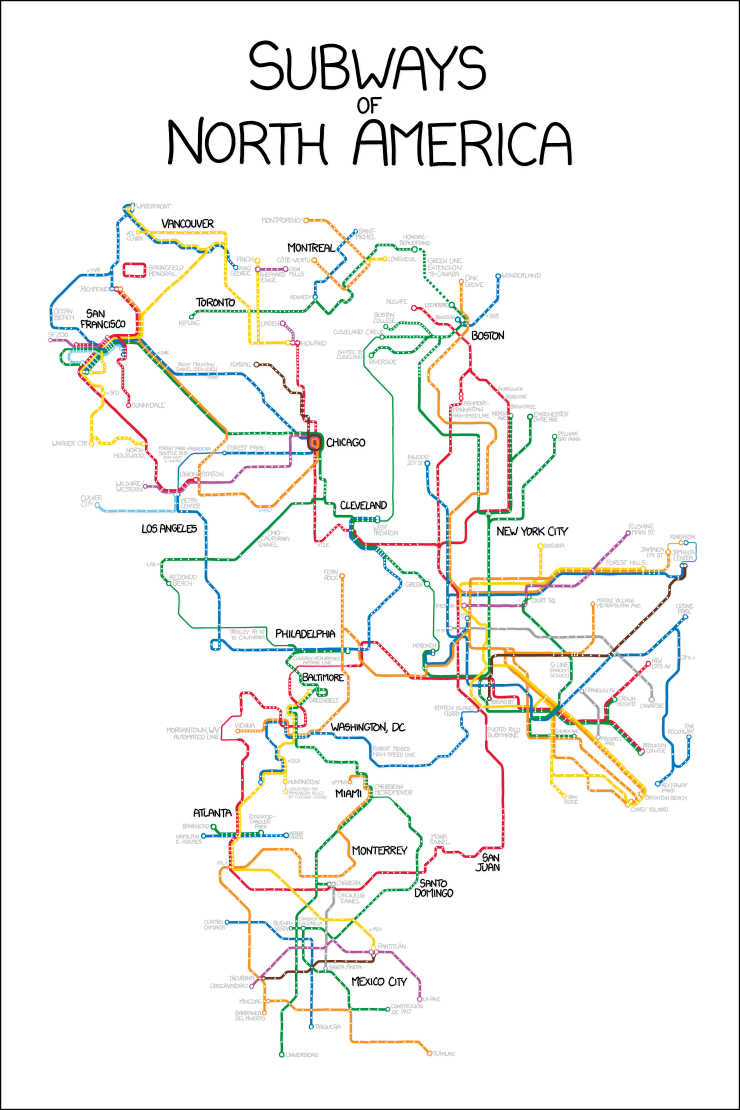
Randall Monroe says: ‘For the pedantic rail enthusiasts, the definition of a subway used here is, with some caveats, “a network containing high capacity grade-separated passenger rail transit lines which run frequently, serve an urban core, and are underground or elevated for at least part of their downtown route.” For the rest of you, the definition is “an underground train in a city.”‘
How is Seattle not included?
Our ‘subway’ doesn’t have a color. It can’t connect into the North American system.
… unless Seattle is represented by “Springfield Monorail”
I don’t know… perhaps because Link is as it presently exists is not high-capacity, is only minimally grade-separated, barely serves the urbanized area in any useful way, can be downgraded to 20-minute frequencies for months on end without so much as a controversy, and just generally lacks any of the cross-city transport heft of even the lowest-demand systems (like Cleveland) that the designer included.
I don’t see you raising a stink about the omission of the Newark City Subway* or the Pittsburgh T, each of which has just as many downtown subway stations and similar merits for inclusion as our little local baby.
And where the hell is Guadalajara, 2/3 of which is fully underground? That’s an actual omission!
Anyway, it is obvious that the designer simply went with the red dots on this map and called it a day.
*(PATH appears to connect directly to PATCO and SEPTA)
(Note: The Springfield Monorail does not have an Urbanrail.net entry. I have no idea why the designer failed to put Brockway, Ogdenville, and North Haverbrook on the map.)
I hear Shelbyville is getting a new light rail line…
It seems right now the Senate Transportation Budget is in a bottleneck due to the CRC… and I know State Senator Barbara Bailey is surprisingly pro-transit and has some very important amendments for us. The below is from blog-friendly Crosscut:
There’s the proposed new Interstate 5 bridge connecting Vancouver and Portland. The Columbia River Crossing is a $3.5 billion project to replace the current structure with a modern bridge, which would include a Vancouver-to-Portland light rail extension. Democrats like it. Washington state Republicans hate it.
The two sides are really, really in hardcore combat over the bridge’s replacement.
That division includes the Clark County delegation. Sens. Ann Rivers, R-La Center, and Don Benton, R-Vancouver are vehemently against it. U.S. Rep. Jaime Herrera Beutler, R-Washington, opposes it. Meanwhile, state Sen. Annette Cleveland, D-Vancouver, and Rep. Jim Moeller, D-Vancouver, support the replacement. The U.S..Department of Transportation, Inslee and U.S. Sen. Patty Murray, D-Washington, support it.
The main pro-new-bridge arguments are that the current bridge is very old and is a major link along a major West Coast transportation corridor. The anti-new-bridge arguments are that iit would be too low for some boat traffic and Vancouver residents don’t want to pay for light rail.
I realize within 10 to 30 years, a new Deception Pass bridge or other fixed link to Whidbey will have to be built. It would not surprise me if the debate was somewhat as contentious as some will want a 4-lane bridge, some will want a multi-lane causeway and some will want to just copy the current bridge. I just hope the CRC is replaced w/ a more fiscally responsible project that gets the federal funding and has four HOV lanes.
Not even a mention of the opposition to the CRC among left-wing public transport advocates, who oppose it beacause it’s an enormous, land-occupying highway widening project which won’t pay for itself and will increase VMT and greenhouse gas emissions without reducing congestion?
It seems we don’t have too many representatives in the state legislature… particularly in Clark County.
On a somewhat related note, I just got back from a week each in London and Paris. The Oystercard (their Orca) has a daily price-cap that varies depending on the zones you’ve used that day. It creates, in-effect, a daily pass. If they can do this, calculating the cap over six different price structures, surely Orca can figure out a way to do the same among the various agencies and institute a cap as well. And never mind that you can get an Oystercard at a zillion places in London.
In Paris, their wonderful Metro runs every 2-3 minutes on most lines. It “slows down” to 6 minutes during some hours on weekends. As a consequence they are heavily used. That’s a real “Rapid Ride.”
I have a vague recollection somewhere that the Oysercard’s system of a daily price cap was patented, thereby preventing any other agency from using such a system without paying far more in patent licensing fees than it would be worth.
Finally, the system was contracted-for in 1998. Any patent will be expiring soon.
I object to this xkcd drawing. Link is as much a subway as those SF muni lines are.
As many issues as Muni Metro has, the fact remains that I can go to a whole bunch of different parts of the city without ever emerging from the tunnel or slowing to a grade-crossing crawl.
Link lets me do that… from one end of downtown to the other end of downtown.
And anyway, it is very clear from the designer’s statement that the SF network is included in its entirety not on the basis of Muni’s specific merits, but because it exists in quasi-tandem with the quasi-overlapping BART system.
Obviously, I was joking, but I disagree with you on this
… I can go to a whole bunch of different parts of the city without ever emerging from the tunnel or slowing to a grade-crossing crawl
One curious historical anecdote:the only reason Muni still exists is because of the twin peaks tunnel. When they were switching all the streetcars to buses in the 30s, 40s and 50s, they couldn’t put buses through the tunnel, so it remained a streetcar. Then when BART opened, they were able to greatly expand it.
I am aware of all of this.
Frankly, the only reason any urban American trains survived the 20th century was because they were in possession of exclusive right-of-way and/or a tunnel segment somewhere along their routes. Boston, Pittsburgh, Philly… any line that didn’t possess some exclusive ROW was eventually bustituted.
SF Muni has the L, M, and K thanks to the Twin Peaks Tunnel. It has the N thanks to the Sunset Tunnel. And it has the J thanks to the ROW through Dolores Park and down to 22nd. All the rest are gone.
Nevertheless, the distance from Embarcadero to the Twin Peaks West Portal is five miles. That’s roughly 3/4 of the distance across the city. There 8 stops along the way, serving at six or seven distinct neighborhoods. All as an uninterrupted subway.
No matter how you slice it, Link does not do that.
Oh, and though the surface Muni has problems, precisely nowhere is it as bad as the SLUT.
The big issue with the N (other than overcrowding) is the shockingly stupid decision not to bury the tiny section between the Market Street Subway and the Sunset Tunnel. The crawl through Duboce Triangle makes Link entering the DSTT feel fast. All the stop signs and weaving around on small streets in the Inner Sunset further curtail its usefulness to people in the Outer Districts.
There is, of course, no denying that the utility of the rail system overall is much higher, as is the utility of the bus system outside of the traffic-crippled downtown streets.
I dunno, there are places where muni trains run in the middle of streets with no platforms whatsoever. It’s kind of dangerous t cross in front of cars to board the train.
Bruce:
Fully agreed. Which is why the subway-level utility for those using the Twin Peaks Tunnel is better.
There’s lots of very bad legacy stuff on display in the Muni system, but you can’t deny the benefit of being able to shoot from the Financial District past the Castro and on to the significantly less traffic-choked outer districts (with myriad destinations, neighborhoods, and cross-transit connections in between) without ever having to surface.
Any similarity one tries to draw to (present-day) Link, which is grade-separated for all of one mile of urban running, is quite false.
Andrew:
No-platform boarding has existed since the dawn of railways. It is not particularly dangerous. The problem is the inaccessibility and the dwell time — both of which Muni addresses by having full platforms at any high-volume location, and never more than 3/4 mile apart.
I’ll still take center-running in sometimes-mixed, sometimes-exclusive lanes on low-traffic outer arterials over constantly-blocked outside-lane running on ultra-busy streets in the middle of the freaking city, which is what the SLUT and the FHSC represent.
Yes, sorry, I shouldn’t have pretended that slut or fhac compare to muni. The slut is barely better than nothing, and the fhsc is gong to be a tourist attraction more than a useful transit line.
Andrew,
For the K, L, and M the Muni Metro tunnel is more than half the length of the line. Yes once they leave the West Portal station they are indeed streetcars, but not like the Inekons. Their acceleration, braking, and capacity is much more like that of Link. They do run in mixed traffic in many places, but they also have significant reserved right of way.
All in all, they’re the very model of a modern urban tramway.
“Frankly, the only reason any urban American trains survived the 20th century was because they were in possession of exclusive right-of-way and/or a tunnel segment somewhere along their routes. Boston, Pittsburgh, Philly… any line that didn’t possess some exclusive ROW was eventually bustituted.”
I’m going to dig into that in detail, and run through the shared-ROW systems.
– I’m omitting the “full railway” lines with no street running (but with grade crossings), which generally became “commuter rail” (although one in PA became the “Norristown” line, and a few others became metro lines).
– I’m also omitting the mostly-elevated and mostly-underground lines which were already operating as metro systems in the early 20th century: the Chicago L, the NYC Subway, Boston’s Blue/Red/Orange lines, Phildelphia’s Market-Frankford and Broad St. lines and PATCO. These generally survived due to tunnels and elevateds.
First, I’d specify that you mean US. Canadian history was different in some weird ways, resulting in the survival of the Toronto streetcars. It also resulted in the removal of trolleybus systems as late as 1992 in the case of Toronto and Hamilton ON, and, outrageously, *2009* in the case of Edmonton. In the US, nobody’s been dumb enough to switch from electricity to gasoline that recently.
—
In most cases survival of streetcars depended on a tunnel. Tunnels in the case of Boston, Philly, Pittsburgh, Cleveland, Newark, and San Francisco streetcars.
There is a major exception, however. New Orleans. The St. Charles line runs in median (“neutral ground” in local parlance) the entire way. Similar lines were bustituted practically everywhere else; I have no idea why this one survived in New Orleans.
The Media/Sharon Hill lines in Philadelphia are also an odd survivor, but I suppose the 69th St. terminal, substantial exclusive ROW, and exclusive bridges, may account for it. Similar lines were bustituted elsewhere, however.
Trolleybuses generally only survived in areas with steep hills or tunnels, too. This applies to Boston (Cambridge), San Francisco, and Seattle. Dayton, OH is the weird exception here.
And of course the San Francisco cable cars survived; these were a special case due to the very steep hills, which were considered too steep for trams and even trolleybuses. By the time of the destruction of public transportation in the 1950s, they were already tourist attractions, hence their survival.
The South Shore interurbans survived (and have been slowly beefed up repeatedly), probably due to sharing the Illinois Central approach to Chicago. Back in the day, there was not nearly such a sharp legal distinction between different types of rail — a “interurban” electric streetcar, running down the middle of the street in Michigan City, could coexist with steam-powered freight trains and have a grade-separated approach to Chicago.
Anyway, there are a few odd ones out. If anyone can explain why the St. Charles line in New Orleans survived, or why the Dayton trolleybuses survived, or why the
I’m wondering if there are any plans in the work to get buses who take Stewart St. into downtown into the center of downtown faster. Currently, the light at Denny can take multiple cycles to get through during the peak and, once you clear Denny, the lights are all timed so that cars get to breeze through, while buses have to wait for a full red light cycle after every bus stop.
Here’s my dream list of improvements:
– Don’t allow parking in the right-hand bus lane on Stewart any time
– Extend the bus lane so the block before Denny has the right lane restricted for buses and right turns only. The restriction on this block would be 24/7.
– Use a skip-stop pattern, similar to what we do on 3rd., so that buses unloading passengers don’t block other bus’s access to the stops.
– During peak hours (both morning and afternoon), ban left turns from Denny onto Stewart. This eliminates a signal phase, allowing traffic on Stewart, as well as eastbound traffic on Denny, to get more green time. Drivers who would be making that turn can take an alternate route instead, for example, enter downtown on Pine St. In addition to benefiting the downtown routes, this change should make the 8 slightly more reliable as well.
– Implement some sort of transit priority on the traffic signals along Stewart.
Heh, a lot of routes (from KCM, ST, and CT!) use Stewart and I haven’t heard about any as major targets for improvement soon. There are so many factors making Stewart easy to overlook: the routes are split among three different agencies, many are peak-only, many are coming from places waiting for (or hoping for) rail, none are straightforward candidates for something like RR…
I hope SDOT does something there… and that if they do TSP, that they manage to get all the agencies on board!
It also doesn’t particularly help things that a large percentage of the peak-hour commuters who take Stewart St. buses into downtown Seattle don’t actually live in Seattle. Most of the buses are suburban expresses originating anywhere from Kirkland to Stanwood to Snohomish.
Just read the Link notice. From April 1 to July 31 — that’s four freaking months! — between 9pm and 1am Link will operate every 20 minutes.
Link is already closed for about 4 hours a night – a bit longer on Sat & Sun nights. They need to strangle night service for four months to build a stinking wall? Why is that acceptable? Do the work during the existing shutdowns and the 15-min frequency periods.
And of course Sound Transit values riders time as so unimportant that they can’t be bothered to tell us when Link will be running
My guess is that labor is cheaper between 9 PM and 1 AM than between 1 AM and 5 AM. It could be worse. The labor would probably be even cheaper if they were willing to cut link back to every 20 minutes in the middle of the day on a weekday.
Cheaper at night? Ha!
As I say below, it’s the work window that’s important. You can’t get 8 uninterrupted hours during the day. I expect they’ll be using that time from 1am to 5am.
Since installing the sound wall affects operations, it is presumably attached to the trackway. If it were on the ground, they could presumably do that without affecting operations.
Now, I’ll assume that twenty minute headways allows them to use single track operation south of Rainier Beach. That means that they can occupy on track with their hi-rail vehicles and materials while installing the sound wall. That gives them an 8 hour uninterrupted work window. But they also need to mobilize to the worksite and get out of there by 5am each day. If it takes four months to build the sound wall with 8 hours a day, how many months would it take with four hours per day if perhaps one hour at each end was taken up with getting in and out?
I’m not sure a soundwall is needed at all. But if a soundwall is needed, how about getting four times the crew working simultaneously and get it done in a month instead of four months?
And how about publishing a schedule for when the 20 minute service will operate?
This is a silly graphic in too many ways to mention — both for what’s represented and what isn’t. I wouldn’t frame it for my house.
It’s supposed to be a silly graphic.
Why it’s a A webcomic of romance,
sarcasm, math, and language.
Co-worker rode the first (of two) CT 424 from Snohomish this morning (he boarded in Monroe). He reports that the driver took a wrong freeway exit, took the ramp from 405 to 520 so fast that he had to slam the brakes on so hard they burned and didn’t stop at the first downtown Seattle stop until told by passengers so he slammed on the brakes and a few passengers hit the floor.
When he called CT customer service the operator said it would likely be two or three days before someone would get back to him but it sounds like this driver shouldn’t be driving their busses. CT doesn’t seem to have much a customer feedback form except an email address and phone number.
He’ll write an email but if anyone has other thoughts on how to provide effective CT feedback that would be appreciated. Co-worker has extensive CT experience.
So… an odd experience around Southcenter, place names, and signage mostly unrelated to any of the arguments above…
A few weeks ago I got on the 150 down in the tunnel; a family from Vancouver boarded just after me, looking for Southcenter Mall. They got the full wonderful Seattle transit experience:
– When making sure they were getting on the right bus, they called the mall “Westfield Mall”. The bus driver made sure to correct them that it was called “Southcenter”. When they arrived and saw the mall signage featuring “Westfield” prominently the father (clearly embarrassed and frustrated) commented to the family, “See, it’s Westfield!”
– They had purchased Link tickets, apparently thinking they were for all buses, and tried to give them to the driver. The driver at this point realized they were probably from out of town and gave them transfers since they’d already paid more than full bus fare, after a somewhat confused conversation.
– On the way down the SODO busway the bus pulled up to a stop with some people waiting in the shelter. The driver very briefly opened the door then sped away after hardly even coming to a complete stop just as one of the people in the shelter realized he wanted the 150, and started chasing it, yelling. The family sort of looked back like, “Really? We’re not going to pick him up?” A few minutes later we were early to a time point and had to sit around waiting at a stop. Hmmm…
I probably should have explained to them the distinction between the Westfield and Southcenter names once the bus got moving, so they were aware the naming confusion was some random local arcana and not their fault, but I’m not really the most outgoing person so I didn’t. Anyway, they probably didn’t go home with a very good opinion of Seattle’s transit system.
I just saw the “Green Line Extension to Canada” route on the Boston side of the map. Ha! The MBTA recently broke ground for the Green Line Extension- but only to Somerville and Medford, eh?
I was watching a movie, “Micky and Nicky” (1974) and for some reason thought it was set in NYC. But then they got on a red bus and I thought that doesn’t seem right. Then a close up on the plate behind the driver..Septa. Ah yes, good old Philadelphia.
I also saw a movie from 1996 a few weeks ago that had a scene in an MTA Manhattan blue buses…the ones that only had two benches, facing each other across a wide aisle. I was surprised they were using them that late. It always seemed like the best solution for dense corridors where more people would stand then sit.
People complain that Kemper Freeman and Bellevue leaders didn’t want light rail going near Bellevue Square or through downtown, but isn’t it true that Tukwila didn’t want light rail going through their downtown or by Southcenter mall? Why not the same acrimony for Tukwila?
Because it doesn’t matter as much.
So what Link bypassing the massive employment center that is the Southcenter area taught us is it’s really not that important if a light rail line goes through the exact center of town or goes near a mall or employment center, and all this whining about Bellevue Station being a couple of blocks too far to the east is ridiculous.
Tukwila has no “center of town”, and the “massive employment center that is the Southcenter” is segregated-use and irredeemably autocentric.
I know you’re just trolling, but I will nevertheless request that you spend five seconds with http://en.wikipedia.org/wiki/False_equivalence
When traveling around the Seattle area on public transit, I’m more likely to go to Bellevue for shopping rather than Southcenter. And if I want to see a movie that isn’t at Cinerama, I would rather go to Lincoln Square than Southcenter. Sure, if LINK stopped right next to Macys at Southcenter, I would go there more often, but since Tukwila fought hard against LINK, that ain’t happening. Besides, there’s more to do in Bellevue than shopping…what else is there at Southcenter? During the Holidays, Bellevue also has their festivals.
Baloney. The Southcenter mall would be tremendous if Link stopped there. It also employs quite a few people. We’d be much better off building a trolley down there than to Ballard also. It’s only irredeemable if you are too Seattle centric.
I’m not saying Southcenter doesn’t matter at all; I’ve taken the 150 on weekends and seen all the people getting on and off there. It would be great for, say, Kent, if the 150 could get through Southcenter in a quick, direct, reliable way… a grade-separated way…
But Link doesn’t so much bypass it as it goes someplace else instead. It goes to the airport instead. It doesn’t bypass Southcenter any more than North Link will bypass U Village or Lake City. Should Link have gone to Southcenter instead of the airport? I don’t have the information to have an opinion on it… the airport was surely the better political choice, so that’s where it went.
@Cinesea: The area around Southcenter (generally the areas served by routes 140 and 150) has a bunch of office and industrial parks. They’re quite sparse and utterly auto-oriented, though there is frequent, pretty fast transit on a few corridors. As with many of this region’s suburban commercial/industrial areas, transit is an option for many workers (many cities, even those with vastly superior inner-city transit and more transit-friendly land use there, have much worse suburban transit and land-use) but most will find driving easier, because that’s just how the places were built… even if a train was built, the entrenched dominance of private autos in the area might make it hard to build convenient pedestrian centers even right around train stations.
And that’s why downtown Bellevue is so important to get right. A couple well-placed stations could really provide convenient access to a wide variety of jobs, residences, and amenities. Downtown Bellevue could actually break through auto-dependence.
Thank you so much for writing this, Al. This is a far gentler response than I could have offered to Butch’s exceptionally clueless reiteration of this blog’s painfully intractable geometric blind spot.
Sprawl-based land forms like Southcenter serve a 360° sprawl. By definition, you cannot consolidate demand into anything resembling high-capacity corridors.
A single stop on a long-distance line that is useful only in two dimensions offers access only to those with little interest in Southcenter, and misses those who actually want or need to go there.
Urban mass transit helps to allow auto-free access across entire areas with uncountable destinations and potential trip needs. Latent comprehensive urban demand is so high that Butch’s bête-noire trolley doesn’t even begin to cut it.
But when he opines that “we’d be much better off building a trolley to Southcenter”, I can only wonder where the fuck he thinks that trolley would even come from, and who the fuck he thinks would be on it. Because it sure as hell wouldn’t be of use to any of the Southcenter area’s current attendees.
I’m tired of “if you brain-fart it, they will come” being an rhetorical strategy on this blog. Back it up, or shut up.
Compare 150 ridership with 550 ridership and you have your answer.
Oh, there’s acrimony about it, but that fight’s over and done with and STB wasn’t around then.
Central Link was originally planned by Sound Transit to head south at-grade, from south Boeing Field, down Hwy 99. There were going to be two stations within the Tukwila city limits, one of them being at the current location, and one farther north.
The city wanted the alignment to go directly south from MLKing way to the Tukwila Sounder station, then through the Southcenter mall, then up to the airport.
That alignment was much more expensive, without the ridership gain to justify it.
What you see now is the result of the Puget Sound Cooperative Standard Model.
Tukwila got pissy about the Sounder/Amtrak station and the mall being bypassed by LINK and tried to “force” Sound Transit to serve those destinations by making it nearly impossible to build along SR-99 similar to the MLK alignment.
Sound Transit moved the alignment to I-5 instead. There still wasn’t the money or the ridership to justify serving Southcenter. Furthermore the travel time increase would have potentially cost Sound Transit Federal New Starts grants.
Southcenter is a huge mall parking lot with all of the surrounding streets filled with strip malls and expansive parking lots.
Downtown Bellevue is full of office and apartment highrises and continues to grow. The situation is just a tad different.
Ryan, don’t place a higher value on office workers over retail workers. In terms of public transit, they are of equal importance.
That’s not placing a higher value on office workers than retail workers; it’s placing a higher value on more workers than fewer workers.
But if you put a light rail stop at Southcenter, you’d have the foundation for turning that site into something much less auto-oriented and perhaps much more dense. Westfield might decide that the parking lots are more valuable with apartments on them rather than cars.
A downtown Bellevue subway is important, absolutely. But we shouldn’t base routing decisions solely on present uses. Future opportunities matter too.
Yeah! Just like totally happened around BART stations and throughout suburban Denver, Dallas, and Sacramento!
Right? Didn’t it? (Because I’m not willing to actually check myself, lest a landslide of precedent bury the deeply erroneous beliefs I insist on repeating over and over again on a blog!)
Read Al’s comment above. He really nails it. Southcenter was built as a sprawl magnet. It serves the sprawl, and it draws its customers and employees from the sprawl.
Southcenter will not and can not divest of the landscape that allows it to function in this way. And “a light rail stop” that promises to make transit access possible from a handful of distant points in two directions — and not from the 360° surrounding sprawl — will do absolutely nothing to change this.
This is a non-starter.
D.P., you mean like the impact WMTA trains are having on Tyson’s Corner, Arlington and Pentagon City?
I think you need to get off with the arrogant dismissal of long established places that people live and work. SouthCenter is a nexus for the hundreds of thousands that live in South King County. We can make things better by providing viable transit. If Link had indeed gone into SouthCenter, then perhaps those auto-centric parking lots might start being filled with high rise apartments.
Oh and Cinesea, I appreciate that you might want to shop in Bellevue, but as a South Seattle resident, I and many others here would like to shop at South Center and feel I’m being punished for wanting to do so as there is no direct service from my area of town.
As the posts above indicate, Tukwila fought hard to get Link into their commercial area and was turned down. And frankly, it would have added maybe 5-7 minutes to the travel time to the airport but Link ridership would have likely been far more robust given the unrecognized demand for travel between South Seattle and SouthCenter.
I appreciate and support the drive to get world class frequent, grade separated rail transit to all corners of Seattle, but I also recognize that we must also successfully build regional rail that recognizes that not all social and economic activity in the region is centered IN Seattle.
[ad hom]
Rosslyn and north Arlington are Bellevue in this analogy. Existing urbanity, underpedestrianized and with auto-width boulevards, but with the bones of a city and the ability to grow as a city before and after the train arrives.
Pentagon City, by contrast, is a hellhole mall with massive parking lots and garages everywhere literally hundreds of feet between any two given buildings. It’s a fucking nightmare without a car, and the existence of the Metro station hasn’t changed its form or function one iota.
Tysons Corner, of course, has made voluminous hay about its upcoming attempts to “downtown-ize” itself as the Metro arrives. But anyone who has seen the plans and knows a single thing about human behavior can tell you it won’t work. They’re going to spend $1-$15 billion and all it will get them is a couple of cut-throughs and sidewalks on their 7-lane arterials.
When all is said and done, Tysons Corner will be an even more intensely traffic-choked shithole with four P&Rs in the middle that everyone will drive to as well. “New Downtown Fairfax” is a pipe dream.
Unlike the delusions of a Tysons transformation, nobody was even suggesting a change in Southcenter’s physical state. City officials probably thought a train would bring more customers and thus more tax revenue, but no one was going to risk their parking space on it. And they probably overestimated the gravitational pull of a thousand chain stores that each have locations elsewhere in and around the city anyway. Southcenter would have looked exactly as today, but with a train stop in the far corner of the parking lot, unpleasant to reach from the mall and too far to walk to for any employees of adjacent properties.
Thank god we don’t make multi-million-dollar decisions on the basis of one commenter’s “perhaps”.
Tukwila is indeed planning for more density, and specifically TOD around Southcenter.
http://www.tukwilawa.gov/dcd/urbanplan/recommended_draft/Ch10-TUC_PCDraft.pdf
Starting with two 17 story residential towers.
http://www.tukwilareporter.com/news/191858581.html
No, it’s not going to turn into Greenwhich Village overnight, but the city is most definitely moving in the right direction.
I don’t know. It sounds like whoever wrote the Tukwila Reporter headline even found the claim suspect.
Also note that ground zero for this “TOD” is more than 2/3 of a mile from where any Southcenter Link station actually would have been. These will be high-rises for cars.
And funny that you mention Greenwich Village, as that place is the great refutation of Seattle/Tukwila’s false association of “height” with “density” and “transit orientation”.
d.p., I don’t believe North Arlington was not like that before the Metro came.
I also feel like you’re casting suboptimal density in with sprawl. There’s a huge difference between downtown Bethesda — even if tons of people use cars to access it — and the nothing that was there before.
This is when Rosslyn got its street grid.
All of which happened before…
Bethesda’s story is similar.
Transit that follows existing demand tends to help make those existing places better, where good bones for good growth exist.
Where the bones are scoliotic (Southcenter, Federal Way, Pentagon City, New Jersey Metropark, Alameda County), the results are always a disappointment.
The “21st-century BART-style transit can create new things from whole cloth” assertion is fundamentally inaccurate!
(Anyway, someone decided to blow up my hometown today, so I’m going to shift my focus over to checking on people’s safety.)
I specifically said “North Arlington,” not “Rosslyn,” because Metro is generally credited with building out the rest of that corridor.
If you’re using “bones” to narrowly refer to the street grid, then that’s a different story. However, unless you are going to forever limit growth to the well-gridded places in greater Seattle, giant-parking-lot places like Southcenter, Northgate, and Lynnwood seem like better bets than cul-de-sac neighborhoods.
Personally, and on the basis of no study whatsoever, I suspect a Link line where RR F is going would be a superior alternative to extending down to Federal Way and Tacoma.
Charles,
I would’ve loved for LINK to go to Southcenter and Sea-Tac. Mostly for the people that have a layover at the airport and want to do something for their two or three hours. Knowing that they could go to a large shopping center, walk around, maybe eat at a restaurant that has a bigger variety than what available at the airport, AND have a relatively stable and timely way to get back to the airport. That right there would have made Southcenter a rich ‘target’ for LINK to exploit.
Because one is currently in progress and one is water under the bridge.
Sam: just the opposit; Tukwila wanted Link to serve Southcenter; ST could not afford it.
Tukwila has a downtown? And I think you are really referring to Seatac (city of) which got bypassed-much to their loss. LR just cuts through now on the way to the airport. Very stupid on their part.
Clarification. Very stupid on Seatac’s part (city of) that forced ST to bypass the original Hwy 99 route in favor of the current route ST was fragile then and couldn’t afford a fight with anyone. But thank Gawd they didn’t go to Southcenter Mall
@lazarus
“Very stupid on Seatac’s part (city of) that forced ST to bypass the original Hwy 99 route in favor of the current route ST was fragile then and couldn’t afford a fight with anyone. “
The the original Hwy99 alignment from south Boeing field to SR 516 is within the Tukwila city limits.
Ah, my bad. You are correct, north of 518 is Tukwila, south is Seatac. I guess I just see all those cheap motels and general blight and think “Seatac”, but that of course is incorrect. When I see that I should actually give credit where credit is due and think “Tukwila” instead. I apologize to the people of Seatac.
However, during those days both cities were against LR and the POS was not onboard either (parking revenue?). Eventually the current route along I-5/SR518 and the airport access road was selected, but not before lots of options were considered and eventually rejected.
Tukwila is the biggest loser in all this – the blight north of SR518 has not been redeveloped, and the elevated route along I5/SR518 provides no redevelopment potential. And of course South Center got nothing.
Tukwila really blew it.
Actually i believe tukwila was upset because light rail DID NOT serve southcenter. i remember they being upset when it was not compatible with sound transit’s desire to bring light rail to the airport. I believe the bellevue opposition was largely keemper freeman’s work.
Randall Monroe says: ‘For the pedantic rail enthusiasts, the definition of a subway used here is, with some caveats, “a network containing high capacity grade-separated passenger rail transit lines which run frequently, serve an urban core, and are underground or elevated for at least part of their downtown route.” For the rest of you, the definition is “an underground train in a city.”‘
How is Seattle not included?
Our ‘subway’ doesn’t have a color. It can’t connect into the North American system.
… unless Seattle is represented by “Springfield Monorail”
I don’t know… perhaps because Link is as it presently exists is not high-capacity, is only minimally grade-separated, barely serves the urbanized area in any useful way, can be downgraded to 20-minute frequencies for months on end without so much as a controversy, and just generally lacks any of the cross-city transport heft of even the lowest-demand systems (like Cleveland) that the designer included.
I don’t see you raising a stink about the omission of the Newark City Subway* or the Pittsburgh T, each of which has just as many downtown subway stations and similar merits for inclusion as our little local baby.
And where the hell is Guadalajara, 2/3 of which is fully underground? That’s an actual omission!
Anyway, it is obvious that the designer simply went with the red dots on this map and called it a day.
*(PATH appears to connect directly to PATCO and SEPTA)
(Note: The Springfield Monorail does not have an Urbanrail.net entry. I have no idea why the designer failed to put Brockway, Ogdenville, and North Haverbrook on the map.)
I hear Shelbyville is getting a new light rail line…
It seems right now the Senate Transportation Budget is in a bottleneck due to the CRC… and I know State Senator Barbara Bailey is surprisingly pro-transit and has some very important amendments for us. The below is from blog-friendly Crosscut:
I realize within 10 to 30 years, a new Deception Pass bridge or other fixed link to Whidbey will have to be built. It would not surprise me if the debate was somewhat as contentious as some will want a 4-lane bridge, some will want a multi-lane causeway and some will want to just copy the current bridge. I just hope the CRC is replaced w/ a more fiscally responsible project that gets the federal funding and has four HOV lanes.
Not even a mention of the opposition to the CRC among left-wing public transport advocates, who oppose it beacause it’s an enormous, land-occupying highway widening project which won’t pay for itself and will increase VMT and greenhouse gas emissions without reducing congestion?
It seems we don’t have too many representatives in the state legislature… particularly in Clark County.
On a somewhat related note, I just got back from a week each in London and Paris. The Oystercard (their Orca) has a daily price-cap that varies depending on the zones you’ve used that day. It creates, in-effect, a daily pass. If they can do this, calculating the cap over six different price structures, surely Orca can figure out a way to do the same among the various agencies and institute a cap as well. And never mind that you can get an Oystercard at a zillion places in London.
In Paris, their wonderful Metro runs every 2-3 minutes on most lines. It “slows down” to 6 minutes during some hours on weekends. As a consequence they are heavily used. That’s a real “Rapid Ride.”
I have a vague recollection somewhere that the Oysercard’s system of a daily price cap was patented, thereby preventing any other agency from using such a system without paying far more in patent licensing fees than it would be worth.
Not patentable. Business method.
Of course, agencies may not want the legal fight.
Also, it needs improvement.
http://www.bbc.co.uk/news/uk-england-london-14086122
Finally, the system was contracted-for in 1998. Any patent will be expiring soon.
I object to this xkcd drawing. Link is as much a subway as those SF muni lines are.
As many issues as Muni Metro has, the fact remains that I can go to a whole bunch of different parts of the city without ever emerging from the tunnel or slowing to a grade-crossing crawl.
Link lets me do that… from one end of downtown to the other end of downtown.
And anyway, it is very clear from the designer’s statement that the SF network is included in its entirety not on the basis of Muni’s specific merits, but because it exists in quasi-tandem with the quasi-overlapping BART system.
Obviously, I was joking, but I disagree with you on this
Muni’s tunnel is a straight-shot:
http://en.wikipedia.org/wiki/Muni_Metro, and outside of that most of it is like the SLUT rather than like Link.
One curious historical anecdote:the only reason Muni still exists is because of the twin peaks tunnel. When they were switching all the streetcars to buses in the 30s, 40s and 50s, they couldn’t put buses through the tunnel, so it remained a streetcar. Then when BART opened, they were able to greatly expand it.
I am aware of all of this.
Frankly, the only reason any urban American trains survived the 20th century was because they were in possession of exclusive right-of-way and/or a tunnel segment somewhere along their routes. Boston, Pittsburgh, Philly… any line that didn’t possess some exclusive ROW was eventually bustituted.
SF Muni has the L, M, and K thanks to the Twin Peaks Tunnel. It has the N thanks to the Sunset Tunnel. And it has the J thanks to the ROW through Dolores Park and down to 22nd. All the rest are gone.
Nevertheless, the distance from Embarcadero to the Twin Peaks West Portal is five miles. That’s roughly 3/4 of the distance across the city. There 8 stops along the way, serving at six or seven distinct neighborhoods. All as an uninterrupted subway.
No matter how you slice it, Link does not do that.
Oh, and though the surface Muni has problems, precisely nowhere is it as bad as the SLUT.
The big issue with the N (other than overcrowding) is the shockingly stupid decision not to bury the tiny section between the Market Street Subway and the Sunset Tunnel. The crawl through Duboce Triangle makes Link entering the DSTT feel fast. All the stop signs and weaving around on small streets in the Inner Sunset further curtail its usefulness to people in the Outer Districts.
There is, of course, no denying that the utility of the rail system overall is much higher, as is the utility of the bus system outside of the traffic-crippled downtown streets.
I dunno, there are places where muni trains run in the middle of streets with no platforms whatsoever. It’s kind of dangerous t cross in front of cars to board the train.
Bruce:
Fully agreed. Which is why the subway-level utility for those using the Twin Peaks Tunnel is better.
There’s lots of very bad legacy stuff on display in the Muni system, but you can’t deny the benefit of being able to shoot from the Financial District past the Castro and on to the significantly less traffic-choked outer districts (with myriad destinations, neighborhoods, and cross-transit connections in between) without ever having to surface.
Any similarity one tries to draw to (present-day) Link, which is grade-separated for all of one mile of urban running, is quite false.
Andrew:
No-platform boarding has existed since the dawn of railways. It is not particularly dangerous. The problem is the inaccessibility and the dwell time — both of which Muni addresses by having full platforms at any high-volume location, and never more than 3/4 mile apart.
I’ll still take center-running in sometimes-mixed, sometimes-exclusive lanes on low-traffic outer arterials over constantly-blocked outside-lane running on ultra-busy streets in the middle of the freaking city, which is what the SLUT and the FHSC represent.
Yes, sorry, I shouldn’t have pretended that slut or fhac compare to muni. The slut is barely better than nothing, and the fhsc is gong to be a tourist attraction more than a useful transit line.
Andrew,
For the K, L, and M the Muni Metro tunnel is more than half the length of the line. Yes once they leave the West Portal station they are indeed streetcars, but not like the Inekons. Their acceleration, braking, and capacity is much more like that of Link. They do run in mixed traffic in many places, but they also have significant reserved right of way.
All in all, they’re the very model of a modern urban tramway.
“Frankly, the only reason any urban American trains survived the 20th century was because they were in possession of exclusive right-of-way and/or a tunnel segment somewhere along their routes. Boston, Pittsburgh, Philly… any line that didn’t possess some exclusive ROW was eventually bustituted.”
I’m going to dig into that in detail, and run through the shared-ROW systems.
– I’m omitting the “full railway” lines with no street running (but with grade crossings), which generally became “commuter rail” (although one in PA became the “Norristown” line, and a few others became metro lines).
– I’m also omitting the mostly-elevated and mostly-underground lines which were already operating as metro systems in the early 20th century: the Chicago L, the NYC Subway, Boston’s Blue/Red/Orange lines, Phildelphia’s Market-Frankford and Broad St. lines and PATCO. These generally survived due to tunnels and elevateds.
First, I’d specify that you mean US. Canadian history was different in some weird ways, resulting in the survival of the Toronto streetcars. It also resulted in the removal of trolleybus systems as late as 1992 in the case of Toronto and Hamilton ON, and, outrageously, *2009* in the case of Edmonton. In the US, nobody’s been dumb enough to switch from electricity to gasoline that recently.
—
In most cases survival of streetcars depended on a tunnel. Tunnels in the case of Boston, Philly, Pittsburgh, Cleveland, Newark, and San Francisco streetcars.
There is a major exception, however. New Orleans. The St. Charles line runs in median (“neutral ground” in local parlance) the entire way. Similar lines were bustituted practically everywhere else; I have no idea why this one survived in New Orleans.
The Media/Sharon Hill lines in Philadelphia are also an odd survivor, but I suppose the 69th St. terminal, substantial exclusive ROW, and exclusive bridges, may account for it. Similar lines were bustituted elsewhere, however.
Trolleybuses generally only survived in areas with steep hills or tunnels, too. This applies to Boston (Cambridge), San Francisco, and Seattle. Dayton, OH is the weird exception here.
And of course the San Francisco cable cars survived; these were a special case due to the very steep hills, which were considered too steep for trams and even trolleybuses. By the time of the destruction of public transportation in the 1950s, they were already tourist attractions, hence their survival.
The South Shore interurbans survived (and have been slowly beefed up repeatedly), probably due to sharing the Illinois Central approach to Chicago. Back in the day, there was not nearly such a sharp legal distinction between different types of rail — a “interurban” electric streetcar, running down the middle of the street in Michigan City, could coexist with steam-powered freight trains and have a grade-separated approach to Chicago.
Anyway, there are a few odd ones out. If anyone can explain why the St. Charles line in New Orleans survived, or why the Dayton trolleybuses survived, or why the
I’m wondering if there are any plans in the work to get buses who take Stewart St. into downtown into the center of downtown faster. Currently, the light at Denny can take multiple cycles to get through during the peak and, once you clear Denny, the lights are all timed so that cars get to breeze through, while buses have to wait for a full red light cycle after every bus stop.
Here’s my dream list of improvements:
– Don’t allow parking in the right-hand bus lane on Stewart any time
– Extend the bus lane so the block before Denny has the right lane restricted for buses and right turns only. The restriction on this block would be 24/7.
– Use a skip-stop pattern, similar to what we do on 3rd., so that buses unloading passengers don’t block other bus’s access to the stops.
– During peak hours (both morning and afternoon), ban left turns from Denny onto Stewart. This eliminates a signal phase, allowing traffic on Stewart, as well as eastbound traffic on Denny, to get more green time. Drivers who would be making that turn can take an alternate route instead, for example, enter downtown on Pine St. In addition to benefiting the downtown routes, this change should make the 8 slightly more reliable as well.
– Implement some sort of transit priority on the traffic signals along Stewart.
Heh, a lot of routes (from KCM, ST, and CT!) use Stewart and I haven’t heard about any as major targets for improvement soon. There are so many factors making Stewart easy to overlook: the routes are split among three different agencies, many are peak-only, many are coming from places waiting for (or hoping for) rail, none are straightforward candidates for something like RR…
I hope SDOT does something there… and that if they do TSP, that they manage to get all the agencies on board!
It also doesn’t particularly help things that a large percentage of the peak-hour commuters who take Stewart St. buses into downtown Seattle don’t actually live in Seattle. Most of the buses are suburban expresses originating anywhere from Kirkland to Stanwood to Snohomish.
Just read the Link notice. From April 1 to July 31 — that’s four freaking months! — between 9pm and 1am Link will operate every 20 minutes.
Link is already closed for about 4 hours a night – a bit longer on Sat & Sun nights. They need to strangle night service for four months to build a stinking wall? Why is that acceptable? Do the work during the existing shutdowns and the 15-min frequency periods.
And of course Sound Transit values riders time as so unimportant that they can’t be bothered to tell us when Link will be running
My guess is that labor is cheaper between 9 PM and 1 AM than between 1 AM and 5 AM. It could be worse. The labor would probably be even cheaper if they were willing to cut link back to every 20 minutes in the middle of the day on a weekday.
Cheaper at night? Ha!
As I say below, it’s the work window that’s important. You can’t get 8 uninterrupted hours during the day. I expect they’ll be using that time from 1am to 5am.
Since installing the sound wall affects operations, it is presumably attached to the trackway. If it were on the ground, they could presumably do that without affecting operations.
Now, I’ll assume that twenty minute headways allows them to use single track operation south of Rainier Beach. That means that they can occupy on track with their hi-rail vehicles and materials while installing the sound wall. That gives them an 8 hour uninterrupted work window. But they also need to mobilize to the worksite and get out of there by 5am each day. If it takes four months to build the sound wall with 8 hours a day, how many months would it take with four hours per day if perhaps one hour at each end was taken up with getting in and out?
I’m not sure a soundwall is needed at all. But if a soundwall is needed, how about getting four times the crew working simultaneously and get it done in a month instead of four months?
And how about publishing a schedule for when the 20 minute service will operate?
This is a silly graphic in too many ways to mention — both for what’s represented and what isn’t. I wouldn’t frame it for my house.
It’s supposed to be a silly graphic.
Why it’s a A webcomic of romance,
sarcasm, math, and language.
Co-worker rode the first (of two) CT 424 from Snohomish this morning (he boarded in Monroe). He reports that the driver took a wrong freeway exit, took the ramp from 405 to 520 so fast that he had to slam the brakes on so hard they burned and didn’t stop at the first downtown Seattle stop until told by passengers so he slammed on the brakes and a few passengers hit the floor.
When he called CT customer service the operator said it would likely be two or three days before someone would get back to him but it sounds like this driver shouldn’t be driving their busses. CT doesn’t seem to have much a customer feedback form except an email address and phone number.
He’ll write an email but if anyone has other thoughts on how to provide effective CT feedback that would be appreciated. Co-worker has extensive CT experience.
So… an odd experience around Southcenter, place names, and signage mostly unrelated to any of the arguments above…
A few weeks ago I got on the 150 down in the tunnel; a family from Vancouver boarded just after me, looking for Southcenter Mall. They got the full wonderful Seattle transit experience:
– When making sure they were getting on the right bus, they called the mall “Westfield Mall”. The bus driver made sure to correct them that it was called “Southcenter”. When they arrived and saw the mall signage featuring “Westfield” prominently the father (clearly embarrassed and frustrated) commented to the family, “See, it’s Westfield!”
– They had purchased Link tickets, apparently thinking they were for all buses, and tried to give them to the driver. The driver at this point realized they were probably from out of town and gave them transfers since they’d already paid more than full bus fare, after a somewhat confused conversation.
– On the way down the SODO busway the bus pulled up to a stop with some people waiting in the shelter. The driver very briefly opened the door then sped away after hardly even coming to a complete stop just as one of the people in the shelter realized he wanted the 150, and started chasing it, yelling. The family sort of looked back like, “Really? We’re not going to pick him up?” A few minutes later we were early to a time point and had to sit around waiting at a stop. Hmmm…
I probably should have explained to them the distinction between the Westfield and Southcenter names once the bus got moving, so they were aware the naming confusion was some random local arcana and not their fault, but I’m not really the most outgoing person so I didn’t. Anyway, they probably didn’t go home with a very good opinion of Seattle’s transit system.
I just saw the “Green Line Extension to Canada” route on the Boston side of the map. Ha! The MBTA recently broke ground for the Green Line Extension- but only to Somerville and Medford, eh?