
By WILLIAM CONDON
This week focuses on the Overlake/Crossroads area in eastern Bellevue/southern Redmond. Today William Condon discusses the bridges over 520. Tuesday we’ll review current conditions. Thursday and Friday will look at the proposal to split RapidRide B into two longer lines.
The Overlake neighborhood at the border of Bellevue and Redmond is divided down the middle by the 520 freeway.
Redmond has grand plans for the neighborhood, including at least 10,000 new jobs and 8,000 housing units. Currently most of what’s happening there is southeast of the freeway. The northwest side has tech offices (mostly Microsoft); and apartments and condos on the far west side of 148th across the city limits in Bellevue. The Redmond city council is planning to merge the Redmond part into one upzoned district.
To make the problems of the freeway worse, there are now pedestrian destinations right next to the freeway — East Link light rail with two stations in the Overlake neighborhood. There have long been plans to deal with this by building new pedestrian bridges – and now both of them are open. This makes a total of five bridges over the freeway in the Overlake neighborhood.
Let’s take a look at each of those five bridges. All of them have some good and points and some bad points, but there are lessons we can take from each of them.
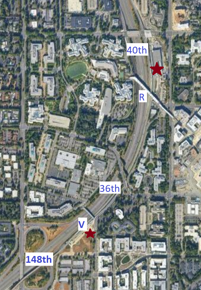
The two Link stations are marked with red stars and letters in the map above: “V” for Overlake Village station and “R” for Redmond Technology station.
148th Avenue
Going from south to north, we start with 148th Avenue NE – in the lower left corner of the map above.
That’s an old bridge built in car-centric days. It carries four lanes of often-high-speed traffic and one skinny sidewalk. All pedestrians have to use the west side of the street and deal with traffic right next to them.
I’ve walked it; it’s not pleasant but doable. Even when I’m biking northbound, I usually cross to the west side sidewalk because of the northbound traffic in the right lane speeding up to take the loop ramp onto the freeway. I’d rather not risk being tipped into traffic if I fell… but it’s still the least bad way.
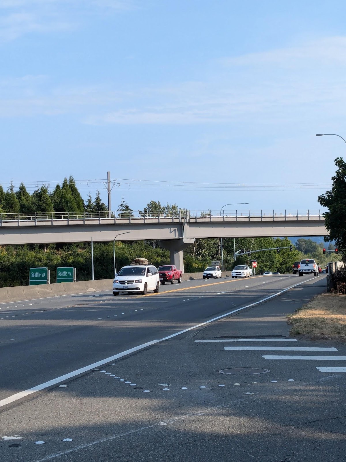
Despite these obvious problems, I still regularly see pedestrians on the bridge. This is because it heads where people want to go – it’s the most direct route to the Safeway and Fred Meyer grocery stores along 148th south of the freeway.
This bridge is outdated but it’s still used. The lesson for pedestrian bridges from this is: Go where people want to go, and that’ll cover a multitude of faults.
(Metro route 221 used to cross this bridge but it has now been rerouted to Overlake Village station. Its successor in the East Link restructure will remain that way.)
Overlake Village
Heading north along the freeway, the next bridge we see is the newest, marked with a “V” on the map above: the Overlake Village Station Pedestrian Bridge.
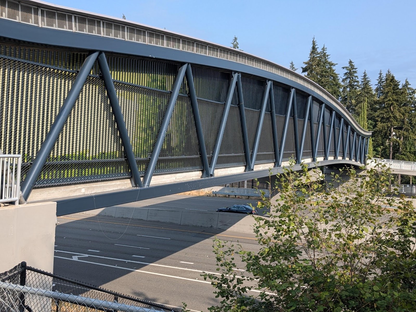
It’s a covered bridge, with the slats on the sides blending into some nice art reminiscent of a green forest:
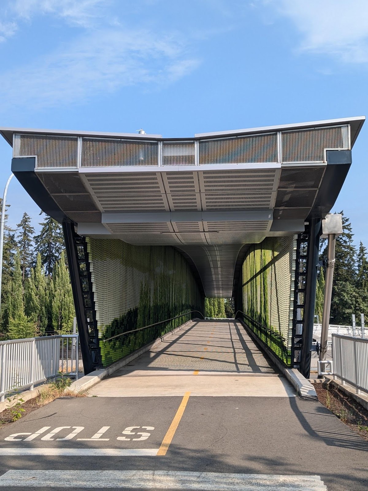
I used to walk by here regularly during construction, and I’ve crossed it several times – including for several weeks on my daily commute. I rarely see anyone else using it.
I think that’s because there aren’t yet many destinations to go to from the bridge. At the east end of the bridge is the Overlake Village light rail station, with some new high-rises beyond it. At the west end are, currently, some Microsoft office buildings and parking lots. Beyond those are some condos – with this bridge being easily the best route for them to get to light rail.
Currently, the light rail just goes to Bellevue; if you want to get from these condos to Bellevue, you can easily drive on the freeway. This is is the problem with building light rail along a freeway. But once light rail connects to Seattle, the bridge will become more useful. Fortunately the bridge is already in place.
36th Street
Continuing north, the next bridge is NE 36th St.
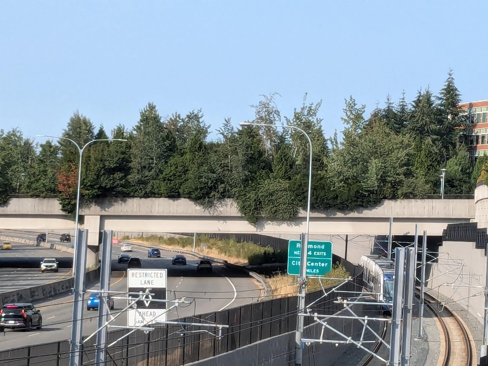
This was opened in 2010 to “connect the Overlake area, including the Microsoft campus”. It has definitely connected the Microsoft campus, carrying many cars and cyclists, especially during peak hours. Personally, I commute across it regularly on my bike.
This is the most lid-like of the bridges. When I’m here, it feels like I’m walking or biking through a park; I really find it easy to forget I’m crossing a freeway.
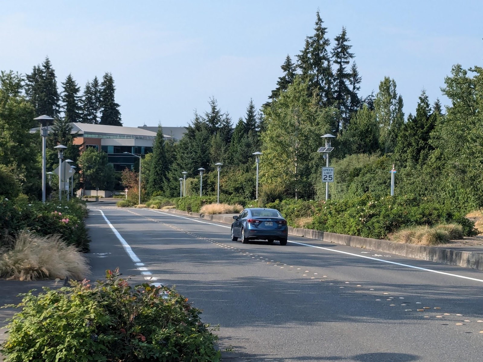
I haven’t seen many pedestrians here. I think that’s is because there aren’t any nearby destinations except Microsoft offices. But still, just looking at how many cars and bikes cross this bridge, I think it’s definitely necessary.
(The 221 and 249 cross this bridge. It isn’t direct for either of them, but it’s needed to connect to Overlake Village station. After the East Link Connections restructure, this will only be used by the new 223 route.)
Redmond Technology
Further north, the next bridge – marked with an “R” on the map – is the “Redmond Technology Station Pedestrian Bridge”.
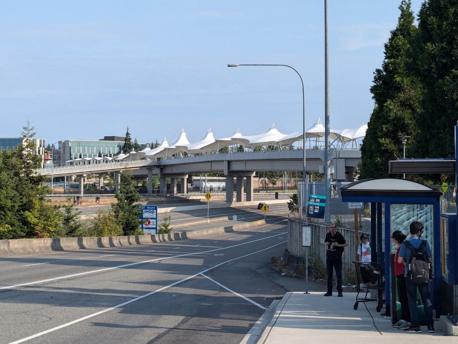
On the west side it connects to the Microsoft Commons (something of a small mall open to Microsoft employees), NE 40th St, the freeway ramp bus stop, and the 520 Bike Trail. In the middle, there’s a branch going to the Redmond Technology station station and parking garage. On the east, it bridges 156th Avenue to connect to the newest part of the Microsoft campus, with offices and another small mall for Microsoft employees.
The rail connection is indirect – you’ll need to turn down that small tendril connecting to the bridge on the left of my photo. I asked about this at one open house before construction started; the Sound Transit employees explained that Microsoft had put up most of the money and thus chose the design.
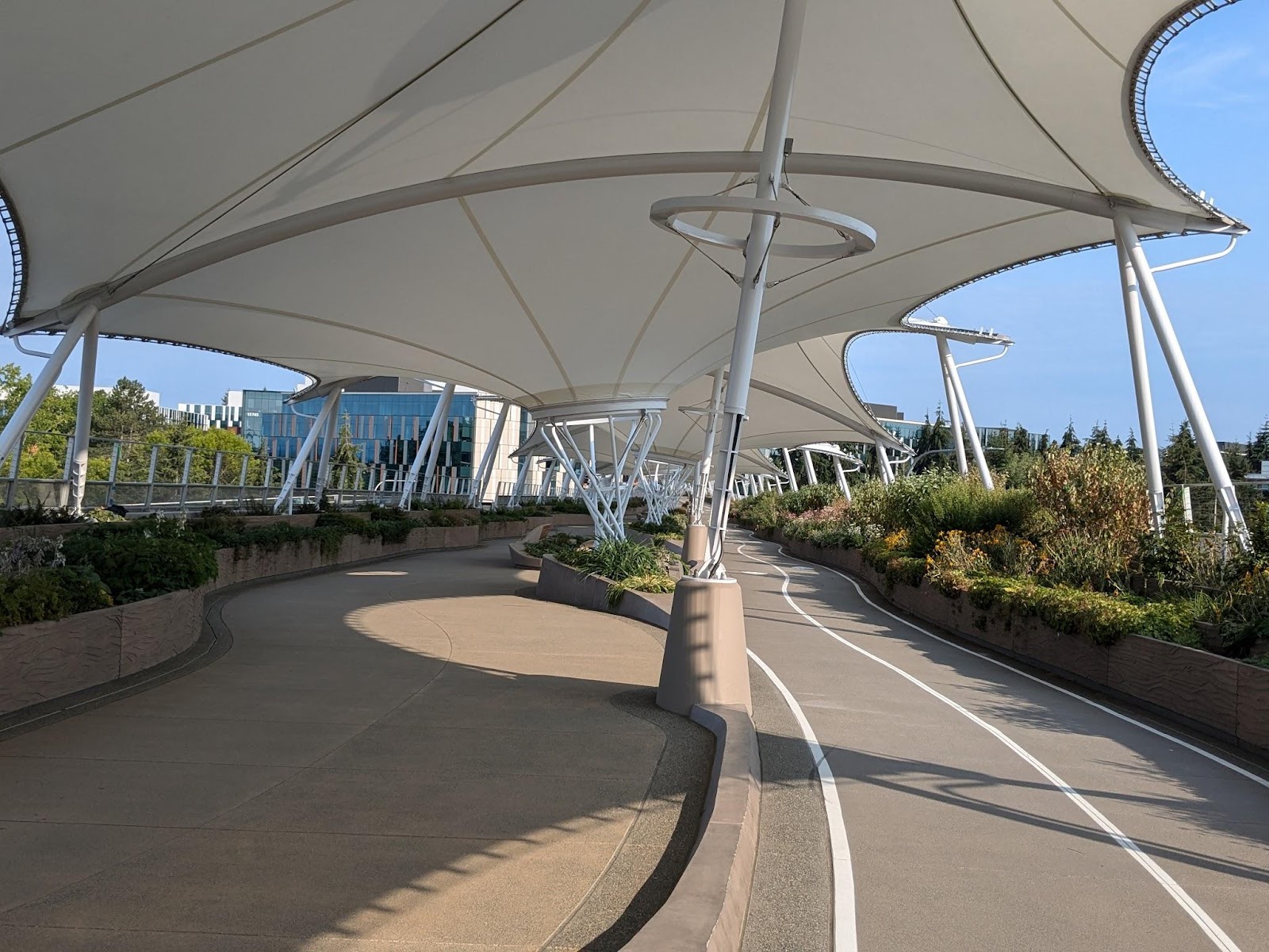
But still, I’ve regularly seen people crossing it. I suspect a lot of them are Microsoft employees. There are also a number of people coming from Link – which makes sense. It’s a lot more pleasant a bridge than 40th St, and I’d say it’s worth the slight detour:
40th Street
Finally, just a bit further north, we reach the last of the five bridges: NE 40th Street.
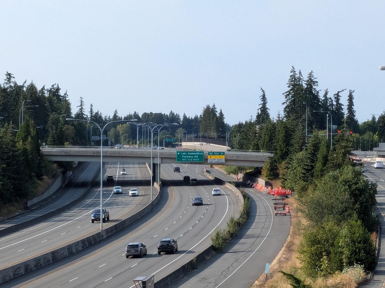
This bridge carries four through lanes of traffic, four more left-turn lanes (to get onto the freeway), a small north sidewalk, and a very wide south sidewalk:
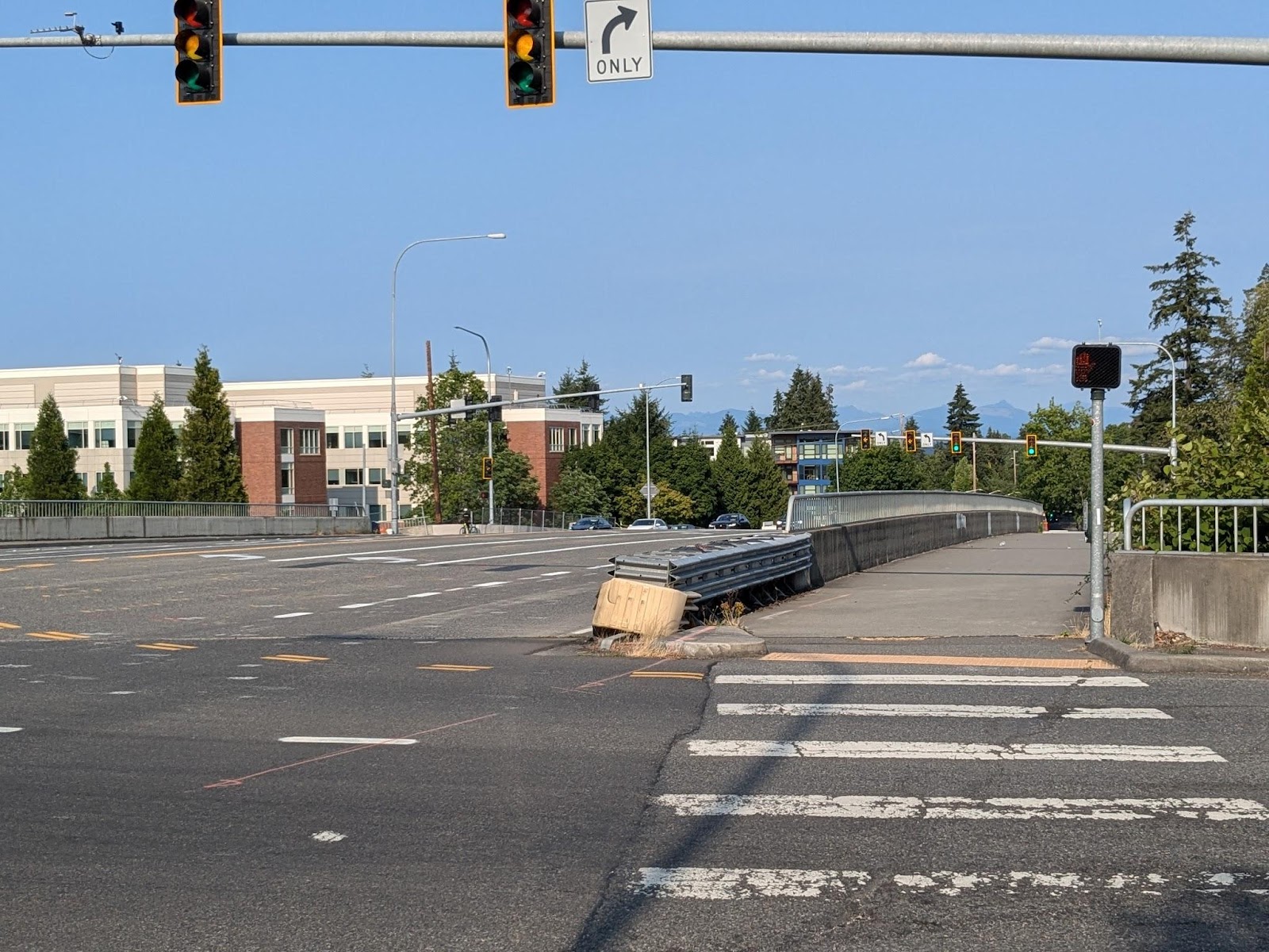
Before the pandemic, every bit of that south sidewalk was needed at peak hours, to hold people walking or biking to and from the flyer stops. I was regularly among them. Now, I don’t go there so often, but when I do I don’t see such large crowds. In part, this is because so many Microsoft employees are now working from home. But another part is because of the new pedestrian bridge just to the south.
The NE 40th Street bridge it a very utilitarian bridge, focused on getting cars onto and off of the freeway. Even then the four left-turn lanes -regularly back up at peak hours. For anyone but cars, it’s not in the best place anymore given the new pedestrian bridge. But it did its purpose, and its designers gave pedestrians enough space until the new bridge was built.
The lesson of this bridge is not to let the perfect be the enemy of the good, or the future of the present. Even if you’re designing a new nicer piece of infrastructure close by, you should still do what you can with what exists at present.
(A lot of buses use this bridge: the B, 225, 269, and 566. All these routes are focused around connecting to the Microsoft campus and Redmond Technology station. In the future East Link restructure, the 269 will be rerouted to start further north, but the other routes will remain along with the new 544 peak express.)
These five bridges all cross the SR 520 freeway within a mile of each other, in the Overlake neighborhood. That might seem like a lot of bridges, but an equivalent distance on I-5 in downtown Seattle will get you from Yesler Way to Pine Street. So, if the plans for the Overlake neighborhood are going to come anywhere near fruition, it’s a good thing to have all these bridges.
These five bridges all cross the SR 520 freeway within a mile of each other in the Overlake neighborhood. That might seem like a lot of bridges, but an equivalent distance on I-5 in downtown Seattle will get you from Yesler Way to Pine Street. So if the plans for the Overlake neighborhood are going to come anywhere near fruition, it’s a good thing to have all these bridges. None of these five bridges is perfect, but each of them serves a good purpose.
With so many different designs, I’m curious to ask this: Which bridge is the loudest and which is the quietest while crossing?
I find some other freeway pedestrian bridges in the area to be extremely loud. I haven’t walked over any of these yet.
The bridges with a vegetative or short concrete wall buffer lining the sides help reduce the freeway noise better than those without it, so RTS pedestrian bridge and 36th Street are a bit quieter. But, even on the other, more open crossings, the freeway sound doesn’t get as loud as Northgate pedestrian bridge, for example, mainly due to the fact that 520 has less lanes and less vehicles than I-5.
The quietest is definitely 36th Street.
The loudest would probably be 148th, but due to the traffic roaring up 148th right next to you more than on the freeway below. There’s a loop ramp onto the freeway at the north end of the bridge, and cars like to start getting up to freeway speed early.
Don’t forget the 6th bridge – 51st St. Used by the 245 and needed by pedestrians to reach the freeway stops served by the 542/545, as well as some Microsoft buildings.
It is also worth noting that all six of these bridges connect with the SR-520 bike trail, so these bridges are actually of regional importance to the bike network, not just pedestrians.
Great point about the bike trail!
I didn’t include 51st since it’s another 0.6 mile north, double the distance between the two farthest-apart of these five bridges.
51st is a road bridge, but a quieter road than 148th and 40th. It’s got narrower sidewalks than 40th, but at least there’re sidewalks and bike lines along both sides. Haven’t seen many pedestrians there, probably because there aren’t many destinations nearby.
(Oops, this was supposed to be a reply to asdf2)
I wish the analysis had included NE 51st Street. It has employment (e.g., Nintendo and several MS buildings) and housing and transit service. Routes 542 and 545 serve a stop pair at NE 51st Street. Route 245 crosses SR-520 on NE 51st Street. Route 225 was new in March 2020; it crosses on NE 40th Street so duplicates the B line and Route 221 on 148th Avenue NE; the network would be more balanced if Route 225 served NE 51st Street and 156th Avenue NE; it could terminate at RTS and be shorter and less costly.
Once the full 2 Line opens, pedestrian use of the various bridges should increase. Some of them currently don’t see many people at all, like the Overlake Village ped bridge.
My sister-in-law’s father shared about 20 photographs of the Redmond Technology Bridge. He’s a retired architect, so he mostly focused on the design aspects, particularly the canvas rain spouts on the roof that feed into plants and don’t splash onto the walkway. He did marvel at how the bridge was wide enough to accommodate both transport (pedestrians, a two-way bike section) and decor (landscaping, benches).
One design aspect that people misunderstand is the bike and walking path curves. Some people have speculated that they made the path curvy to slow the bicyclists down. Except, the walking path is also curvy. What I heard is that architects put a lot of thought into not wanting it to feel and look like a long tunnel, since it’s a very long structure. And I think it would feel and look like a long, boring, never-ending tunnel if everything on it were straight. That’s why the pathways are curvy, and the canopies are tilted, the rain spouts are tilted, and side planter boxes are curved, etc.
A nod to Art Nouveau, maybe.
BTW, what lane would you use if you’re on a skateboard or mechanical scooter (e.g. Lime without a motor)?
And good point about the curves to break up the scenery. It could’ve ended up feeling like those long corridors between airport concourses.
Cool pictures, thanks for sharing!