The B1M, a channel for construction videos, features our system expansion.
This is an open thread.
The B1M, a channel for construction videos, features our system expansion.
This is an open thread.
The ROI on bus lanes is remarkable:
Another benefit of the lanes is a more consistent trip time for riders. Travel-time variability decreased by up to 26% northbound and 55% southbound, according to the data. And the lanes appear to have encouraged more people to take the bus, with ridership increasing 13% in the first week the Bus Rapid Transit lanes were in service, a pattern that has remained consistent in the following weeks, Tumlin said.
No guarantees that ST staff will read your incisive 1500-word comment on STB, unfortunately, so you might want to share it with them directly. Re-read Seattle Subway’s post and the comments below if you want to refresh your memory.
We’re migrating to a new server and comments may not post on Wednesday 4/27 and possibly into Thursday 4/28.
Erica has an excellent overview of Metro’s latest report on the possibility:
In a recent report on the future of Metro’s fare system, the agency outlined its plans for smoothing the transition to eliminating cash fares, which—according to Metro—will make boarding faster, ease conflicts between riders and drivers, and eliminate the need to periodically repair Metro’s 1,509 on-board fareboxes, which are a decades-old model that is no longer being produced. Replacing fareboxes with new ones that accommodate cash payments would cost around $29 million, Metro estimates—a substantial cost for a system that is still recovering from the pandemic. Cash riders also have to pay a second fare to transfer to Sound Transit trains and buses, a problem that will only become more acute as Metro terminates more routes at light rail stations.
The flip side is access: many people simply don’t have ORCA cards. It would be impossible to even contemplate until next-gen ORCA is more widespread. Getting ORCA cards into more pockets is always a good thing, and if this facilitates wider distribution of ORCA LIFT and other similar low-income programs, all the better.
Beginning in May 2022, the new myORCA mobile app and website will make paying for transit rides in the Puget Sound region faster and easier.
Later in 2022, we’re adding more retail locations where you can buy and reload ORCA cards and launching a new card design.
MyORCA replaces the aging orcacard.com and orcacard.biz sites, which was never really usable on mobile phones (and barely usable on desktops). It will include exciting new features like instant fare uploading. There will be a virtual open house on May 4 to learn more.
It’s the first milestone for the next-generation ORCA system. Previous coverage of next-generation ORCA here and here.
After a somewhat confused day of messaging, all local transit agencies jointly lifted their mask requirements after a federal judge knocked down the CDC’s rule. David Kroman in the Times:
Immediately after the Monday ruling, Seattle-area agencies largely kept their current policies in place, albeit without strong enforcement mechanisms. By late Monday and early Tuesday, however, that shifted.
Eight Seattle-area transit agencies — Community Transit, Everett Transit, King County Metro, Kitsap Transit, Pierce Transit, Seattle Department of Transportation, Seattle Center Monorail and Sound Transit — said in a joint statement Tuesday that masks are now optional.
The rule was set to expire on May 3. The administration may appeal.
As the public comment window for Sound Transit’s West Seattle Ballard Link Extension draft environmental impact statement (DEIS) comes to a close, it’s time to make your voice heard about what will be built as part of ST3.
As always, powerful stakeholders who do not prioritize transit quality are very well represented in this process – we need your voice to make sure that our leaders hear from future transit riders. When evaluating options, we focus on what will be best for transit riders: reliability, expandability, and accessibility.
There were a lot of surprises in this round of Sound Transit planning. Some of them were positive, such as options in West Seattle that seem to address both community and transit riders’ concerns, and cost parity between elevated and tunnel options in both Ballard and West Seattle.
Some surprises were cause for alarm, such as deep stations, slow transfers, and lack of options that serve Central Ballard and South Lake Union. Sound Transit made significant steps during this round but still has a long way to go. Sound Transit needs to study more options; because of that, we are not ready to recommend specific options for every alignment and station presented. After reviewing the draft plan, these are Seattle Subway’s recommendations for giving feedback on Sound Transit’s DEIS.
BALLARD:
Continue reading “Seattle Subway’s summary recommendations for the ST3 DEIS”As Sound Transit has moved the West Seattle-Ballard Link Extension (WSBLE) through the EIS process, several challenges have emerged, with early concerns focused on the Ballard and West Seattle termini. These are nowhere near solved, but a compromise alignment seems within reach.
The middle of the line is another question: serious disruption in Chinatown / ID, deep stations with poor transfers, and some really complicated maneuvering and bridging required in SODO to add a second set of tracks that isn’t strictly necessary. Meanwhile, the only palatable option in CID, a shallow 4th Avenue station, adds $500M to the project budget and has some nasty impacts.
So, since it’s Saturday and we’re waiting for the EIS comment period to close, let us indulge ourselves in an alternative alignment through downtown that avoids some of these problems.

When looking at the two options presented by Sound Transit for South Lake Union (SLU) in the Draft Environmental Impact Statement (DEIS), we’re struck by how poorly the station will serve South Lake Union. The Harrison option is deep at about 120’ and all the way on the western edge of SLU. The Mercer option is slightly less deep at about 85’ but its location west of highway 99 isn’t really in SLU and involves an extremely poor pedestrian environment. Both stations are monumentally difficult to build and expensive due to their proximity to highway 99. We can avoid all of those issues and build a station that serves South Lake Union far better by building the SLU station on Westlake.
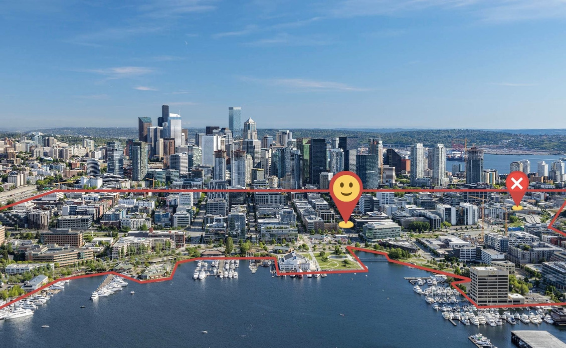
A station under Westlake located approximately between Harrison and Republican has a lot of advantages. Though it’s still slightly to the west of the center of South Lake Union, the walkshed includes nearly all of this dense neighborhood. It’s aligned with the Denny station which means isolated construction impacts and the potential for a shallow station. It can also cross SR 99 further north where it isn’t as deep while avoiding the need for a complex and expensive mined station under the highway.
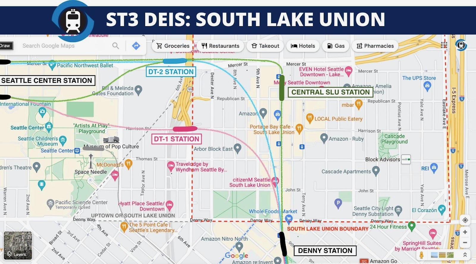
A SLU station under Westlake aligned north/south can also serve the dense population and job centers to the north and east far better than the proposed DEIS SLU station locations. Aligning the station north/south will also enable a future Link extension along the highway 99 corridor much easier – opening up one of the best corridors for transit oriented development opportunities in the country.
Continue reading “SLU Station Can Be Better, Cheaper, and Easier to Build on Westlake”